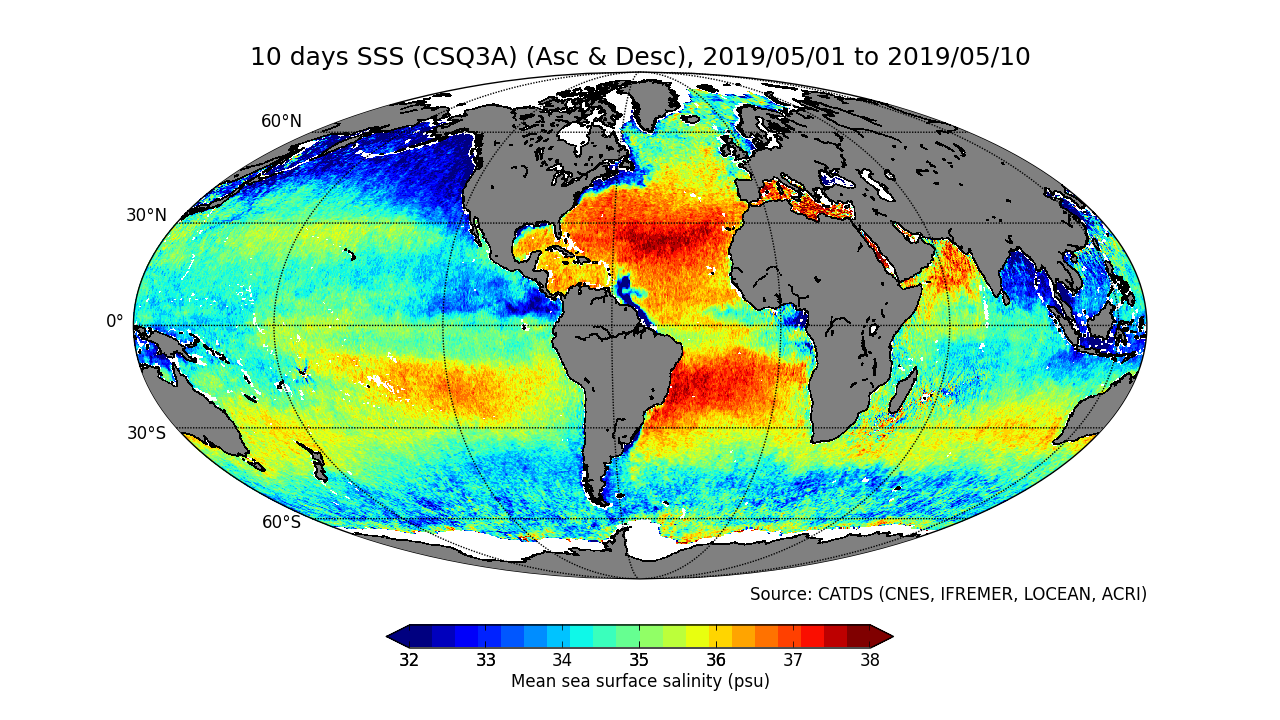
CATDS-PDC L3OS 3Q mixed - Debiased average 10 days & monthly salinity field product from SMOS satellite (mixed orbits)
This product contains average 10 days & monthly salinity field corrected from land-sea contamination and latitudinal bias, based on L2Q products, mixing ascending and descending orbits.
| Date(s) Date(s) |
|
| Author(s) Auteur(s) |
CATDS
|
| Contact(s) Contact(s) |
Jacqueline Boutin
(
LOCEAN
)
CATDS (CNES, IFREMER, LOCEAN, ACRI) Jean-Luc Vergely ( ACRI ) |
| Source Source |
CATDS (CNES, IFREMER, LOCEAN, ACRI) |
| Lineage Généalogie |
The base products, for all the CATDS-PDC (Centre Aval de Traitement des Données SMOS - Production & Dissemination Center) processing chains, are the SMOS L1B products - https://doi.org/10.57780/SM1-e20cf57 - from ESA (European Space Agency). From these, brightness temperatures at various incidence angles are reconstructed. The Sea Surface Salinity (SSS) are retrieved from multi-angular brightness temperatures through a maximum likehood Bayesian approach in which measured Tb and Tb simulated using a forward direct model are compared (see Zine et al. 2008 for a general description of the retrieval method, and pro_con table for a summary of the similarities/differences with respect to ESA level 2 ocean salinity processing). The L3OS 3Q mixed product contains average 10 days & monthly salinity field corrected from land-sea contamination and latitudinal bias, based on L2Q products, at 2 spatial resolutions (25km, 50km), mixing ascending and descending orbits. Products from reprocessing RE07 are available for the period 01/2010 - 05/2021. Products from operational (OPER) processing are available since 06/2021. Reprocessed products and operational products are derived using the same algorithm and configuration, hence ensuring the temporal continuity. Note that links are only provided for the 50km spatial resolutions products. 25km resolution can be accessed by changing the product name (see below) These products are generated with a delay of 5 days after the end of the averaging period (Please see below for alternative 1-day delay products). File naming : SM_clas_MIR_CSQ3r__startdate_enddate_vvv_ccc_7 - clas : File class (OPER : operational mode, REXX : reprocessing xx) - r : A for 25km, B for 50km - startdate : sensing start date/time of the data (format yyyymmddThhmiss) - enddate : sensing end date/time of the data (format yyyymmddThhmiss) - vvv : version number of the processor generating the product - ccc : file counter File format : In each archive file (.tgz extension), there are two files - A Header file (.HDR), which is a text file, in XML Earth Explorer Header format - A Data file (.DBL.nc), which is a netcdf file, format variant 2 (netcdf 3 with 64 bits offset option) Alternative 1-day delay products : Since 07/2019, 1-day delay products are also available, in operational (OPER) processing only. These products are only available by FTP (i.e. not by Sipad). The paths and file names are identical, except that the "MIR" tags are replaced by "NRT". Reference : Boutin J., Vergely J.L., Marchand S., D'Amico F., Hasson A., Kolodziejczyk Nicolas, Reul Nicolas, Reverdin G., Vialard J. (2018). New SMOS Sea Surface Salinity with reduced systematic errors and improved variability. Remote Sensing of Environment, 214, 115-134. Publisher's official version : http://doi.org/10.1016/j.rse.2018.05.022 , Open Access version : http://archimer.ifremer.fr/doc/00441/55254/ |
| Constraints Contraintes |
|
| Spatial informations Informations géographiques |
|
Citation proposal Proposition de citation
CATDS (2022).CATDS-PDC L3OS 3Q mixed - Debiased average 10 days & monthly salinity field product from SMOS satellite (mixed orbits).CATDS (CNES, IFREMER, LOCEAN, ACRI)
http://dx.doi.org/10.12770/0f02fc28-cb86-4c44-89f3-ee7df6177e7b
When using this dataset in a publication, also cite the related work(s) with:
Boutin J., Vergely J.L., Marchand S., D'Amico F., Hasson A., Kolodziejczyk Nicolas, Reul Nicolas, Reverdin G., Vialard J. (2018). New SMOS Sea Surface Salinity with reduced systematic errors and improved variability. Remote Sensing of Environment, 214, 115-134. Publisher's official version : http://doi.org/10.1016/j.rse.2018.05.022 , Open Access version : http://archimer.ifremer.fr/doc/00441/55254/
)))