Programme de surveillance continue «Habitats benthiques intertidaux » RNF
Continuous Monitoring Programme «Intertidal Benthic Habitats » RNF
Phase test du protocole RNF de surveillance continue des Habitats biomorphosédimentaires intertidaux en zone estuarienne
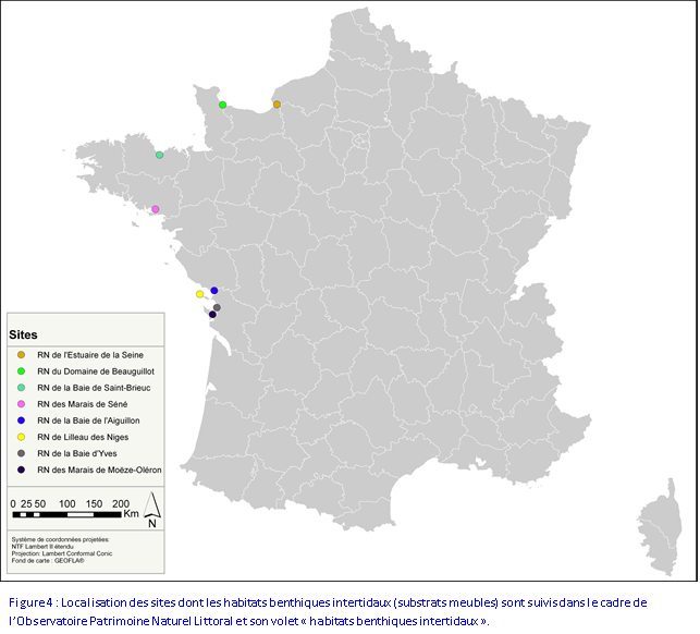
- RN impliquées dans la phase test : Baie de Somme, Estuaire de la Seine,
Domaine de Beauguillot, Baie de Saint-
Brieuc, Marais de Séné, Marais de Müllembourg, Baie de l'Aiguillon, Lilleau des Niges, Marais d'Yves et Marais de Moëze-Oléron - Principal objectif : Elaborer un protocole de surveillance inter-site des habitats
biomorphosédimentaires intertidaux en zone estuarienne, qui puisse être mis en oeuvre à l'échelle de l'Observatoire "Littoral, limicoles et macrofaune benthique" RNF pour fournir des données sur le long terme et conduire des analyses comparatives à caractère national. Ces habitats abritent
les ressources alimentaires des limicoles côtiers. Ainsi leur évolution à long terme conditionne en partie la qualité des sites estuariens étudiés pour l'accueil des limicoles côtiers.
Adapté aux substrats meubles situés en zone intertidale, ce protocole se doit de préciser localement les principales caractéristiques des communautés benthiques estuariennes : approche biomorphosédimentaire, taxonomique, densitaire et biométrique* (* : seulement pour principaux mollusques bivalves) et d'en mesurer leur évolution dans le temps. Pour être reconductible chaque année, en tenant compte de la capacité des équipes gestionnaires pour sa mise en oeuvre (temps
disponible, matériels nécessaires, faisabilité
méthodologique), le protocole RNF a été défini pour être facilement applicable annuellement et de façon standardisée.
En lien avec le protocole de comptage mensuel des limicoles côtiers, cette approche bio-morphosédimentaire a été adaptée pour que les informations recueillies nous renseignent également sur la qualité des zones d'alimentation fréquentées par les oiseaux à marée basse :
- Choix d'échantillonner en automne, autour du 15 octobre pour un état des lieux de la ressource avant les stationnements importants d'oiseaux limicoles (avant les effets de la prédation par les oiseaux)
- Echantillonnage pour chaque entité géographique de 3 des grands habitats biomorphosédimentaires
(identification via les trois 1ers niveaux de la classification EUNIS) présents à l'échelle de l'unité fonctionnelle définie pour les oiseaux limicoles côtiers
- Carottage-faune à 25 cm de profondeur pour prendre en compte l'ensemble de l'espace où se distribue la faune-proie des oiseaux limicoles
- Carottage-sédiment à 5 cm de profondeur pour appréhender la qualité des sédiments de surface, constituant un des paramètres influençant l'accessibilité, la détectabilité de la ressource benthique par les oiseaux limicoles Ainsi, à plus long terme, par le croisement des jeux de données issus des deux protocoles développés (limicoles côtiers & habitats biomorphosédimentaires), des correspondances inter-site pourront être recherchées entre communautés benthiques et communautés d'oiseaux limicoles pour conduire, à une échelle à caractère national, une approche fonctionnelle comparée des localités suivies.
Enfin, divers autres programmes de surveillance sont déjà appliqués sur plusieurs des sites étudiés dans le cadre de notre programme RNF. Ainsi, le protocole que nous développons, inspiré des méthodes déjà existantes, adaptées à une même échelle géographique (Réseau Rebent et protocoles issus : DCEo), doit permettre à terme de renforcer les réseaux existant en complétant
la couverture spatiale et temporelle de certains habitats. Même si les objectifs initiaux de ces divers dispositifs de surveillance présentent des différences marquées, le protocole développé à pour vocation de s'inscrire en complémentarité de l'existant.
Test phase of the RNF protocol of continuous monitoring of intertidal biomorphosedimentary habitats in estuaries
- RN involved in the test phase: Baie de Somme, Seine estuary Domaine de Beauguillot, Baie de Saint-Brieuc, Marais de Séné, Marais de Müllembourg, Baie de l'Aiguillon, Lilleau des Niges, Marais d'Yves et Marais de Moëze-Oléron –
Main objective : to establish a multi-site monitoring protocol for studying intertidal biomorphosedimentary habitats in estuaries, to be implemented on the scale of the RNF Observatory “Coasts, waders and benthic macrofauna” in order to provide long-term data and conduct comparative analyses on a national level.
These habitats are a source of food for coastal waders. Therefore their long-term evolution is, at least in part, a condition of the quality of estuary sites and their capacity as habitats for coastal waders.
Suited to soft substrate in intertidal areas, this protocol must specify the main characteristics of benthic communities in the estuaries: biomorphosedimentary, taxonomic, density and biometric* approaches (* : only for the principal bivalve molluscs), and must also measure changes over time. In order to be able to continue the programme each year, taking into account the implementation capacity of managing teams (time available, necessary equipment, methodological feasibility), the RNF protocol was designed to be easily standardised and applicable on an annual basis.
In connection with the monthly coastal wader counts, this biomorphosedimentary approach was designed so that the information gathered might also inform us of the quality of feeding grounds frequented by the birds at low tide :
- Choice to take samples in autumn, around 15 October in order to conduct an inventory of the resource prior to the arrival of large numbers of wading birds (before the predatory effects of the birds’ presence)
- Sampling for each geographical entity of the three biomorphosedimentary habitats (identification thanks to the three first levels of the EUNIS classification) present in terms of the functional unit defined for coastal wading birds
- 25-cm fauna Core samples in order to account for the overall space where the fauna-prey of the wading birds is distributed
- 5-cm fauna Core samples in order to understand the quality of surface sediments, which is one of the parameter influencing the accessibility and detectability of benthic resources by wading birds. Thus, in the long term, by confronting datasets from both the developed protocols (coastal waders and biomorphosedimentary habitats), correspondences between sites could be made between benthic communities and communities of wading birds in order to achieve a comparative functional approach to the areas monitored, on a national scale.
Finally, there are already numerous other monitoring programmes for many of the sites studied within the context of our RNF programme. Therefore, the protocol that we are developing, which draws on existing methods and is adapted to the same geographical scale (Rebent network and DCEo protocols), must in the long term enable us to reinforce existing networks by completing the spatial and temporal coverage of certain habitats. Even if the initial objectives of these various measures are markedly different, the aim of the protocol developed here is to complete those which already exist.
)))