DGMW Ems Model A (1m)
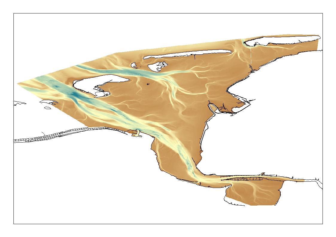
High Resolution DTM of the German Ems Approach.
What
Metadata details
- File identifier
- SDN_CPRD_1850_DGMW_UAEMS
- Catalogue type
-
Composite Product Record
-
Project name
-
-
EMODNet Bathymetry
-
- Dissemination level
-
public
- Metadata language
- English
- Date stamp
- 2018-09-27T10:52:08
Identification
- Dataset name
-
DGMW Ems Model A (1m)
- Short name of dataset (SDN Local Product-ID)
-
DGMW_UAEMS
-
Parameter Discovery Vocabulary (P02)
-
-
Bathymetry and Elevation
-
-
SeaDataNet device categories
-
-
single-beam echosounders
-
multi-beam echosounders
-
-
SeaDataNet device categories
-
-
Differential Global Positioning System receivers
-
Geometry
- Spatial representation type
- Grid
- Number of columns
- 1000000
- Number of lines
- 1000000
- Pixel size
- 1 Metres (m)
- Maximum scale of use
- 5000
Abstract
- Dataset description abstract
-
High Resolution DTM of the German Ems Approach.
- Description of processed data sources
-
Description of processed data sources :
- Description of data processing
-
Description of data processing :The Digital Terrain Model Waterways project serves the purpose to gather, process and shape topographical data. Aquisition of data took place by single and multi beam echosunders as well as Airborne Laserscanning. After processing and harmonisation the data was compiled and suplemented by structure information. Results of this process chain is in the first place a 1*1m² raster (Model A) and in the second place a reduced and less accurate Tringulated Irregular Network (Model B) derived from this grid. The Model A exists in multiple tiles of 1km*1km.
Quality
Accuracy / Calibration
Quality Indicators
- Horizontal Quality Indicator
- 3 - < 20 m
- Vertical Quality Indicator
- 3 - Lidar, SBES high frequency
- Purpose Quality Indicator
- 3 - Hydrographic survey or compatible with hydrographic standards
Where
))
- Min. depth in meters (>0 below Sea Level)
- 30.7
- Max. depth in meters (>0 below Sea Level)
- -30.14
Projection
- code
-
ETRS89 (EPSG:4258)
- Version or custom projection details
-
7.4
When
Creation date
- date
- 2012-01-31
Revision date
Temporal extent*
- Begin
- 2010-03-18
- End
- 2011-09-24
Who
Originator
- Organisation name
-
Federal Maritime and Hydrographic Agency
Data Holding Center
- Organisation name
-
Federal Maritime and Hydrographic Agency
Collating Centre = Metadata author
- Organisation name
-
Federal Maritime and Hydrographic Agency
Access
Distributor
- Organisation name
-
Federal Maritime and Hydrographic Agency
Data formats*
- Format
-
ASCII grid
- Transfer size (in MB)
- 10.5 GB
- OnLine resource
-
Protocol Linkage Name WWW:LINK
www.bsh.de
Intellectual property
- Access constraints
- License
- Use constraints
- Copyright