Svalbard_data_2016
Modern multibeamdata on Svalbard, processed autumn 2015. Data have been gridded to 10*10m, converted to geographicalo coordinates and tiled into 2*2degree tiles.
What
Metadata details
- File identifier
- SDN_CPRD_543_Svalbard_Bathymetry
- Catalogue type
-
Product record
-
Project name
-
-
EMODNet Hydrography
-
- Dissemination level
-
public
- Metadata language
- English
- Date stamp
- 2018-09-18T14:25:04
Identification
- Dataset name
-
Svalbard_data_2016
- Short name of dataset (SDN Local Product-ID)
-
Svalbard_Bathymetry
-
Parameter Discovery Vocabulary (P02)
-
-
Unspecified
-
-
SeaDataNet device categories
-
-
multi-beam echosounders
-
multi-beam echosounders
-
-
SeaDataNet device categories
-
-
NAVSTAR Global Positioning System receivers
-
Geometry
- Spatial representation type
- Grid
- Number of columns
- 1740
- Number of lines
- 1920
- Pixel size
- 3 Metres (m)
- Maximum scale of use
- 5000
Abstract
- Dataset description abstract
-
Modern multibeamdata on Svalbard, processed autumn 2015. Data have been gridded to 10*10m, converted to geographicalo coordinates and tiled into 2*2degree tiles.
- Description of processed data sources
-
Description of processed data sources : Modern Multibeam surveys until autumn 2015
- Description of data processing
-
Description of data processing : Processed by CARIS
- Processing software
-
Caris
Quality
Accuracy / Calibration
Quality Indicators
- Horizontal Quality Indicator
- 3 - < 20 m
- Vertical Quality Indicator
- 2 - MBES low frequency (lower than 100kHz) (similar than 1+2%d)
- Purpose Quality Indicator
- 3 - Hydrographic survey or compatible with hydrographic standards
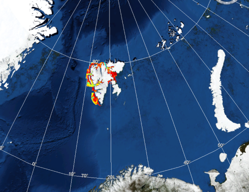
Where
))
- Min. depth in meters (>0 below Sea Level)
- 0.5
- Max. depth in meters (>0 below Sea Level)
- 1000
Projection
- code
-
WGS 84 (EPSG:4326)
- Version or custom projection details
-
7.4
When
Creation date
Revision date
Temporal extent*
- Begin
- 2011-07-21T00:00:00
- End
- 2015-09-21T00:00:00
- Measurement frequency
- 1
Who
Originator
Data Holding Center
- Organisation name
-
Norwegian Hydrographic Service (NHS)
Collating Centre = Metadata author
- Organisation name
-
Norwegian Hydrographic Service (NHS)
Access
Distributor
- Organisation name
-
Norwegia Hydrographic Service (NHS)
Data formats*
- Format
-
GML
- Version
-
3.2.1
- Transfer size (in MB)
- 2000000000
Intellectual property
- Access constraints
- Intellectual property rights
- Use constraints
- Copyright
)))