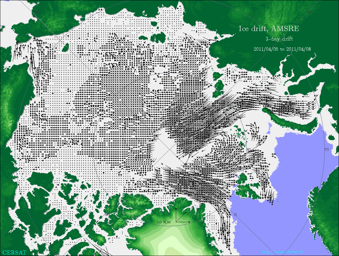
3-Daily Sea-Ice Drift Vectors from ASMR-E onboard AQUA over Arctic on a 31.25 km Polar Grid
This products provides the sea-ice drift calculated over a three day rolling window during winter time (October to April) over Arctic ocean from AMSR-E microwave radiometer onboard AQUA
Simple
- Title
-
3-Daily Sea-Ice Drift Vectors from ASMR-E onboard AQUA over Arctic on a 31.25 km Polar Grid
- Date (Publication)
- 2007-02-02
- Citation identifier
- CER_PSI_ARC_3D_031_DFT_AMS
- Abstract
-
This products provides the sea-ice drift calculated over a three day rolling window during winter time (October to April) over Arctic ocean from AMSR-E microwave radiometer onboard AQUA
- Credit
-
CERSAT, Ifremer
- Point of contact
-
Organisation name Individual name Electronic mail address Role IFREMER
Ardhuin Fanny
Author IFREMER
Piolle Jean-Francois
Production center
-
Centre de données ODATIS
-
-
CDS-SAT-CERSAT
-
- Keywords
-
-
Sea Ice
-
-
Type de jeux de donnée ODATIS
-
-
/Télédétection
-
-
Thèmatiques ODATIS
-
-
Télédétection
-
-
ODATIS aggregation parameters and Essential Variable names
-
-
Glace de mer
-
- Use limitation
-
Aucune condition ne s’applique
- Access constraints
- Other restrictions
- Use constraints
- Copyright
- Spatial representation type
- Grid
- Language
- Français
- Character set
- UTF8
- Topic category
-
- Oceans
))
- Begin date
- 2002-10-01
- End date
- 2011-04-30
- Geometric object type
- Surface
- Distribution format
-
Name Version
- OnLine resource
-
Protocol Linkage Name WWW:LINK
http://cersat.ifremer.fr/data/products/catalogue CERSAT Catalogue
WWW:LINK
ftp://ftp.ifremer.fr/ifremer/cersat/products/gridded/psi-drift/documentation/amsr.pdf User Manual
- Hierarchy level
- Dataset
- Statement
-
This product provides users with a continuous winter (Oct-April) time series of drift vectors over Arctic. These drift vectors are provided on a polar stereographic grid every 31.25 km, over a 3-days overlapping time period. It is a merging of the sea-ice drift vectors retrieved separately using respectively the H and V AMSR-E polarizations channels (from winter 2002-2003) observations. The estimation of sea-ice drift for each one relies on a basic correlation technique applied to the field of the second spatial derivative (Laplacian) of 6.25km resolution composite maps separated by a few days (brightness temperature).
Metadata
- File identifier
- 04315e23-027b-4abe-a154-b0c4d17fed7a
- Metadata language
- Français
- Character set
- UTF8
- Hierarchy level
- Dataset
- Date stamp
- 2019-03-21T09:40:20
- Metadata standard name
-
ISO 19115:2003/19139 - SEXTANT
- Metadata standard version
-
1.0
accessData
Overviews
)))