Fishery characterisation | Fisheries characteristics-fish fleet | Statistical office of the European Union | Fishing fleet
Simple
Identification info
- Alternate title
-
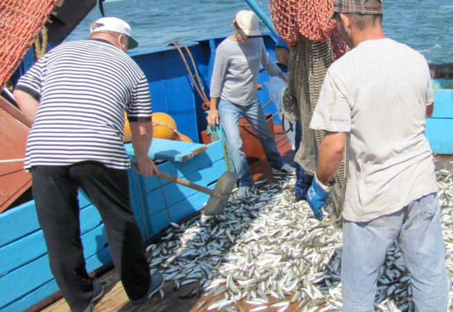
Fishing fleet
- Date
- Citation identifier
- Fishery characterisation | Fisheries characteristics-fish fleet | Statistical office of the European Union | Fishing fleet
- Convention
-
Fishing fleet
- Purpose
-
Provide the European Union with statistics at European level that enable comparisons between countries and regions.
- Status
- On going
- Point of contact
-
Organisation Individual Electronic mail address ORCID Role Statistical office of the European Union
EUROSTAT
edmerp Statistical office of the European Union
edmo
- Spatial representation type
- Vector
- Topic category
-
- Oceans
Extent
))
Extent
- Time period
- 2007-01-01T00:00:00 2012-01-01T00:00:00
- Maintenance and update frequency
- Unknown
- Used by challenges
-
-
BlackSea - CH07 - Fisheries Impact
-
- Environmental matrix
-
-
Marine water
-
- Production mode
-
-
Delayed
-
- Visibility
-
-
Use of open search engines, searching by name either the data provider or the characteristics
-
- Policy visibility
-
-
There is detailed information provided to understand data policy
-
- Readyness
-
-
Format proprietary but content clearly specified
-
- Parameter Discovery Vocabulary (P02)
-
-
Fishery characterisation
-
- GEMET - INSPIRE themes, version 1.0
-
-
Species distribution
-
- Processing level of characteristics
-
-
Observation (raw, QC)
-
- Data delivery mechanisms
-
-
Online discovery and downloading services
-
- Parameter Usage Vocabulary (other)
-
-
Fisheries characteristics-fish fleet
-
- Agreed Parameter Groups (P03)
-
-
Fish
-
- Service extent
-
-
The datasets are referenced in a public national catalogue, in an international catalogue service
-
Resource constraints
- Access constraints
- Other restrictions
- Other constraints
-
Unrestricted
Resource constraints
- Use limitation
-
Open and Free. No charge
- Language
- Français
- Character encoding
- UTF8
- Environment description
-
Fishing fleet
Content Information
- Attribute description
- observation
- Content type
- Physical measurement
Distribution Information
BLACKSEA_CH07_Product_1 / Extent of fisheries trawlers (bottom trawling) : computed from Vessel Monitoring System Dataset (2012-2015)
))
- Begin date
- 2012-01-01
- End date
- 2012-12-31 Before
Vertical element
- Minimum value
- 5
- Maximum value
- 90
BLACKSEA_CH07_Product_1 / Extent of fisheries trawlers (bottom trawling) : computed from Vessel Monitoring System Dataset (2012-2015)
- Begin date
- 2013-01-01
- End date
- 2013-12-31 Before
Vertical element
- Minimum value
- 5
- Maximum value
- 90
BLACKSEA_CH07_Product_1 / Extent of fisheries trawlers (bottom trawling) : computed from Vessel Monitoring System Dataset (2012-2015)
- Begin date
- 2014-01-01
- End date
- 2014-12-31 Before
Vertical element
- Minimum value
- 5
- Maximum value
- 90
BLACKSEA_CH07_Product_1 / Extent of fisheries trawlers (bottom trawling) : computed from Vessel Monitoring System Dataset (2012-2015)
- Begin date
- 2015-01-01
- End date
- 2015-12-31 Before
Vertical element
- Minimum value
- 1
- Maximum value
- 40
BLACKSEA_CH07_Product_2 / Extent of fisheries impact on the seafloor: sandy habitats where trawling is performed
- Begin date
- 2016-01-01
- End date
- 2016-12-31 Before
Vertical element
- Minimum value
- 10
- Maximum value
- 30
BLACKSEA_CH07_Product_2 / Extent of fisheries impact on the seafloor: sandy habitats where trawling is performed
- Begin date
- 2016-01-01
- End date
- 2016-12-31 Before
Vertical element
- Minimum value
- 10
- Maximum value
- 80
Resource lineage
- Hierarchy level
- Dataset
Spatial representation info
- Axis dimension properties
-
Dimension name Dimension size Resolution Time 1 day
- Cell geometry
- Transformation parameter availability
- true
- Check point availability
- true
Metadata
- Metadata identifier
- urn:uuid/2c306fa3-ce87-4111-a361-93af9ee01eec
- Language
- English
- Character encoding
- UTF8
- Contact
-
Organisation Individual Electronic mail address ORCID Role EUROSTAT
Type of resource
- Resource type
- Dataset
- Name
-
BlackSea - CH07 - Fisheries Impact
- Metadata linkage
-
https://sextant.ifremer.fr/geonetwork/srv/eng//metadata/5690f752-6d62-469a-b5c1-ef141af35aa7
- Metadata linkage
-
https://sextant.ifremer.fr/geonetwork/srv/eng//metadata/2c306fa3-ce87-4111-a361-93af9ee01eec
- Metadata linkage
-
https://sextant.ifremer.fr/geonetwork/srv/fre//metadata/2c306fa3-ce87-4111-a361-93af9ee01eec
- Date info (Revision)
- 2018-02-01T08:39:43Z
- Date info (Creation)
- 2014-10-08T14:35:32
Metadata standard
- Title
-
ISO 19115-3 - Emodnet Checkpoint - Upstream Data
- Edition
-
1.0
Fishing fleet
accessData
Overviews
Spatial extent
)))