Mesoscale eddy trajectory atlas product - Delayed Time - Twosat
Eddies detected in Delayed-Time (DT) for the entire period [1993 - present]. Variables provided include day-by-day, and for one rotation type (Cyclonic/Anticyclonic) :
- Center position (Longitude and latitude of the center of the best fit circle with the contour of maximum circum-average geostrophic speed);
- Amplitude (|SSH(local_extremum) – SSH(outermost_contour)|);
- Speed radius (Radius of the best fit circle with the contour of maximum circum-average geostrophic speed);
- Speed average (Average geostrophic speed of the contour defining the speed radius);
- Speed profile (Profile speed average values from effective contour inwards to smallest inner contour);
- Effective contour (Largest contour of the detected eddy);
- Speed contour (Contour of maximum circum-average geostrophic speed for the detected eddy).
Simple
- Title
-
Mesoscale eddy trajectory atlas product - Delayed Time - Twosat
- Date (Creation)
- 2017-06-15
- Date (Publication)
- 2022-03-22
- Abstract
-
Eddies detected in Delayed-Time (DT) for the entire period [1993 - present]. Variables provided include day-by-day, and for one rotation type (Cyclonic/Anticyclonic) :
- Center position (Longitude and latitude of the center of the best fit circle with the contour of maximum circum-average geostrophic speed);
- Amplitude (|SSH(local_extremum) – SSH(outermost_contour)|);
- Speed radius (Radius of the best fit circle with the contour of maximum circum-average geostrophic speed);
- Speed average (Average geostrophic speed of the contour defining the speed radius);
- Speed profile (Profile speed average values from effective contour inwards to smallest inner contour);
- Effective contour (Largest contour of the detected eddy);
- Speed contour (Contour of maximum circum-average geostrophic speed for the detected eddy).
- Credit
-
AVISO+
- Point of contact
-
Organisation name Individual name Electronic mail address Role CNES
AVISO+
Local service desk AVISO+
Publisher CLS
Pegliasco Cori
Author CLS
Busché Clément
Author CLS
Faugere Yannice
Author
-
Centre de données ODATIS
-
-
CDS-SAT-AVISO
-
-
Type de jeux de donnée ODATIS
-
-
/Remote sensing
-
-
Thèmatiques ODATIS
-
-
Remote sensing
-
Added-value products
-
- Keywords
-
-
mesoscale eddies
-
-
ODATIS aggregation parameters and Essential Variable names
-
-
Currents
-
- Use limitation
- Licence
- Access constraints
- Other restrictions
- Use constraints
- Other restrictions
- Other legal constraints
-
Citation:
When using the Mesoscale Eddy Trajectory Atlas products, please cite in the text the following exemple, with the proper DOI, CITATION, DATE OF DOWNLOAD and MONTH & YEAR:
For META3.2 DT twosat, released in March 2022:
"The altimetric Mesoscale Eddy Trajectory Atlas product (META3.2 DT twosat, DOI: 10.24400/527896/a01-2022.006.210802; (Pegliasco et al., 2022a)) was produced by SSALTO/DUACS and distributed by AVISO+ ( https://www.aviso.altimetry.fr/) with support from CNES, in collaboration with IMEDEA. This atlas was downloaded the DATE OF DOWNLOAD, and covers the period from January 1993 to MONTH & YEAR."
- Spatial representation type
- Grid
- Language
- Français
- Character set
- UTF8
- Topic category
-
- Oceans
))
- Begin date
- 1993-01-01
Vertical extent
- Minimum value
- 0
- Maximum value
- 0
Vertical CRS
- Geometric object type
- Complex
- Distribution format
-
Name Version NetCDF
NetCDF-4 Classic
- OnLine resource
-
Protocol Linkage Name WWW:LINK
https://www.aviso.altimetry.fr/en/data/products/value-added-products/global-mesoscale-eddy-trajectory-product.html Further information
WWW:LINK
ftp://LOGIN:PASSWORD@ftp-access.aviso.altimetry.fr/value-added/eddy-trajectory/ Authenticated access through FTP
WWW:DOWNLOAD-1.0-link--download
https://dataterra:odatis@tds-odatis.aviso.altimetry.fr/thredds/catalog/dataset-duacs-rep-value-added-eddy-trajectory/catalog.html Mesoscale Eddy Trajectories Atlas in Altimeter Observations of SLA
WWW:LINK
https://www.aviso.altimetry.fr/fileadmin/documents/data/tools/hdbk_eddytrajectory_META3.2_DT.pdf Handbook DT META3.2
WWW:LINK-1.0-http--metadata-URL
https://doi.org/10.24400/527896/a01-2022.006 DOI dataset META3.2 DT two satellites
- Hierarchy level
- Dataset
- Statement
-
Note that DT versions differ by the input product used. The “two-satellite” maps are built using at most two altimetric missions, with the Topex-Poseidon and Jason satellites on the same long-term ground tracks, and a second satellite mission, mainly on the ERS-Envisat-Saral-Sentinel-3A ground tracks. As the sampling and the represented scales are stable throughout time, this dataset is considered to be homogeneous in time in terms of climate signals and mesoscale content.
The data used are “two-satellite” daily Delayed Time DUACS2021 version, with the variable Gridded Global Absolute Dynamic Topographies (ADT), from the Copernicus Climate Change Service (C3S) http://climate.copernicus.eu/
Several versions exist : Delayed time "Allsat" and a real time version, described on other metadata sheets.
Types of dataset: multimission altimeter products.
Contents: multimission altimetry-derived eddy trajectories
Format : NetCDF-4 Classic with CF standards.
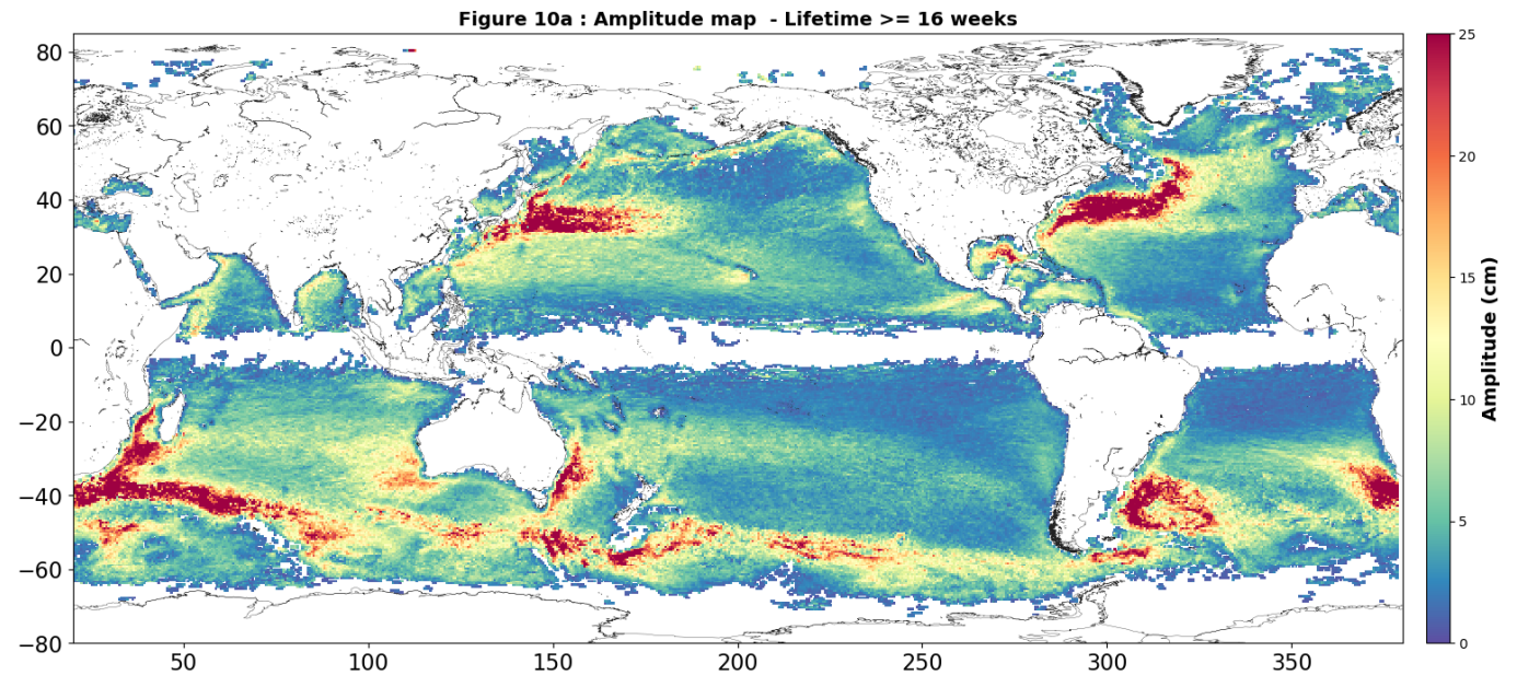
Statistical analysis document (Figures following Chelton et al. 2011): https://www.aviso.altimetry.fr/fileadmin/documents/data/products/value-added/META3.2_twosat_report.pdf
Reading software: examples in Python programming language. Details on Aviso+ Users Newsletter #14, page 4: Tools for the Mesoscale Eddy Trajectory Atlas, https://www.aviso.altimetry.fr/fileadmin/documents/newsstand/Newsletter/aviso_newsletter_14.pdf#page=4
Code delivery: the open source code is available at https://github.com/AntSimi/py-eddy-tracker from version META3.0 onwards. When using the code, please cite "The code used to compute the Mesoscale Eddy Trajectories Atlas from version 3.0 onwards, was developed in collaboration between IMEDEA (E. Mason) and CLS, is freely available under GNU General Public License https://github.com/AntSimi/py-eddy-tracker ".
Image of the month, June 2017: Eddies everywhere, https://www.aviso.altimetry.fr/en/news/image-of-the-month/2017/jun-2017-eddies-everywhere.html
References:
- Pegliasco, C., Delepoulle, A., Morrow, R., Faugère, Y., and Dibarboure, G.: META3.1exp : A new Global Mesoscale Eddy Trajectories Atlas derived from altimetry, Earth Syst. Sci. Data Discuss. [preprint], https://doi.org/10.5194/essd-2021-300 in review, 2021.
- Mason, E., A. Pascual, and J.C. McWilliams, 2014: A New Sea Surface Height–Based Code for Oceanic Mesoscale Eddy Tracking. J. Atmos. Oceanic Technol., 31, 1181–1188, https://doi.org/10.1175/JTECH-D-14-00019.1
Metadata
- File identifier
- 387879ca-24b7-4bbf-a551-33356dc76656
- Metadata language
- Français
- Other language
-
Language Character encoding English UTF8
- Character set
- UTF8
- Hierarchy level
- Dataset
- Date stamp
- 2023-12-01T08:55:54.735Z
- Metadata standard name
-
ISO 19115:2003/19139 - SEXTANT
- Metadata standard version
-
1.0
accessData
Overviews
)))