River flow and discharge | Riverine discharge of water | Global River Discharge Database | Dniester River, PointID: 776
Simple
Identification info
- Alternate title
-
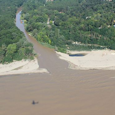
Dniester River, PointID: 776
- Date
- Citation identifier
- River flow and discharge | Riverine discharge of water | Global River Discharge Database | Dniester River, PointID: 776
- Convention
-
Dniester River, PointID: 776
- Purpose
-
The Global Monthly River Discharge Data Set contains compilation of monthly mean river discharge data for over 3500 sites worldwide. The data sources are RivDis2.0, the United States Geological Survey, Brazilian National Department of Water and Electrical Energy, and HYDAT-Environment Canada. The period of record for each station is variable, from 3 years to greater than 100. All data is in m3/s.
- Status
- On going
- Point of contact
-
Organisation Individual Electronic mail address ORCID Role Global River Discharge Database
edmo Global River Discharge Database
edmerp
- Spatial representation type
- Vector
- Topic category
-
- Oceans
Extent
)
Extent
- Time period
- 1965-01-01T00:00:00 1984-12-31T00:00:00
- Maintenance and update frequency
- As needed
- Used by challenges
-
-
BlackSea - CH09 - River Inputs
-
- Environmental matrix
-
-
Fresh water
-
- Production mode
-
-
Delayed
-
- Visibility
-
-
Use of open search engines, searching by name either the data provider or the characteristics
-
- Policy visibility
-
-
There is detailed information provided to understand data policy
-
- Readyness
-
-
Format not proprietary and content clearly specified (e.g. autodescriptive like ODV, NetCDF CF) or at least with appropriate document describing the content
-
- Parameter Discovery Vocabulary (P02)
-
-
River flow and discharge
-
- GEMET - INSPIRE themes, version 1.0
-
-
Hydrography
-
- Processing level of characteristics
-
-
Observation (raw, QC)
-
- Data delivery mechanisms
-
-
Online discovery and downloading services
-
- Parameter Usage Vocabulary (P01)
-
-
Riverine discharge of water
-
- Parameter Usage Vocabulary (other)
-
-
Monthly averaged discharge measurements and average discharge over all years
-
- Agreed Parameter Groups (P03)
-
-
Fluxes
-
- Service extent
-
-
The datasets are referenced in a public national catalogue, in an international catalogue service
-
Resource constraints
- Access constraints
- Other restrictions
- Other constraints
-
Unrestricted
Resource constraints
- Use limitation
-
Open and Free. No charge
- Language
- Français
- Character encoding
- UTF8
- Environment description
-
Monthly averaged discharge measurements and average discharge over all years
Content Information
- Attribute description
- observation
- Content type
- Physical measurement
BLACKSEA_CH09_Product_1 / Monthly mean time series of Water Discharge into Black Sea basin from in situ data (RIVDIS) (1921-1984)
))
- Begin date
- 1965-01-01
- End date
- 1984-12-31
Vertical element
- Minimum value
- 1
- Maximum value
- 50
BLACKSEA_CH09_Product_2 / Yearly mean time series of Water Discharge into Black Sea basin from in situ data (RIVDIS) (1921-1984)
- Begin date
- 1965-01-01
- End date
- 1984-12-31
Vertical element
- Minimum value
- 1
- Maximum value
- 50
Resource lineage
- Hierarchy level
- Dataset
Spatial representation info
- Axis dimension properties
-
Dimension name Dimension size Resolution Time
- Cell geometry
- Transformation parameter availability
- true
- Check point availability
- true
Metadata
- Metadata identifier
- urn:uuid/3de49005-e3d6-44a2-9d74-2578ee570ad5
- Language
- English
- Character encoding
- UTF8
- Contact
-
Organisation Individual Electronic mail address ORCID Role
Type of resource
- Resource type
- Dataset
- Name
-
BlackSea - CH09 - River Inputs
- Metadata linkage
-
https://sextant.ifremer.fr/geonetwork/srv/eng//metadata/565e5145-73b0-4146-b2d1-5725c53d1559
- Metadata linkage
-
https://sextant.ifremer.fr/geonetwork/srv/eng//metadata/380416b8-8a7d-4c7b-8a7a-98b3d024a2e6
- Metadata linkage
-
https://sextant.ifremer.fr/geonetwork/srv/eng//metadata/d7b82bd9-fe5f-4067-ae30-b6258a463a6b
- Metadata linkage
-
https://sextant.ifremer.fr/geonetwork/srv/eng//metadata/ce938108-9194-4a33-abbd-0d0d20d352ff
- Metadata linkage
-
https://sextant.ifremer.fr/geonetwork/srv/eng//metadata/3de49005-e3d6-44a2-9d74-2578ee570ad5
- Metadata linkage
-
https://sextant.ifremer.fr/geonetwork/srv/fre//metadata/3de49005-e3d6-44a2-9d74-2578ee570ad5
- Date info (Revision)
- 2018-03-26T09:34:29Z
- Date info (Creation)
- 2014-10-08T14:35:32
Metadata standard
- Title
-
ISO 19115-3 - Emodnet Checkpoint - Upstream Data
- Edition
-
1.0
Dniester River, PointID: 776
accessData
Overviews
Spatial extent
))