X-TRACK: SEA LEVEL ANOMALIES DEDICATED TO COASTAL APPLICATIONS - Regional (23 areas)
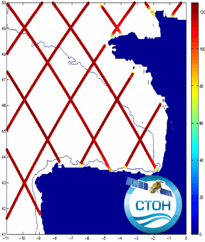
The CTOH computes and distributes specific, coastal along-track sea level anomalies (SLA) using its X-TRACK processor over 23 regions, for all precise altimeter missions : Topex/Jason-1/Jason-2/Jason-3 (+Topex Interleaved orbit (TPN)/Jason-1 Interleaved orbit (J1N)), SARAL/AltiKa, Envisat, Geosat Follow On
The CTOH computes and distributes specific, coastal along-track sea level anomalies (SLA) using its X-TRACK processor for all precise altimeter missions : Topex/Poseidon (TP), Jason-1 (J1) , Jason-1 interleaved (J1N), Topex/Poseidon interleaved (TPN), Jason-2, Geosat Follow on (GFO) and Envisat.
X-TRACK cover today all the coastal oceans, with 23 new regions.
Simple
- Title
-
X-TRACK: SEA LEVEL ANOMALIES DEDICATED TO COASTAL APPLICATIONS - Regional (23 areas)
- Date (Creation)
- 1993-02-01
- Date (Publication)
- 2016-06-15
- Abstract
-
The CTOH computes and distributes specific, coastal along-track sea level anomalies (SLA) using its X-TRACK processor over 23 regions, for all precise altimeter missions : Topex/Jason-1/Jason-2/Jason-3 (+Topex Interleaved orbit (TPN)/Jason-1 Interleaved orbit (J1N)), SARAL/AltiKa, Envisat, Geosat Follow On
The CTOH computes and distributes specific, coastal along-track sea level anomalies (SLA) using its X-TRACK processor for all precise altimeter missions : Topex/Poseidon (TP), Jason-1 (J1) , Jason-1 interleaved (J1N), Topex/Poseidon interleaved (TPN), Jason-2, Geosat Follow on (GFO) and Envisat.
X-TRACK cover today all the coastal oceans, with 23 new regions.
- Credit
-
CTOH
- Point of contact
-
Organisation name Individual name Electronic mail address Role AVISO+
Local service desk CTOH
Author CTOH
Publisher
-
Centre de données ODATIS
-
-
CDS-SAT-AVISO
-
- Keywords
-
-
Type de jeux de donnée ODATIS
-
-
/Remote sensing
-
-
Thèmatiques ODATIS
-
-
Remote sensing
-
-
Services Nationaux d'Observation
-
-
SNO-CTOH
-
-
ODATIS aggregation parameters and Essential Variable names
-
-
Sea surface height
-
- Use limitation
- Licence ouverte
- Access constraints
- Other restrictions
- Use constraints
- Other restrictions
- Other legal constraints
-
You must give appropriate credits and acknowledgments : "These products were developed, validated and distributed by CTOH/LEGOS France. Publications should include the following statement in the Acknowledgments: “Altimetry data used in this study (doi 10.6096/CTOH_X-TRACK_2017_02) were developed, validated by the CTOH/LEGOS, France and distributed by Aviso+”.
- Spatial representation type
- Grid
- Language
- Français
- Character set
- UTF8
- Topic category
-
- Oceans
))
- Begin date
- 1993-02-01
- End date
- 2020-06-02
- Geometric object type
- Complex
- Distribution format
-
Name Version
- OnLine resource
-
Protocol Linkage Name WWW:LINK
https://www.aviso.altimetry.fr/en/data/products/sea-surface-height-products/regional/x-track-sla.html Plus d'information sur AVISO+
WWW:LINK
ftp://ftp-access.aviso.altimetry.fr/regional-xtrack-coastal Accès authentifié aux données via FTP
WWW:LINK
https://www.aviso.altimetry.fr/fileadmin/documents/data/tools/hdbk_XTRACK_CTOH.pdf Manuel utilisateur X-TRACK
WWW:DOWNLOAD-1.0-link--download
https://dataterra:odatis@tds-odatis.aviso.altimetry.fr/thredds/catalog/dataset-l2-coastal-sla-xtrack/version_x_track_2017_02/catalog.html TDS fileserver X-Track
- OnLine resource
-
Protocol Linkage Name WWW:LINK-1.0-http--metadata-URL
https://doi.org/10.6096/ctoh_x-track_2017_02 10.1016/j.asr.2016.11.005
- Hierarchy level
- Dataset
- Statement
-
Using the latest corrections available in the CTOH database, CTOH computes a coastally-adapted Sea Surface Height (SSH) along the satellites ground-track for each cycle. Additionnal geophysical corrections are applied accounting for the aliasing of tides and short-term atmopheric effects in the SSH measurements. Details on selected corrections are given here. The Mean Sea Surface (MSSH) is computed at each point, based on the mission period currently available, and subtracted from the corrected SSH in order to form the SLA. The SLA are finally projected onto a reference track with a spatial interval of about 7 km between points (1 second). For every region, both the raw SLA and a 40-km along-track filtered SLA produc are distributed.
Birol, F., N. Fuller, F. Lyard, M. Cancet, F. Niño, C. Delebecque, S. Fleury, et al. 2016. “Coastal Applications from Nadir Altimetry: Example of the X-TRACK Regional Products.” Advances in Space Research, November. doi:10.1016/j.asr.2016.11.005
Metadata
- File identifier
- 3ee4926e-37d7-4a43-b5a8-45888e3a7dee
- Metadata language
- Français
- Other language
-
Language Character encoding English UTF8
- Character set
- UTF8
- Hierarchy level
- Dataset
- Date stamp
- 2023-12-01T12:48:52.322Z
- Metadata standard name
-
ISO 19115:2003/19139 - SEXTANT
- Metadata standard version
-
1.0
accessData
Overviews
)))