IWWOC Global Ocean Wind and Wave Parameters Level 2S from SWIM and SCAT onboard CFOSAT
The SWISCA Level 2S (L2S) product provides along-track colocation of SWIM wave measuring instrument onto SCAT scatterometer grid, over the global ocean. SWIM and SCAT are both instruments onboard CFOSAT. CFOSAT (Chinese French Ocean SATellite) is a french-chinese mission launched in 2018, whose aim is to provide wind (SCAT instrument) and wave (SWIM instrument) measurements over the sea surface.
The SWISCA L2S product is broken down into three different subproducts:
- L2A containing the sigma0 of both SWIM and SCAT
- L2B containing the wave parameters measured by SWIM and wind vectors measured by SCAT
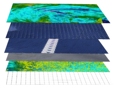
- AUX containing additional ancillary fields such as sea ice concentration (from CERSAT/SSMI), ocean currents (from CMEMS/GlobCurrent), SST and Wind (from ECMWF), rain rate (from IMERG), and WaveWatch3 wave spectra.
All SWIM and ancillary observations are resampled onto SCAT scatterometer's geometry (wind vector cells, WVC).
The SWISCA level 2S product is generated in delayed mode, a few days after acquisition. It is intended to foster cross analysis of SWIM and SCAT observations, and their combination to improve the retrieval of both wind and wave parameters.
The SWISCA L2S product is generated and distributed by Ifremer / CERSAT in the frame of the Ifremer Wind and Wave Operation Center (IWWOC) co-funded by Ifremer and CNES and dedicated to the processing of the delayed mode data of CFOSAT mission.
Simple
Identification info
- Date (Creation)
- 2022-03-07
- Date (Publication)
- 2022-03-07
- Citation identifier
- IWWOC_SWISCA_L2S___
- Point of contact
-
Organisation Individual Electronic mail address ORCID Role eOdyn
Alexey Mironov
Principal investigator Ifremer / CERSAT
CERSAT help desk
Point of contact Ifremer / CERSAT
CERSAT help desk
Distributor
- Spatial representation type
- Grid
Spatial resolution
- Spatial resolution
- 25 km
- Temporal resolution
-
P0Y0M0DT0H0M0S
- Topic category
-
- Oceans
Extent
))
- Geographic identifier
- Global
Extent
- Time period
- 2019-04-25
- GEMET - INSPIRE themes, version 1.0
-
-
Oceanographic geographical features
-
- Cersat - Parameter
-
-
Sea State
-
Ocean Winds
-
Ocean Waves
-
- Cersat - Project
-
-
IWWOC
-
CFOSAT
-
- Cersat - Latency
-
-
Less than 4 days
-
- Cersat - GCMD parameter
-
-
/Ocean Winds
-
/Ocean Waves/Sea State
-
/Ocean Winds/Surface Winds
-
/Ocean Waves
-
/Ocean Circulation/Ocean Currents
-
- Centre de données ODATIS
-
-
CDS-SAT-CERSAT
-
Resource constraints
- Use limitation
-
None
- Access constraints
- Unrestricted
- Use constraints
- Other restrictions
- Other constraints
- CC-BY (Creative Commons - Attribution)
- Other constraints
-
Ifremer / CERSAT. 2022. IWWOC Global Ocean Wind and Wave Parameters Level 2S from SWIM and SCAT onboard CFOSAT. Ver. 1.0. Ifremer, Plouzane, France. Dataset accessed [YYYY-MM-DD]. DOI: 10.12770/40164663-7948-4ac7-9e6c-e7dc6746175f
Associated resource
- Association Type
Content Information
- Attribute description
- orbit
- Processing level code
- L2S
Distribution Information
- Distribution format
-
-
NetCDF
-
- Distributor contact
-
Organisation Individual Electronic mail address ORCID Role
- OnLine resource
-
Ifremer HTTP Server
HTTP
- OnLine resource
-
Ifremer FTP server
FTP
- OnLine resource
-
Processing and validation
Algorithm Theoretical Basis Document (ATBD)
- OnLine resource
-
Local path on Datarmor
Local path
- OnLine resource
-
Digital Object Identifier (DOI)
Data quality info
- Hierarchy level
- Dataset
Reference System Information
- Reference system identifier
- http://www.opengis.net/def/crs/EPSG/0/4326
- Instrument
-
Instrument Platform SWIM
CFOSAT
SCAT
CFOSAT
Metadata
- Metadata identifier
- urn:uuid/40164663-7948-4ac7-9e6c-e7dc6746175f
- Language
- English
- Character encoding
- UTF8
- Contact
-
Organisation Individual Electronic mail address ORCID Role CERSAT Exploitation
Editor
Type of resource
- Resource type
- Dataset
- Metadata linkage
-
https://sextant-test.ifremer.fr/geonetwork/srv/api/records/c37b183e-0257-401d-b09d-3e8b0697887f
- Date info (Revision)
- 2022-06-20T13:31:30.995Z
- Date info (Creation)
- 2022-01-26T17:57:18.695Z
Metadata standard
- Title
-
ISO 19115-3:2018 - Remote Sensing
accessData
Overviews
Spatial extent
)))