Bathymetry and Elevation | Sea-floor depth (below mean sea level) {bathymetric depth} | EMODnet | EMODnet Digital Terrain Model
Simple
Identification info
- Alternate title
-
EMODnet Digital Terrain Model
- Date
- Citation identifier
- Bathymetry and Elevation | Sea-floor depth (below mean sea level) {bathymetric depth} | EMODnet | EMODnet Digital Terrain Model
- Purpose
-
Gridded bathymetry data
- Status
- On going
- Point of contact
-
Organisation Individual Electronic mail address ORCID Role EMODnet Digital Terrain Model
DTM
edmerp EMODnet
edmo General Bathymetric Chart of the Oceans (GEBCO)
Originator
- Spatial representation type
- Vector
Spatial resolution
- Spatial resolution
- 7.5 Arc second
- Topic category
-
- Oceans
Extent
))
Vertical element
- Minimum value
- 0
- Maximum value
- 11000
- Maintenance and update frequency
- As needed
- Used by challenges
-
-
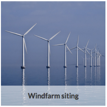
MedSea - CH01 - Windfarm Siting
-
- Environmental matrix
-
-
Seabed - Riverbed
-
- Production mode
-
-
Delayed
-
- Parameter Discovery Vocabulary (P02)
-
-
Bathymetry and Elevation
-
- GEMET - INSPIRE themes, version 1.0
-
-
Elevation
-
- Processing level of characteristics
-
-
High level analyzed
-
- Data delivery mechanisms
-
-
Online discovery + downloading + viewing services (Advanced services)
-
- Parameter Usage Vocabulary (P01)
-
-
Sea-floor depth (below mean sea level) {bathymetric depth}
-
- Parameter Usage Vocabulary (other)
-
-
Sea-floor depth (below mean sea level) {bathymetric depth}
-
- Agreed Parameter Groups (P03)
-
-
Gravity, magnetics and bathymetry
-
- Service extent
-
-
The datasets are referenced in a public national catalogue, in an international catalogue service
-
- Visibility
-
-
Search via reference catalogue (e.g. MyOcean, GEOSS Geoportal…)
-
- Policy visibility
-
-
There is detailed information provided to understand data policy
-
- Readyness
-
-
Format not proprietary and content clearly specified (e.g. autodescriptive like ODV, NetCDF CF) or at least with appropriate document describing the content
-
Resource constraints
- Access constraints
- Other restrictions
- Other constraints
-
Unrestricted
Resource constraints
- Use limitation
-
Open and Free. No charge
- Language
- Français
- Character encoding
- UTF8
- Environment description
-
Site assesment and data evaluation
Determine the suitability of sites for wind farm development
Evaluate the accuracy and the suitability of the available data
Content Information
- Attribute description
- observation
- Content type
- Physical measurement
MEDSEA_CH1_Product_3 / Suitability index of a wind farm in the NWMed concerning the environmental resources, the natural barriers, human activities, MPA and fisheries.
))
- Begin date
- 2001-01-01T00:00:00
- End date
- 2010-12-31T23:59:00Before
Vertical element
- Minimum value
- 0
- Maximum value
- 500
Resource lineage
- Hierarchy level
- Dataset
Spatial representation info
- Number of dimensions
- 0
- Dimension name
- Time
- Cell geometry
- Transformation parameter availability
- true
- Check point availability
- true
Metadata
- Metadata identifier
- urn:uuid/54d0b826-02f0-4273-a79e-dc4b2b0e31e0
- Language
- English
- Character encoding
- UTF8
- Contact
-
Organisation Individual Electronic mail address ORCID Role France Energies Marines
Point of contact
Type of resource
- Resource type
- Dataset
- Name
-
MedSea - CH01 - Windfarm Siting
- Metadata linkage
-
https://sextant.ifremer.fr/geonetwork/srv/eng//metadata/54d0b826-02f0-4273-a79e-dc4b2b0e31e0
- Metadata linkage
-
https://sextant.ifremer.fr/geonetwork/srv/fre//metadata/54d0b826-02f0-4273-a79e-dc4b2b0e31e0
- Date info (Revision)
- 2017-08-24T12:30:10Z
- Date info (Creation)
- 2015-07-01T11:36:58
Metadata standard
- Title
-
ISO 19115-3 - Emodnet Checkpoint - Upstream Data
- Edition
-
1.0
accessData
Overviews

Spatial extent
)))