MEDSEA_CH5_Product_8 / Impact of fisheries on the bottom from Data Logger combined with habitat vulnerability
to deliver maps showing the extent of the trawling fishing grounds for identifying the areas which are most disturbed by bottom trawling over the past ten years and identifying the gaps of fishing vessels’ tracking systems in the Mediterranean Sea
Simple
Identification info
- Date (Creation)
- 2016-11-22
- Date (Revision)
- 2016-11-24
- Citation identifier
- DOI:10.12770/5ebd6027-bcee-4fe9-840d-cc2618a41fd6
- Purpose
-
Assessment of trawling impact on the seabed
- Credit
-
EMODnet Medsea Checkpoint
- Point of contact
-
Organisation Individual Electronic mail address ORCID Role CNR-ISMAR
Point of contact CNR-ISMAR
Point of contact EMODnet Medsea Checkpoint
Publisher CNR-ISMARNora Tassetti
Anna Nora Tassetti
Author CNR-ISMARCarmen Ferrà
Carmen Ferrà
Author CNR-ISMARGiuseppe Scarcella
Giuseppe Scarcella
Author CNR-ISMARAntonello Sala
Antonello Sala
Author CNR-ISMAREmilio Notti
Emilio Notti
Author CNR-ISMARFabrizio Moro
Fabrizio Moro
Author CNR-ISMARJacopo Pulcinella
Jacopo Pulcinella
Author CNR-ISMARGianna Fabi
Gianna Fabi
Author
- Spatial representation type
- Vector
- Topic category
-
- Oceans
Extent
))
Extent
- Time period
- 2012-01-01 2015-12-31
Vertical element
- Minimum value
- 5
- Maximum value
- 270
- Used by challenges
-
-
MedSea - CH05 - Fisheries Management
-
- Processing level of characteristics
-
-
High level analyzed
-
- Production mode
-
-
Delayed
-
- GEMET - INSPIRE themes, version 1.0
-
-
Environmental monitoring facilities
-
- Theme
-
-
Trawling Impact
-
ESIF
-
Seabed substrate
-
Habitat vulnerability
-
Spatial distribution
-
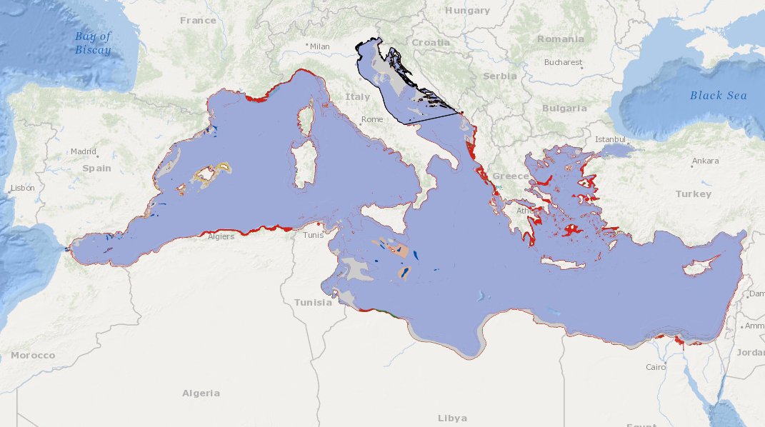
Adriatic Sea
-
Resource constraints
- Use limitation
-
For demostration of assessment
- Use constraints
Associated resource
- Association Type
- Cross reference
- Initiative Type
- specification
- Metadata Reference
Associated resource
- Association Type
- Cross reference
- Initiative Type
- upstreamData
Associated resource
- Association Type
- Cross reference
- Initiative Type
- upstreamData
Associated resource
- Association Type
- Cross reference
- Initiative Type
- upstreamData
- Metadata Reference
Associated resource
- Association Type
- Cross reference
- Initiative Type
- upstreamData
- Language
- English
- Character encoding
- UTF8
Distribution Information
- Distribution format
-
-
ESRI Shapefile
-
- OnLine resource
-
DOI of the product
DOI of the product
- OnLine resource
-
CH5_product_8
Product visualization
- OnLine resource
-
Download product
Download product
MEDSEA_CH5_Product_8 / Impact of fisheries on the bottom from Data Logger combined with habitat vulnerability - Impact of fisheries on the bottom from ESIF data combined with seabed substrate and habitat vulnerability
))
- Begin date
- 2012-01-01
- End date
- 2015-12-31
Vertical element
- Minimum value
- 5
- Maximum value
- 270
Reference System Information
- Reference system type
- Geodetic Geocentric
Metadata
- Metadata identifier
- urn:uuid/5ebd6027-bcee-4fe9-840d-cc2618a41fd6
- Language
- English
- Character encoding
- UTF8
Type of resource
- Resource type
- Dataset
- Metadata linkage
-
http://localhost:8080/geonetwork/srv/eng//metadata/286d8887-58a5-4562-a0b9-a69b78fced76
- Metadata linkage
-
http://localhost:8080/geonetwork/srv/eng//metadata/47dea01f-5b6a-48d7-990a-606a6001cbef
- Metadata linkage
-
https://sextant.ifremer.fr/geonetwork/srv/eng//metadata/5ebd6027-bcee-4fe9-840d-cc2618a41fd6
- Metadata linkage
-
https://sextant.ifremer.fr/geonetwork/srv/fre//metadata/5ebd6027-bcee-4fe9-840d-cc2618a41fd6
- Date info (Revision)
- 2025-01-28T09:15:43.757818Z
- Date info (Creation)
- 2005-03-31T19:13:30
Metadata standard
- Title
-
ISO 19115-3 - Emodnet Checkpoint - Targeted Data Product
)))