Polders in Mont Saint-Michel Bay. 1999 Status.
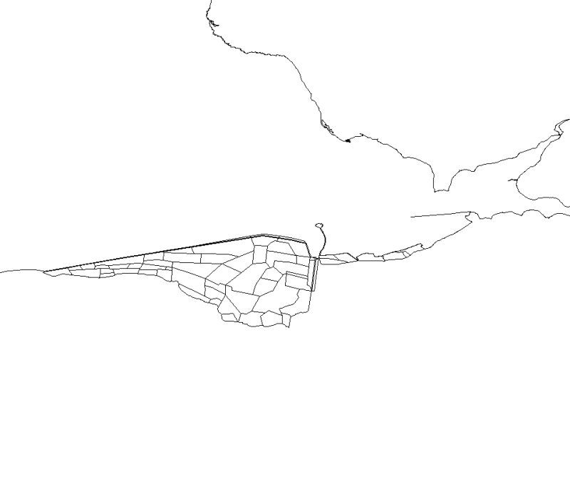
This map, realised with polygons, represents the polderized plot of bay of the Mount Saint-Michel.
Simple
- Title
-
Polders in Mont Saint-Michel Bay. 1999 Status.
- Alternate title
-
SIMON_polderEPHE99_P
- Alternate title
-
PNEC_POLDER_MSM_P
- Date (Creation)
- 2005-01-01T00:00:00
- Citation identifier
- PNEC_POLDER_MSM_P
- Presentation form
- Digital map
- Abstract
-
This map, realised with polygons, represents the polderized plot of bay of the Mount Saint-Michel.
- Status
- Completed
- Point of contact
-
Organisation name Individual name Electronic mail address Role CNRS, UMR 8586 PRODIG, Laboratoire de géomorphologie environnement littoral de Dinard
Chantal BONNOT-COURTOIS
Local service desk Laboratoire de Géomorphologie et Environnement littoral UMR 8586 PRODIG CNRS/EPHE
Xiaojun LI
Processor Laboratoire de Géomorphologie et Environnement littoral UMR 8586 PRODIG CNRS/EPHE
J. le Rhun
Processor
- Maintenance and update frequency
- Not planned
-
Thèmes Sextant
-
-
/Human Activities/Agricultural Activities
-
- Theme
-
-
Polder
-
- Place
-
-
Mont Saint-Michel Bay
-
Brittany
-
Lower Normandy
-
Ille-et-Vilaine
-
-
GEMET - INSPIRE themes, version 1.0
-
-
Installations agricoles et aquacoles
-
- Use limitation
-
All commercial use prohibited
- Use constraints
- Other restrictions
- Other legal constraints
-
Obligation to cite the following reference in bibliographies
X. Li, 2005. Contribution to the implementation of a spatial reference database for Mont Saint-Michel Bay. Mémoire de diplôme de l'École Pratique des Hautes Études. 85 p
- Spatial representation type
- Vector
- Denominator
- 25000
- Language
- Français
- Character set
- UTF8
- Topic category
-
- Farming
- Environment
- Elevation
- Planning cadastre
- Oceans
- Description
-
Date shooting SPOT image
- Description
-
Creation of the source figure (J. Le Rhun, 1982. Physical study of Mont Saint-Michel Bay. Thesis from the University of Paris. 313 p.)
))
- Supplemental Information
-
This data was digitalised on the SPOT © CNES image of Mont Saint-Michel Bay (1999). The attributed data and contours of the polders were defined from a figure by J. le Rhun (J. Le Rhun, 1982. Physical study of Mont Saint-Michel Bay. Thesis from the University of Paris. 313 p.), which was in turn drawn up from statements and the thesis of F. Verger (F. Verger, 1968. Marais et wadden du littoral français. Coastal geomorphological study. Doctoral Thesis from the University of Paris. 544 p.).
This digitalisation was conducted by X. LI (LI X., 2005. Contribution to the drawing up of a spatial reference database in Mont Saint-Michel Bay". Final Dissertation from École Pratique des Hautes Études. 85 p.).
Details of attributed fields :
- DATE_DE_CR : year that the area was reclaimed
- Reference system identifier
- 4326
- Topology level
- Geometry only
- Geometric object type
- Surface
- Geometric object count
- 58
Distributor
- Distributor contact
-
Organisation name Individual name Electronic mail address Role Ifremer
Dissemination Unit
- Distributor format
-
Name Version
- OnLine resource
-
Protocol Linkage Name OGC:WMS
https://sextant.ifremer.fr/services/wms/ogive_agil PNEC_POLDER_MSM_P
- Hierarchy level
- Dataset
- Statement
-
This data was digitalised from the SPOT © CNES image of Mont Saint-Michel Bay (1999). Indeed, a figure by J. Le Rhun (J. Le Rhun, 1982. Physical Study of Mont Saint-Michel Bay.
Thesis from the University of Paris. 313 p.) assisted in the positioning of the areas and the completion of attribute tables. Digitalisation conducted by X. LI (LI X., 2005. Contribution to the drawing up of a spatial reference database in Mont Saint-Michel Bay". Final Dissertation from École Pratique des Hautes Études. 85 p.). The data has been geometrically validated in accordance with a protocol defined for the
Mont Saint- Michel Bay marine Geographical Information System (SIG) and using d'ArcGIS 9.2 (ESRI). The following operations were carried out: removal of fields SOURCE and ID_CODE,
Verification of field type, transformation of multiple-part entities, to a single part (with ArcToolbox), Topological verification and correction (ArcInfo) (for overlay and discontinuity).
Content Information
Metadata
- File identifier
- 62b34650-ad4f-11dc-9ee5-000086f6a62e
- Metadata language
- Français
- Other language
-
Language Character encoding English
- Character set
- UTF8
- Hierarchy level
- Dataset
- Date stamp
- 2020-06-04T01:06:54
- Metadata standard name
-
ISO 19115:2003/19139 - SEXTANT
- Metadata standard version
-
1.0
- Metadata author
-
Organisation name Individual name Electronic mail address Role IFREMER
Xavier ROZEC
Local service desk
accessData
Overviews
)))