GLOBAL OCEAN ALONG-TRACK L3 SEA SURFACE HEIGHTS REPROCESSED & NRT(1993-ONGOING)
For the Global Ocean - Monomission altimeter satellite along-track sea surface heights computed with respect to a twenty-year mean. Previously distributed by Aviso+, no change in the scientific content. All the missions are homogenized with respect to a reference mission which is currently Jason-3. The acquisition of various altimeter data is a few days at most. The sla is computed with a non-centered computation time window (6 weeks before the date).
Simple
- Title
-
GLOBAL OCEAN ALONG-TRACK L3 SEA SURFACE HEIGHTS REPROCESSED & NRT(1993-ONGOING)
- Date (Creation)
- 1993-01-01
- Abstract
-
For the Global Ocean - Monomission altimeter satellite along-track sea surface heights computed with respect to a twenty-year mean. Previously distributed by Aviso+, no change in the scientific content. All the missions are homogenized with respect to a reference mission which is currently Jason-3. The acquisition of various altimeter data is a few days at most. The sla is computed with a non-centered computation time window (6 weeks before the date).
- Credit
-
Marine Core Service
- Point of contact
-
Organisation name Individual name Electronic mail address Role Copernicus
Marine Core Service
Local service desk
-
Centre de données ODATIS
-
-
CDS-SAT-AVISO
-
- Keywords
-
-
Type de jeux de donnée ODATIS
-
-
/Remote sensing
-
-
Thèmatiques ODATIS
-
-
Operational oceanography
-
-
Processing level
-
-
Level 3
-
-
ODATIS aggregation parameters and Essential Variable names
-
-
Sea surface height
-
- Use limitation
- Open Licence
- Access constraints
- License
- Use constraints
- License
- Other legal constraints
-
Les conditions spécifiques de la licence sont détaillées dans http://marine.copernicus.eu/services-portfolio/service-commitments-and-licence/
- Spatial representation type
- Grid
- Language
- Français
- Character set
- UTF8
- Topic category
-
- Oceans
))
- Begin date
- 1993-01-01
- Geometric object type
- Complex
- Distribution format
-
Name Version
- OnLine resource
-
Protocol Linkage Name WWW:LINK
ftp://my.cmems-du.eu/Core/SEALEVEL_GLO_PHY_L3_REP_OBSERVATIONS_008_045/ Accès authentifié aux données DT via FTP
WWW:LINK
ftp://nrt.cmems-du.eu/Core/SEALEVEL_GLO_PHY_L3_NRT_OBSERVATIONS_008_044/ Accès authentifié aux données NRT via FTP
WWW:LINK
http://marine.copernicus.eu/services-portfolio/access-to-products/?option=com_csw&view=details&product_id=SEALEVEL_GLO_PHY_L3_REP_OBSERVATIONS_008_045 Plus d'information sur CMEMS (DT)
WWW:LINK
http://marine.copernicus.eu/services-portfolio/access-to-products/?option=com_csw&view=details&product_id=SEALEVEL_GLO_PHY_L3_NRT_OBSERVATIONS_008_044 Plus d'information sur CMEMS (NRT)
WWW:LINK-1.0-http--metadata-URL
https://doi.org/10.48670/moi-00147 DOI dataset
OnLine resource
- Hierarchy level
- Dataset
- Statement
-
Detailed description:
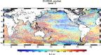
This product is processed by the SL-TAC multimission altimeter data processing system. It serves in near-real time the main operational oceanography and climate forecasting centers in Europe and worldwide. It processes data from all altimeter missions: Jason-3, Sentinel-3A, HY-2A, Saral/AltiKa, Cryosat-2, Jason-2, Jason-1, T/P, ENVISAT, GFO, ERS1/2. It provides a consistent and homogeneous catalogue of products for varied applications, both for near real time applications and offline studies.
Horizontal sampling:
14km
Metadata
- File identifier
- 66babe59-04d8-41d0-b1b8-5f94fe857611
- Metadata language
- Français
- Other language
-
Language Character encoding English UTF8
- Character set
- UTF8
- Hierarchy level
- Dataset
- Date stamp
- 2023-05-22T07:26:48.508Z
- Metadata standard name
-
ISO 19115:2003/19139 - SEXTANT
- Metadata standard version
-
1.0
accessData
Overviews
)))