Bathymetry and Elevation | Sea-floor depth (below Lowest Astronomical Tide datum) {bathymetric depth} in the water body | EMODnet Secretariat | 250m Digital terrain model
Simple
Identification info
- Alternate title
-
250m Digital terrain model
- Date
- Citation identifier
- Bathymetry and Elevation | Sea-floor depth (below Lowest Astronomical Tide datum) {bathymetric depth} in the water body | EMODnet Secretariat | 250m Digital terrain model
- Convention
-
EMODnet bathymetry
- Purpose
-
Gridded bathymety datasets for multipurpose uses
- Status
- On going
- Point of contact
-
Organisation Individual Electronic mail address ORCID Role EMODNet Bathymetry
EMODNet Bathymetry
edmerp EMODnet Secretariat
edmo Originator
- Spatial representation type
- Vector
Spatial resolution
- Spatial resolution
- 250 meter
- Topic category
-
- Oceans
Extent
))
Extent
- Time period
- 1800-01-01T00:00:00 2015-12-31T00:00:00
Vertical element
- Minimum value
- 0
- Maximum value
- 6500
- Maintenance and update frequency
- As needed
- Used by challenges
-
-
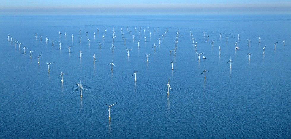
Atlantic - CH01 - Windfarm Siting
-
- Environmental matrix
-
-
Seabed - Riverbed
-
- Production mode
-
-
Delayed
-
- Visibility
-
-
Search via reference catalogue (e.g. MyOcean, GEOSS Geoportal…)
-
- Policy visibility
-
-
There is detailed information provided to understand data policy
-
- Readyness
-
-
Format not proprietary and content clearly specified (e.g. autodescriptive like ODV, NetCDF CF) or at least with appropriate document describing the content
-
- Parameter Discovery Vocabulary (P02)
-
-
Bathymetry and Elevation
-
- GEMET - INSPIRE themes, version 1.0
-
-
Hydrography
-
- Processing level of characteristics
-
-
High level analyzed
-
- Data delivery mechanisms
-
-
Online discovery + downloading + viewing services (Advanced services)
-
- Parameter Usage Vocabulary (P01)
-
-
Sea-floor depth (below Lowest Astronomical Tide datum) {bathymetric depth} in the water body
-
- Parameter Usage Vocabulary (other)
-
-
Sea-floor depth (below Lowest Astronomical Tide datum) {bathymetric depth} in the water body
-
- Agreed Parameter Groups (P03)
-
-
Gravity, magnetics and bathymetry
-
- Service extent
-
-
The datasets are provided through an EU Inspire catalogue service (OGC)
-
- Validation
-
-
Submitted
-
Resource constraints
- Access constraints
- Other restrictions
- Other constraints
-
Unrestricted
Resource constraints
- Use limitation
-
Open and Free. No charge
- Language
- Français
- Character encoding
- UTF8
- Environment description
-
Seabed depth will used as major indicator in fitness for use OWF siting assessment
Content Information
- Attribute description
- observation
- Content type
- Physical measurement
Distribution Information
- Distribution format
-
-
Ascii
-
GeoTIFF
-
NetCDF
-
- OnLine resource
-
EMODnet bathymetry
OnLine resource
- Protocol
-
WWW:LINK
ATLANTIC_CH01_Product_1 / Map of offshore windfarm siting suitability in the geographic area where waters of France, Ireland and UK meet
))
ATLANTIC_CH01_Product_2 / Map of windfarm siting suitability in the area where waters of France and Spain meet in Bay of Biscay on 500 m contour
))
ATLANTIC_CH01_Product_3 / Map of windfarm siting suitability in the area of Southern border of Portugal and Spain at 20 m depth
))
ATLANTIC_CH01_Product_4 / Map of offshore windfarm siting suitability in the area off S. Miguel Island (Azores archipelago)
))
Resource lineage
- Hierarchy level
- Dataset
Spatial representation info
- Number of dimensions
- 0.1
- Dimension name
- Time
- Cell geometry
- Transformation parameter availability
- true
- Check point availability
- true
Metadata
- Metadata identifier
- urn:uuid/697b3e20-e47a-460e-95ef-0a466996ff6e
- Language
- English
- Character encoding
- UTF8
- Contact
-
Organisation Individual Electronic mail address ORCID Role Instituto Português do Mar e da Atmosfera (IPMA)
Type of resource
- Resource type
- Dataset
- Name
-
Atlantic - CH01 - Windfarm Siting
- Metadata linkage
-
https://sextant.ifremer.fr/geonetwork/srv/eng//metadata/697b3e20-e47a-460e-95ef-0a466996ff6e
- Metadata linkage
-
https://sextant.ifremer.fr/geonetwork/srv/fre//metadata/697b3e20-e47a-460e-95ef-0a466996ff6e
- Date info (Revision)
- 2018-04-23T15:50:29Z
- Date info (Creation)
- 2014-10-08T14:35:32
Metadata standard
- Title
-
ISO 19115-3 - Emodnet Checkpoint - Upstream Data
- Edition
-
1.0
EMODnet bathymetry
accessData
Overviews
Spatial extent
)))