Bathymetry and Elevation | Sea-floor depth (below mean sea level) {bathymetric depth} | EMODnet Secretariat | EMODNET Bathymetry
Simple
Identification info
- Alternate title
-
EMODNET Bathymetry
- Date
- Citation identifier
- Bathymetry and Elevation | Sea-floor depth (below mean sea level) {bathymetric depth} | EMODnet Secretariat | EMODNET Bathymetry
- Convention
-
EMODNET Bathymetry
- Purpose
-
EMODNET European sea bed bathymetry
- Status
- On going
- Point of contact
-
Organisation Individual Electronic mail address ORCID Role EMODNet Bathymetry
EMODNet Bathymetry
edmerp EMODnet Secretariat
edmo
- Spatial representation type
- Vector
Spatial resolution
- Spatial resolution
- 0.125 arc minute
- Topic category
-
- Oceans
Extent
))
Extent
- Time period
- unknown
Vertical element
- Minimum value
- 0
- Maximum value
- 230
- Maintenance and update frequency
- Unknown
- Used by challenges
-
-
Atlantic - CH10 - Bathymetry
-
- Environmental matrix
-
-
Seabed - Riverbed
-
- Production mode
-
-
Delayed
-
- Visibility
-
-
Use of open search engines, searching by name either the data provider or the characteristics
-
- Policy visibility
-
-
There is no information at all on data policy adopted by data providers
-
- Readyness
-
-
Proprietary format and not well documented
-
- Parameter Discovery Vocabulary (P02)
-
-
Bathymetry and Elevation
-
- GEMET - INSPIRE themes, version 1.0
-
-
Elevation
-
- Processing level of characteristics
-
-
High level analyzed
-
- Data delivery mechanisms
-
-
Online discovery + downloading + viewing services (Advanced services)
-
- Parameter Usage Vocabulary (P01)
-
-
Sea-floor depth (below mean sea level) {bathymetric depth}
-
- Parameter Usage Vocabulary (other)
-
-
BATHDPTH
-
- Agreed Parameter Groups (P03)
-
-
Terrestrial
-
- Service extent
-
-
The datasets are referenced in a public national catalogue, in an international catalogue service
-
- Validation
-
-
Draft
-
Resource constraints
- Access constraints
- Other restrictions
- Other constraints
-
Unrestricted
Resource constraints
- Use limitation
-
Open and Free. No charge
- Language
- Français
- Character encoding
- UTF8
- Environment description
-
Analysis of water depth.
Standard deviation of measurements (for repeat surveys)
Confidence in the bathymetric measurements (ENC quality flags)
Type of instrument used for bathymetry readings
Age of bathymetry measurement
Content Information
- Attribute description
- observation
- Content type
- Physical measurement
Distribution Information
- Distribution format
-
-
GeoTIFF
-
Ascii
-
NetCDF
-
EMO file
-
EMO (without GEBCO data) file
-
SD file
-
XYZ file
-
- OnLine resource
-
EMODNET Bathymetry
- OnLine resource
-
EMODNET Bathymetry
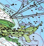
ATLANTIC_CH10_Product_1 / Sample areas of digital bathymetry covering representative areas of the North Atlantic.
))
ATLANTIC_CH10_Product_1 / Sample areas of digital bathymetry covering representative areas of the North Atlantic.
))
ATLANTIC_CH10_Product_1 / Sample areas of digital bathymetry covering representative areas of the North Atlantic.
))
ATLANTIC_CH10_Product_2 / Digital bathymetry uncertainty covering the North Atlantic, and a representative sample area within the North Atlantic.
))
Resource lineage
- Lineage
-
www.emodnet.eu/bathymetry
- Hierarchy level
- Dataset
Spatial representation info
- Number of dimensions
- 500
- Dimension name
- Time
- Cell geometry
- Transformation parameter availability
- true
- Check point availability
- true
Metadata
- Metadata identifier
- urn:uuid/72fea185-7548-40a6-9d4f-b26772b84a0d
- Language
- English
- Character encoding
- UTF8
- Contact
-
Organisation Individual Electronic mail address ORCID Role HR Wallingford
Type of resource
- Resource type
- Dataset
- Name
-
Atlantic - CH10 - Bathymetry and BS-CHK
- Metadata linkage
-
https://sextant.ifremer.fr/geonetwork/srv/eng//metadata/72fea185-7548-40a6-9d4f-b26772b84a0d
- Metadata linkage
-
https://sextant.ifremer.fr/geonetwork/srv/fre//metadata/72fea185-7548-40a6-9d4f-b26772b84a0d
- Date info (Revision)
- 2018-05-31T15:16:13Z
- Date info (Creation)
- 2014-10-08T14:35:32
Metadata standard
- Title
-
ISO 19115-3 - Emodnet Checkpoint - Upstream Data
- Edition
-
1.0
EMODNET Bathymetry
accessData
Overviews
Spatial extent
)))