Operational System for Producing and Using Oceanographic and Acoustic Information - SOAP -
The SOAP system is the baseline for the real-time operational oceanographic forecasting and is the main oceanographic forecasting tool.
Simple
- Title
-
Operational System for Producing and Using Oceanographic and Acoustic Information - SOAP -
- Date (Creation)
- 1998-01-01T00:00:00
- Citation identifier
- FR-DCSMM-PDS-SOAP
- Presentation form
- Digital profile
- Abstract
-
The SOAP system is the baseline for the real-time operational oceanographic forecasting and is the main oceanographic forecasting tool.
- Purpose
-
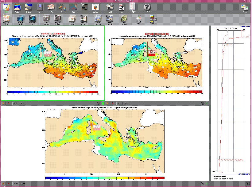
The aim of the SOAP system is to provide value-added products in forecasting and analysis so as to describe the physical and acoustic state of the ocean for both military and civilian purposes. This programme was launched by the SHOM in 1997 and the subsequent versions which have taken scientific advances into account have enabled us to provide a regular operational service, particularly for users in the defence sector. It is used to supervise oceanographic models and ensures specifically-designed post-production in order to meet particular needs (digital products and forecast bulletins). The main functions of SOAP enables it to: adopt the flow of external data (meteorological, hydrodynamic, oceanographic, sedimentological), to design a range of products from raw products to custom products, to measure production, to manage and serve user commands and to pilot production lines.
The version currently operating is version 3. It includes a sub-system for wave forecasting called PREVAG.
- Credit
-
Data producers : SHOM
- Status
- On going
- Point of contact
-
Organisation name Individual name Electronic mail address Role SHOM
JOURDAN Didier
Local service desk
- Maintenance and update frequency
- Daily
- Maintenance note
-
Network Duration: perennial Network
- Theme
-
-
Operational System
-
Oceanography
-
Operational Oceanography,
-
Forecaster
-
Forecast
-
Models
-
Acoustics
-
Hydrological Profiles
-
Temperature
-
Salinity
-
Currents
-
Waves
-
Assisted Decision-Making
-
Oceanographic Bulletin
-
-
GEMET - INSPIRE themes, version 1.0
-
-
Environmental monitoring facilities
-
-
Sous-regions marines
-
-
National
-
-
DCSMM : Type d'espace concerné
-
-
Pas d'espace particulier concerné
-
-
DCSMM : Descripteurs
-
-
D7: Hydrographical Conditions
-
-
DCSMM : Méthodes de recueil des données
-
-
Observation indirecte
-
-
Thèmes Sextant
-
-
/Physical Environment/Coastal Hydrodynamics
-
- Access constraints
- Other restrictions
- Other legal constraints
-
Restricted access
- Use limitation
-
Pricing Methods : the fee is equal to the cost of making the data available.
- Spatial representation type
- Vector
- Denominator
- 50000
- Language
- Français
- Character set
- UTF8
- Topic category
-
- Oceans
))
- Supplemental Information
-
Project leader :
Defence Ministry 1998
Prime contractor :
SHOM 1998
Backer :
Defence Ministry 1998
The SOAP system is operated by the SHOM. The models used are as follows :
- OPA-NEMO from MERCATOR for forecasting on a global scale;
- HYCOM from NRL for forecasting on a global scale;
- the HYCOM oceanographic model from the SHOM for forecasting on a regional and coastal scale ;
- WW3 and SWAN wave models for wave forecasting
The SHOM produces both derived products and value-added services.
- Reference system identifier
- EPSG / WGS 84 (EPSG:4326) / 7.9
- Topology level
- Geometry only
- Geometric object type
- Complex
- Geometric object count
- 0
- Hierarchy level
- Dataset
Conformance result
- Title
-
Inspire specifications
- Date (Creation)
- 2012-01-16
- Explanation
-
Non assessed
- Pass
- Statement
-
April 1998 commissioning of version 1 of SOAP (SOAP-1)
March 2004 : Implementation of SOAP-2
Mars 2006 : Launch
February 2007 : Completion
January 2008 : Integration / Validation May 2008 : Qualification / Deployment
May 2009 : System implemented
May – November 2009 : Operational Experimentation
February 2010 : Products and services available for use
July 2011 : Implementation of SOAP-3
The oceanographic and acoustic products distributed to users are put together from validated analyses and forecasts.
- Description
-
Data type : Hydrology - Hydrodynamics
Precision on the data type :
Analysis and forecasting products (output as digital models)
Area products or temporary products (profiles)
Measured or observed parameters :
- Temperature
- Salinity
- Current
- Acoustic products
- Water level (*)
- Storm surge (*)
- Waves – sea states (level, direction, period)
Parameters resolution :
Depth: surface to sea floor
Resolution : variable depending on coverage : overall 1/12°,
Regional 1/60° (*) Coastal zoom (*)
Update frequency :
Weekly to daily (depending on the parameters)
Daily (during the activation period)
Observation frequency :
1-week forecast
72-hour forecast
- Description
-
Sampling method : Spatial, Geometric
- Description
-
Device associated : MERCATOR, CORIOLIS, PREVIMER, RONIM, REFMAR, PREVAG
Metadata
- File identifier
- 757e8208-6235-46fe-83a7-e5f14445f320
- Metadata language
- Français
- Other language
-
Language Character encoding English
- Character set
- UTF8
- Hierarchy level
- Series
- Date stamp
- 2020-06-04T00:43:47
- Metadata standard name
-
ISO 19115:2003/19139 - SEXTANT
- Metadata standard version
-
1.0
- Metadata author
-
Organisation name Individual name Electronic mail address Role Sextant
Local service desk
accessData
Overviews
)))