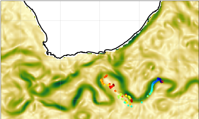
WOC Geostrophic Surface Current Estimated by the BFN-QG over Agulhas Region
For over 25 years, satellite altimetry has provided invaluable information about the ocean dynamics at many scales. Gridded Sea Surface Height (SSH) maps allow to estimate the mesoscale geostrophic circulation in the ocean. However, conventional interpolation techniques rely on static optimal interpolation schemes, hence limiting the estimation of non-linear dynamics at scales not well sampled by altimetry (i.e., below 150-200km at mid latitudes). To overcome this limitation in the resolution of small-scale SSH structures (and thus small-scale geostrophic currents), a Back-and-Forth Nudging algorithm combined with a Quasi-Geostrophic model, a technique called BFN-QG, has been implemented within the theme 1 of the ESA World Ocean Circulation (WOC) project. The performances have been evaluated within Observing System Experiments (OSEs) that use independent data (such as independent SSH, Sea Surface Temperature and drifter data) as ground-truth. By comparing the mapping performances to the ones obtained by operational products, the BFN-QG improves the mapping of short, energetic mesoscale structures and associated geostrophic currents both in space and time. In particular, the BFN-QG improves (i) the spatial effective resolution of the SSH maps by a factor of 20%, (ii) the zonal and (especially) the meridional geostrophic currents and (iii) the prediction of Lagrangian transport for lead times up to 10 days.
The data are available through HTTP and FTP; access to the data is free and open. In order to be informed about changes and to help us keep track of data usage, we encourage users to register at: https://forms.ifremer.fr/lops-siam/access-to-esa-world-ocean-circulation-project-data/
This dataset was generated by Datlas and is distributed by Ifremer / CERSAT in the frame of the World Ocean Circulation (WOC) project funded by the European Space Agency (ESA).
Simple
Identification info
- Date (Creation)
- 2023-07-01
- Date (Publication)
- 2023-07-01
- Citation identifier
- WOC-L4-CURGEO-BFNQG-AGH
- Status
- Final
- Point of contact
-
Organisation Individual Electronic mail address ORCID Role Helpdesk CERSAT
Point of contact ESA
Florian Le Guillou
Author Ifremer/CERSAT > Satellite Data Processing and Distribution Center of the French Research Institute for Exploitation of the Sea
Distributor
- Spatial representation type
- Grid
Spatial resolution
- Spatial resolution
- 0.1 degree
- Temporal resolution
-
P0Y0M0DT3H0M0S
- Topic category
-
- Oceans
Extent
))
- Geographic identifier
- Agulhas
Extent
- Time period
- 2010-01-01 2020-12-31
- GEMET - INSPIRE themes, version 1.0
-
-
Oceanographic geographical features
-
- Cersat - Parameter
-
-
Ocean currents
-
- Cersat - Project
-
-
WOC
-
- Cersat - Latency
-
-
Historical
-
- Cersat - GCMD parameter
-
-
/Ocean Circulation/Ocean Currents
-
- Centre de données ODATIS
-
-
CDS-CERSAT
-
- Type de jeux de donnée ODATIS
-
-
/Observational data/satellite
-
Resource constraints
- Use limitation
-
None
- Access constraints
- Unrestricted
- Use constraints
- Other restrictions
- Other constraints
- CC-BY (Creative Commons - Attribution)
- Other constraints
-
Datlas. 2023. North Atlantic Data-Driven 2D Surface Currents from ESA WOC project. Ver. 2.0. Obtained from CERSAT / Ifremer, Plouzane, France. Dataset accessed [YYYY-MM-DD].
Associated resource
- Association Type
Content Information
- Processing level code
- L4
Distribution Information
- Distribution format
-
-
NetCDF
-
- Distributor contact
-
Organisation Individual Electronic mail address ORCID Role
OnLine resource
- Function
- OnLine resource
-
Ifremer HTTPS server
- OnLine resource
-
Ifremer FTP server
FTP
- OnLine resource
-
User guide
Product User Manual
- OnLine resource
-
Processing and validation
Le Guillou, F., Gaultier, L., Ballarotta, M., Metref, S., Ubelmann, C., Cosme, E., and Rio, M.-H.: Regional mapping of energetic short mesoscale ocean dynamics from altimetry: performances from real observations., EGUsphere [preprint], https://doi.org/10.5194/egusphere-2023-509, 2023
- OnLine resource
-
Digital Object Identifier (DOI)
Data quality info
- Hierarchy level
- Dataset
Reference System Information
- Reference system identifier
- http://www.opengis.net/def/crs/EPSG/0/4326
- Hierarchy level
Extent
- Description
-
grid
- Instrument
-
Instrument Platform
Metadata
- Metadata identifier
- urn:uuid/7fe77c80-798a-42d4-a69c-2b5f0ba81a43
- Language
- English
- Character encoding
- UTF8
- Contact
-
Organisation Individual Electronic mail address ORCID Role CERSAT Exploitation
Editor
Type of resource
- Resource type
- Dataset
- Metadata linkage
-
https://sextant-test.ifremer.fr/geonetwork/srv/api/records/c37b183e-0257-401d-b09d-3e8b0697887f
- Date info (Creation)
- 2023-09-22T08:11:37.947Z
- Date info (Revision)
- 2024-10-15T14:57:10.571793Z
- Date info (Creation)
- 2018-03-31T19:13:30
Metadata standard
- Title
-
ISO 19115-3:2018 - Remote Sensing
)))