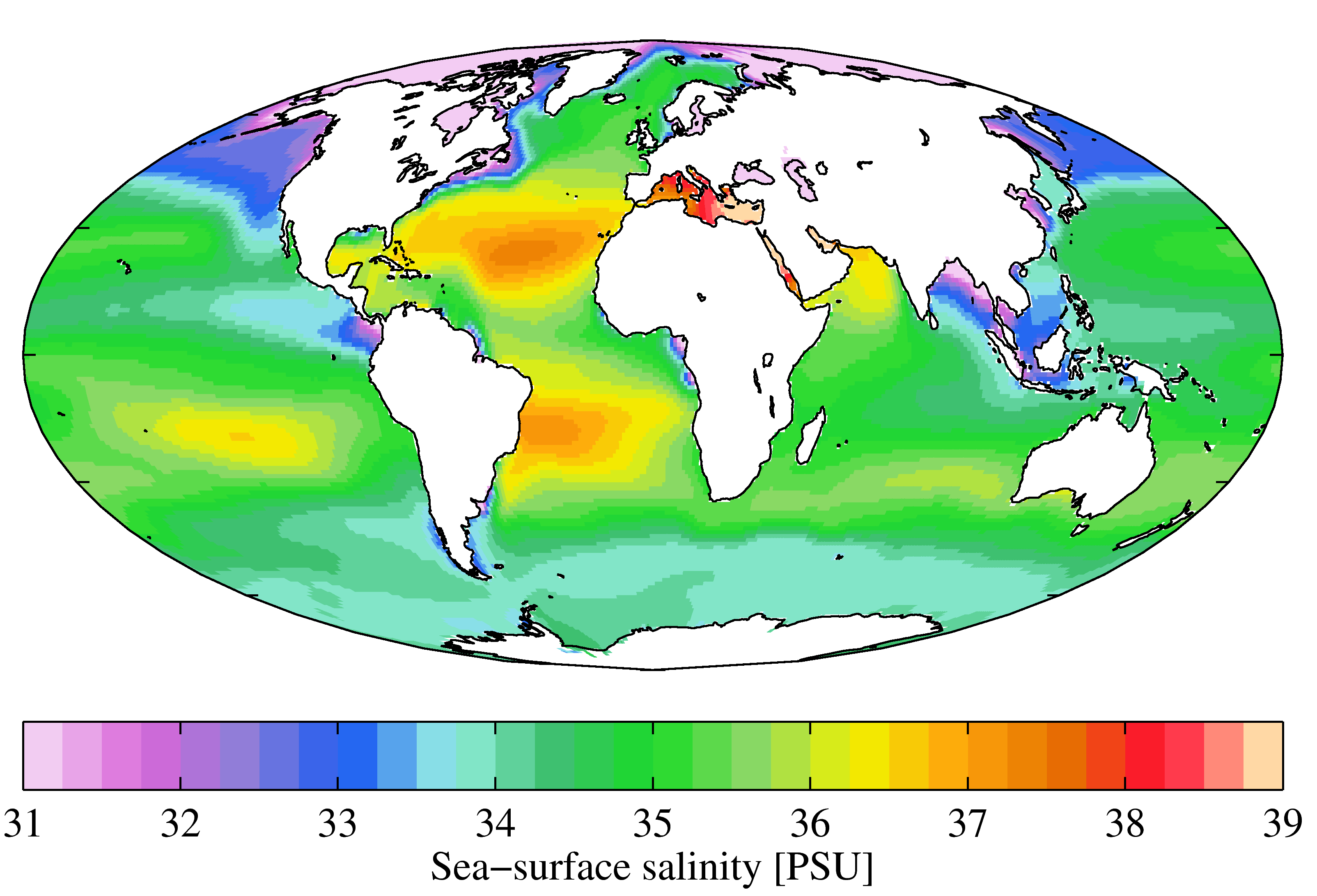
Salinity of the water column | Salinity of the water body | International Council for the Exploration of the Sea (ICES) | ICES Oceanography - CTD and Bottle
Simple
Identification info
- Alternate title
-
ICES Oceanography - CTD and Bottle
- Date
- Citation identifier
- Salinity of the water column | Salinity of the water body | International Council for the Exploration of the Sea (ICES) | ICES Oceanography - CTD and Bottle
- Convention
-
ICES Oceanography - CTD and Bottle
- Purpose
-
Salinity data: Physical and Chemical Oceanographic Data included data from CTD, Bottle and Underway/Pump data collected at depths < 10 m. To provide the ICES working groups and scientific community with data describing the state of the ocean used in various research projects, climate studies etc.
- Status
- On going
- Point of contact
-
Organisation Individual Electronic mail address ORCID Role International Council for the Exploration of the Sea (ICES)
edmo Various programs
Various programs
edmerp Various organisations
Originator
- Spatial representation type
- Vector
Spatial resolution
- Spatial resolution
- 10000 meter
- Topic category
-
- Oceans
Extent
))
Extent
- Time period
- 1990-01-01
Vertical element
- Minimum value
- 0
- Maximum value
- 2000
- Maintenance and update frequency
- Continual
- Used by challenges
-
-
Atlantic - CH08 - Eutrophication
-
- Environmental matrix
-
-
Marine water
-
- Production mode
-
-
Delayed
-
- Visibility
-
-
Information retrieved upon specific request to the data source
-
- Policy visibility
-
-
There is detailed information provided to understand data policy
-
- Readyness
-
-
Format not proprietary and content clearly specified (e.g. autodescriptive like ODV, NetCDF CF) or at least with appropriate document describing the content
-
- Parameter Discovery Vocabulary (P02)
-
-
Salinity of the water column
-
- GEMET - INSPIRE themes, version 1.0
-
-
Oceanographic geographical features
-
- Processing level of characteristics
-
-
Observation (raw, QC)
-
- Data delivery mechanisms
-
-
Online discovery and downloading services
-
- Parameter Usage Vocabulary (P01)
-
-
Salinity of the water body
-
- Parameter Usage Vocabulary (other)
-
-
Salinity of the water body
-
- Agreed Parameter Groups (P03)
-
-
Water column temperature and salinity
-
- Service extent
-
-
The datasets are referenced in a public national catalogue, in an international catalogue service
-
- Validation
-
-
Submitted
-
Resource constraints
- Access constraints
- Other restrictions
- Other constraints
-
Unrestricted
Resource constraints
- Use limitation
-
Open and Free. No charge
- Language
- Français
- Character encoding
- UTF8
- Environment description
-
For eutrophication assessment
Content Information
- Attribute description
- observation
- Content type
- Physical measurement
- Description
-
0 to -2000m
Distribution Information
- Distribution format
-
-
Text
-
- OnLine resource
-
ICES Data Portals
- OnLine resource
-
ICES Oceanography - CTD and Bottle
ATLANTIC_CH08_Product_2 / Map of seasonal averages and changes of Chlorophyll indicator for eutrophication in the past 10 years (2005-2014) in the Atlantic basin
-
Component is not covered because data does not exist
-
Required spatial and temporal coverage for the data did not exist
))
- Begin date
- 2005
- End date
- 2014After
Vertical element
- Minimum value
- 0
- Maximum value
- 0
ATLANTIC_CH08_Product_1 / Map of seasonal averages and changes of dissolved oxygen indicator for eutrophication in the past 10 years (2005-2014) for the Atlantic basin
-
Component is not covered because data does not exist
-
Required spatial and temporal coverage for the data did not exist
))
- Begin date
- 2005-01-01
- End date
- 2014After
Vertical element
- Minimum value
- 0
- Maximum value
- 0
ATLANTIC_CH08_Product_3 / Map of seasonal averages and changes of Dissolved inorganic nitrogen indicator for eutrophication for the past 10 years (2005-2014) in the Atlantic basin
-
Component is not covered because data does not exist
-
Required spatial and temporal coverage for the data did not exist
))
- Begin date
- 2005
- End date
- 2014After
Vertical element
- Minimum value
- 0
- Maximum value
- 0
Resource lineage
- Hierarchy level
- Dataset
Spatial representation info
- Dimension name
- Time
- Resolution
- 1 day
- Cell geometry
- Transformation parameter availability
- true
- Check point availability
- true
Metadata
- Metadata identifier
- urn:uuid/8e2ac167-a16b-492d-8696-ecc36c572dee
- Language
- English
- Character encoding
- UTF8
- Contact
-
Organisation Individual Electronic mail address ORCID Role Cefas
Type of resource
- Resource type
- Series
- Name
-
Atlantic - CH08 - Eutrophication
- Metadata linkage
-
https://sextant.ifremer.fr/geonetwork/srv/eng//metadata/283cd52f-737e-4872-93e6-e74f15da7001
- Metadata linkage
-
https://sextant.ifremer.fr/geonetwork/srv/eng//metadata/36c31e7a-1850-47ec-92ee-7e9243f62151
- Metadata linkage
-
https://sextant.ifremer.fr/geonetwork/srv/eng//metadata/8e2ac167-a16b-492d-8696-ecc36c572dee
- Metadata linkage
-
https://sextant.ifremer.fr/geonetwork/srv/fre//metadata/8e2ac167-a16b-492d-8696-ecc36c572dee
- Date info (Revision)
- 2018-03-05T15:54:21Z
- Date info (Creation)
- 2016-07-13T13:03:45
- Date info (Creation)
- 2014-10-08T14:35:32
Metadata standard
- Title
-
ISO 19115-3 - Emodnet Checkpoint - Upstream Data
- Edition
-
1.0
ICES Oceanography - CTD and Bottle
accessData
Overviews
Spatial extent
)))