Fishery characterisation | Fisheries characteristics-fish fleet32 | Turkish Statistical Institute | MEDAS
Simple
Identification info
- Alternate title
-
MEDAS
- Date
- Citation identifier
- Fishery characterisation | Fisheries characteristics-fish fleet32 | Turkish Statistical Institute | MEDAS
- Convention
-
MEDAS
- Purpose
-
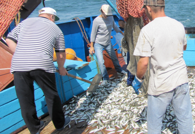
The statistical database on fisheries production and fishing fleet
- Status
- On going
- Point of contact
-
Organisation Individual Electronic mail address ORCID Role Turkish Statistical Institute
TurkStat
edmerp Turkish Statistical Institute
edmo
- Spatial representation type
- Vector
- Topic category
-
- Oceans
Extent
))
Extent
- Time period
- 2000-01-01T00:00:00
- Maintenance and update frequency
- Annually
- Used by challenges
-
-
BlackSea - CH07 - Fisheries Impact
-
- Environmental matrix
-
-
Human activities
-
- Production mode
-
-
Delayed
-
- Visibility
-
-
Use of open search engines, searching by name either the data provider or the characteristics
-
- Policy visibility
-
-
There is detailed information provided to understand data policy
-
- Readyness
-
-
Format not proprietary and content clearly specified (e.g. autodescriptive like ODV, NetCDF CF) or at least with appropriate document describing the content
-
- Parameter Discovery Vocabulary (P02)
-
-
Fishery characterisation
-
- GEMET - INSPIRE themes, version 1.0
-
-
Species distribution
-
- Processing level of characteristics
-
-
Observation (raw, QC)
-
- Data delivery mechanisms
-
-
Online discovery and downloading services
-
- Parameter Usage Vocabulary (other)
-
-
Fisheries characteristics-fish fleet32
-
- Agreed Parameter Groups (P03)
-
-
Fish
-
- Service extent
-
-
The datasets are referenced in a public national catalogue, in an international catalogue service
-
Resource constraints
- Access constraints
- Other restrictions
- Other constraints
-
Unrestricted
Resource constraints
- Use limitation
-
Open and Free. No charge
- Language
- Français
- Character encoding
- UTF8
- Environment description
-
Assesment of fishery pressure
Content Information
- Attribute description
- observation
- Content type
- Physical measurement
BLACKSEA_CH07_Product_2 / Extent of fisheries impact on the seafloor: sandy habitats where trawling is performed
))
- Begin date
- 2014-01-01
- End date
- 2014-12-31Before
Vertical element
- Minimum value
- 30
- Maximum value
- 100
BLACKSEA_CH07_Product_2 / Extent of fisheries impact on the seafloor: sandy habitats where trawling is performed
))
- Begin date
- 2014-01-01
- End date
- 2014-12-31Before
Vertical element
- Minimum value
- 5
- Maximum value
- 30
Resource lineage
- Hierarchy level
- Dataset
Spatial representation info
- Dimension name
- Time
- Resolution
- 1 year
- Cell geometry
- Transformation parameter availability
- true
- Check point availability
- true
Metadata
- Metadata identifier
- urn:uuid/9fffb81b-b0ad-44d1-a2fb-20a196e6ee5d
- Language
- English
- Character encoding
- UTF8
- Contact
-
Organisation Individual Electronic mail address ORCID Role TurkStat
Type of resource
- Resource type
- Dataset
- Name
-
BlackSea - CH07 - Fisheries Impact
- Metadata linkage
-
https://sextant.ifremer.fr/geonetwork/srv/eng//metadata/4d3d9caa-1b64-4e22-80a7-cca66247131c
- Metadata linkage
-
https://sextant.ifremer.fr/geonetwork/srv/eng//metadata/9fffb81b-b0ad-44d1-a2fb-20a196e6ee5d
- Metadata linkage
-
https://sextant.ifremer.fr/geonetwork/srv/fre//metadata/9fffb81b-b0ad-44d1-a2fb-20a196e6ee5d
- Date info (Revision)
- 2017-12-23T11:42:37Z
- Date info (Creation)
- 2014-10-08T14:35:32
Metadata standard
- Title
-
ISO 19115-3 - Emodnet Checkpoint - Upstream Data
- Edition
-
1.0
MEDAS
accessData
Overviews
Spatial extent
)))