Industrial activity | Dredging sites and locations. | EMODnet Secretariat |
Simple
Identification info
- Date
- Citation identifier
- Industrial activity | Dredging sites and locations. | EMODnet Secretariat |
- Convention
-
Dredging sites and locations.
- Purpose
-
Points representing dredging sites in several countries. This facility provides free access to GIS data on dredging in European seas.
- Status
- On going
- Point of contact
-
Organisation Individual Electronic mail address ORCID Role EMODnet Human Activities
EMODnet Human Activities
edmerp EMODnet Secretariat
edmo AZTI-Tecnalia
Originator
- Spatial representation type
- Vector
- Topic category
-
- Oceans
Extent
))
Extent
- Time period
- Invalid Date
- Maintenance and update frequency
- Unknown
- Used by challenges
-
-
Atlantic - CH01 - Windfarm Siting
-
- Environmental matrix
-
-
Human activities
-
- Production mode
-
-
Delayed
-
- Visibility
-
-
Search via reference catalogue (e.g. MyOcean, GEOSS Geoportal…)
-
- Policy visibility
-
-
There is detailed information provided to understand data policy
-
- Readyness
-
-
Format proprietary but content clearly specified
-
- Parameter Discovery Vocabulary (P02)
-
-
Industrial activity
-
- GEMET - INSPIRE themes, version 1.0
-
-
Mineral resources
-
- Processing level of characteristics
-
-
High level analyzed
-
- Data delivery mechanisms
-
-
Online discovery + downloading + viewing services (Advanced services)
-
- Parameter Usage Vocabulary (other)
-
-
Dredging sites and locations.
-
- Agreed Parameter Groups (P03)
-
-
Human activity
-
- Service extent
-
-
The datasets are provided through an EU Inspire catalogue service (OGC)
-
- Validation
-
-
Submitted
-
Resource constraints
- Access constraints
- Other restrictions
- Other constraints
-
Unrestricted
Resource constraints
- Use limitation
-
Open and Free. No charge
- Language
- Français
- Character encoding
- UTF8
- Environment description
-
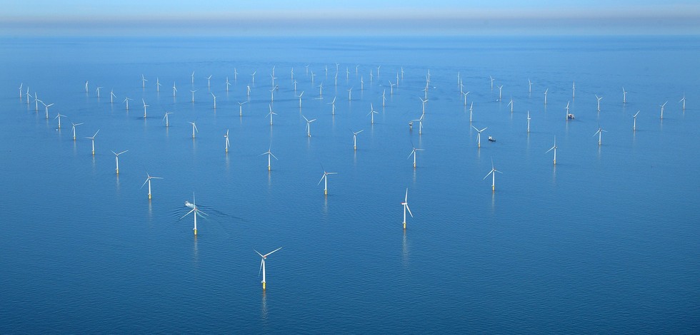
Dredging sites and locations provides information on maritime areal occupation that might conflict with OWF siting
Content Information
- Attribute description
- observation
- Content type
- Physical measurement
Distribution Information
ATLANTIC_CH01_Product_1 / Map of offshore windfarm siting suitability in the geographic area where waters of France, Ireland and UK meet
))
- Begin date
- 2006-01-01
- End date
- 2015-12-31
Vertical element
- Minimum value
- 0
- Maximum value
- 0
ATLANTIC_CH01_Product_2 / Map of windfarm siting suitability in the area where waters of France and Spain meet in Bay of Biscay on 500 m contour
))
- Begin date
- 2006-01-01
- End date
- 2015-12-31
Vertical element
- Minimum value
- 0
- Maximum value
- 0
ATLANTIC_CH01_Product_3 / Map of windfarm siting suitability in the area of Southern border of Portugal and Spain at 20 m depth
))
- Begin date
- 2006-01-01
- End date
- 2015-12-31
Vertical element
- Minimum value
- 0
- Maximum value
- 0
ATLANTIC_CH01_Product_4 / Map of offshore windfarm siting suitability in the area off S. Miguel Island (Azores archipelago)
))
- Begin date
- 2006-01-01
- End date
- 2015-12-31
Vertical element
- Minimum value
- 0
- Maximum value
- 0
Resource lineage
- Hierarchy level
- Dataset
Spatial representation info
- Dimension name
- Time
- Resolution
- 1
- Cell geometry
- Transformation parameter availability
- true
- Check point availability
- true
Metadata
- Metadata identifier
- urn:uuid/a5a32586-e195-4360-adcb-b24b3e9ef31c
- Language
- English
- Character encoding
- UTF8
- Contact
-
Organisation Individual Electronic mail address ORCID Role Instituto Português do Mar e da Atmosfera (IPMA)
Type of resource
- Resource type
- Dataset
- Name
-
Atlantic - CH01 - Windfarm Siting
- Metadata linkage
-
https://sextant.ifremer.fr/geonetwork/srv/eng//metadata/7a90cbef-ef10-46d6-91a3-02d20872b44f
- Metadata linkage
-
https://sextant.ifremer.fr/geonetwork/srv/eng//metadata/a5a32586-e195-4360-adcb-b24b3e9ef31c
- Date info (Revision)
- 2018-04-15T10:50:07Z
- Date info (Creation)
- 2014-10-08T14:35:32
Metadata standard
- Title
-
ISO 19115-3 - Emodnet Checkpoint - Upstream Data
- Edition
-
1.0
Dredging sites and locations.
accessData
Overviews
Spatial extent
)))