2D PREVIMER modelling of currents, sea levels and storm surges for the Channel/Atlantic Coasts
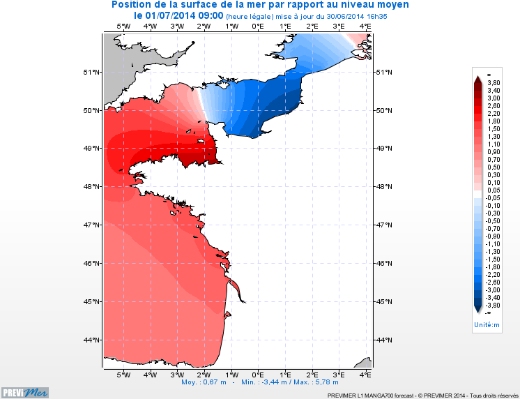
The hydrodynamic MARS 2D model on the Channel / Bay of Biscay coasts is a 2D model of 700m spatial resolution providing currents, sea levels, and maximum/minimum tide levels every hour (4-day forecasts).
Simple
- Title
-
2D PREVIMER modelling of currents, sea levels and storm surges for the Channel/Atlantic Coasts
- Date (Creation)
- 2006-01-01T00:00:00
- Citation identifier
- FR-DCSMM-PDS-BD_PREVIMER_L1
- Presentation form
- Digital profile
- Abstract
-
The hydrodynamic MARS 2D model on the Channel / Bay of Biscay coasts is a 2D model of 700m spatial resolution providing currents, sea levels, and maximum/minimum tide levels every hour (4-day forecasts).
- Credit
-
Data producer : IFREMER
- Status
- On going
- Point of contact
-
Organisation name Individual name Electronic mail address Role IFREMER
Pineau-Guillou Lucia
Local service desk
- Maintenance and update frequency
- Weekly
- Maintenance note
-
Network duration : perennial network
- Theme
-
-
Modelling
-
Barotropic currents
-
Levels
-
Storm surges
-
Channel
-
Biscay
-
MARS-2DH
-
-
GEMET - INSPIRE themes, version 1.0
-
-
Oceanographic geographical features
-
-
Sous-regions marines
-
-
Bay of Biscay
-
Channel-North Sea
-
-
DCSMM : Type d'espace concerné
-
-
Pas d'espace particulier concerné
-
-
DCSMM : Descripteurs
-
-
D7: Hydrographical Conditions
-
-
DCSMM : Méthodes de recueil des données
-
-
Observation directe
-
Observation par point
-
Observation indirecte
-
-
Thèmes Sextant
-
-
/Physical Environment/Coastal Hydrodynamics
-
- Access constraints
- Other restrictions
- Other legal constraints
-
Restricted access.
Ifremer data. Free access, access application on http://www.previmer.org/produits
- Use limitation
-
Data can be viewed but not downloaded.
Free viewing on the site http://www.previmer.org
- Spatial representation type
- Vector
- Denominator
- 100000
- Language
- Français
- Character set
- UTF8
- Topic category
-
- Oceans
))
- Supplemental Information
-
Project leader :
IFREMER
Prime contractor :
IFREMER
Backers :
IFREMER 2008
FEDER, Région Bretagne, CG29, BMO 2008
- Reference system identifier
- EPSG / WGS 84 (EPSG:4326) / 7.9
- Topology level
- Geometry only
- Geometric object type
- Complex
- Geometric object count
- 0
- OnLine resource
-
Protocol Linkage Name WWW:LINK
http://www.previmer.org/previsions/niveaux/modeles_mars2d_atlantique_nord_est Modèle MARS2D Atlantique Nord Est
- Hierarchy level
- Dataset
Conformance result
- Title
-
Inspire specifications
- Date (Creation)
- 2012-01-16
- Explanation
-
Non assessed
- Pass
- Statement
-
Modelling data produced within the context of the PREVIMER project (CPER 2008-2013), using atmospheric forecasts from Météo-France, one of PREVIMER’s partners. Use of large river flow data provided by different water agencies and the Departmental Public Works Directorates (DDE).
Nombre de points d'observation ou de mesure : from 350 000 to 1.6 millions points depending on the model.
Modelling based on the MARS-2DH calculation code version 9.06 (Ifremer) and Météo-France atmospheric forecasts from the AROME and ARPEGE-HR models.
The models account for Charnock’s parametrization provided by the wave forecast and analysis models PREVIMER_WW3- NORGAS2MIN and PREVIMER_WW3-NORGASUG
Use of harmonic constants cstFRANCE (SHOM)for the 250m resolution, FES2004 (LEGOS) in the open sea.
Modelling data are compared daily with the tidal measurements from the RONIM network (SHOM)
- Description
-
Data archived (NetCdf4 files) at the Operational Coastal Oceanography Data Centre (Centre de Données d'Océanographie Côtière Opérationnelle, CDOCO).
Data file are available by FTP and WEB services (OpenDAP, WMS,...)
- Description
-
Data type : Modelling data
Precision on the data type :
Models based on Ifremer’s calculation code MARS 2DH
Measured or observed parameters : currents, sea levels and storm surges,
Résolution du (ou des) paramètre(s) : from 2000 m at sea 250 m from the coast
Update frequency : 24h
Observation frequency : 1h at sea, 15min on the coast
- Description
-
Sampling method : Spatial
Metadata
- File identifier
- aa30fe09-ac1d-4ad7-8954-ff1a8434eb3c
- Metadata language
- Français
- Other language
-
Language Character encoding English
- Character set
- UTF8
- Hierarchy level
- Series
- Date stamp
- 2020-06-04T01:14:13
- Metadata standard name
-
ISO 19115:2003/19139 - SEXTANT
- Metadata standard version
-
1.0
- Metadata author
-
Organisation name Individual name Electronic mail address Role Sextant
Local service desk
accessData
Overviews
)))