CARAVELE - Project Sheet
The objective of the CARAVELE project was to improve the characterisation of extreme winds by combining atmospheric models with satellite and in-situ observations.
Simple
- Title
-
CARAVELE - Project Sheet
- Date (Publication)
- 2021-11-23
- Citation identifier
- https://www.france-energies-marines.org/b29a6ed5-9d40-4f09-b3ed-4404c6767f22
- Abstract
-
The objective of the CARAVELE project was to improve the characterisation of extreme winds by combining atmospheric models with satellite and in-situ observations.
- Credit
-
FEM
- Status
- On going
- Point of contact
-
Organisation name Individual name Electronic mail address Role France Energies Marines
Publisher France Energies Marines
Filipot Jean-François
Author
- Theme
-
-
France Energies Marines
-
Biofouling
-
-
GEMET - INSPIRE themes, version 1.0
-
-
Environmental monitoring facilities
-
-
France Energies Marines - Data Types
-
-
/Documents/Project sheet
-
-
France Energies Marines - Facades
-
-
/Metropolitan France/South Atlantic
-
/Metropolitan France/North Atlantic - Western Channel
-
/Metropolitan France/Eastern Channel - North Sea
-
/Metropolitan France/Mediterranean Sea
-
-
France Energies Marines - Projects
-
-
/FEM/CARAVELE
-
-
France Energies Marines - Technologies
-
-
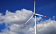
Floating offshore wind
-
Fixed offshore wind
-
- Access constraints
- Other restrictions
- Other legal constraints
- No limitations to public access
- Use limitation
-
Free use subject to mentioning the source (at least the name of the producer) and the date of its last update
- Use constraints
- Other restrictions
- Other legal constraints
-
Supplier partner is not able to guarantee the accuracy, update, integrity, completeness of data and in particular that they are free of errors or inaccuracies, including location, identification or qualification. No warranty as to the fitness of the data for a particular purpose is made by the supplier partner. Users use the data under their full responsibility, without recourse against the supplier partner whose liability can be incurred due to damage resulting directly or indirectly from the use of this data. In particular, it is up to users to decide, on their own responsibility: the opportunity to use the data; File compatibility of their computer systems; adequacy of the data to their needs; that they have sufficient competence to use the data. The partner supplier is in no way responsible for external elements including data analysis tools, hardware, software, networks ... used to view and / or process data. The user ensures verify the timeliness of the information provided is compatible with the use of it.
Spatial resolution
- Language
- Français
- Character set
- UTF8
- Topic category
-
- Geoscientific information
- Oceans
- Environment
))
- Begin date
- 2017
- End date
- 2021
Reference System Information
- Distribution format
-
Name Version pdf
1.0
- OnLine resource
-
Protocol Linkage Name WWW:DOWNLOAD
https://www.france-energies-marines.org/wp-content/uploads/2020/12/CARAVELE-project-sheet.pdf CARAVELE-project-sheet.pdf
- OnLine resource
-
Protocol Linkage Name WWW:LINK
https://www.france-energies-marines.org/en/projects/caravele/ FEM project webpage
- Hierarchy level
- Document
Conformance result
- Date (Publication)
- 2010-12-08
- Explanation
-
Article 7, paragraph 1, of Directive 2007/2 / EC corresponds to the technical procedures for interoperability: this is the regulation on interoperability: regulation n ° 1253/2013 of 21 October 2013 amending and supplementing Regulation n ° 1089/2010 of 23 November 2010
- Pass
- Statement
-
The scientific and technical contents of the CARAVELE project were:
• Methodological developments to extrapolate satellite surface winds at nacelle height.
• Use of observations performed using synthetic aperture radar (SAR) to record the high resolution spatial variability of wind fields and extreme winds, and coupling with wind forecast models.
• Tests in a wave tank fitted with a wind generator to study air-sea interactions during extreme events.
• Extraction of more accurate information from several atmospheric models combined with observations using optimised observation networks.
Partners of the project: France Energies Marines, Ifremer, CLS, OceanDataLab, IPSL, CNRS, EDF, NAVAL Energies, RSMAS, CISESE, Ecole des Ponts Paris-Tech.
Funding: French National Research Agency under the Investment for the Future Programme (ANR-10-IEED-0006-26).
Metadata
- File identifier
- b29a6ed5-9d40-4f09-b3ed-4404c6767f22
- Metadata language
- English
- Other language
-
Language Character encoding French UTF8
- Character set
- UTF8
- Hierarchy level
- Document
- Hierarchy level name
-
Parent
- Date stamp
- 2022-01-18T14:43:57
- Metadata standard name
-
ISO 19115
- Metadata standard version
-
1.0
- Metadata author
-
Organisation name Individual name Electronic mail address Role France Energies Marines
RESCORE
Local service desk
accessData
Overviews
)))