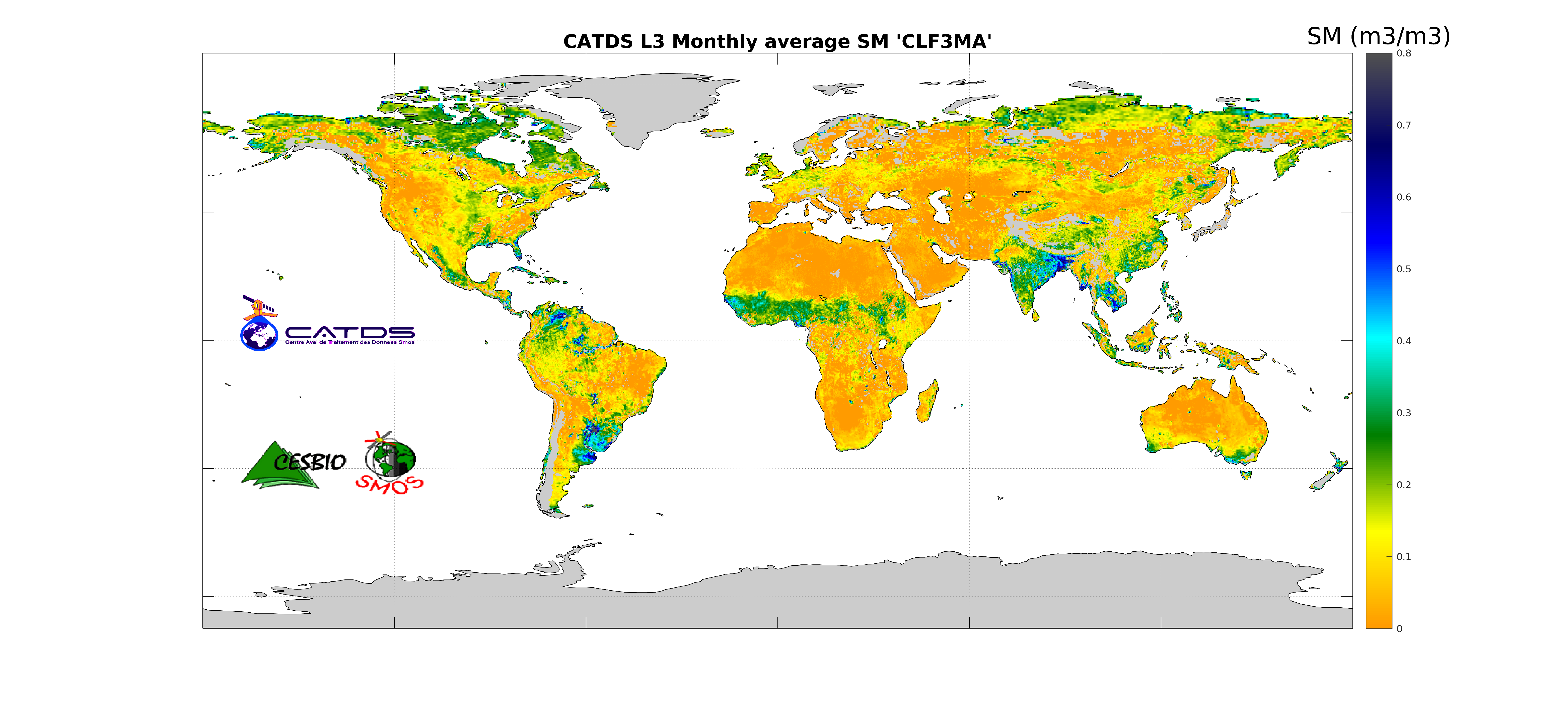
CATDS-PDC L3SM Aggregated - 3-day, 10-day and monthly global map of soil moisture values from SMOS satellite
This product is an aggregation of daily maps of soil moisture, over a 3 day moving window, a decade or a month. Ascending and descending orbits are processed separately.
Simple
- Title
-
CATDS-PDC L3SM Aggregated - 3-day, 10-day and monthly global map of soil moisture values from SMOS satellite
- Date (Publication)
- 2022-02-14
- Citation identifier
- CATDS-PDC_L3SM_Aggregated
- Citation identifier
- DOI:10.12770/b57e0d3d-e6e4-4615-b2ba-6feb7166e0e6
- Abstract
-
This product is an aggregation of daily maps of soil moisture, over a 3 day moving window, a decade or a month. Ascending and descending orbits are processed separately.
- Credit
-
CATDS (CNES, IFREMER, CESBIO)
- Point of contact
-
Organisation name Individual name Electronic mail address Role CATDS
Author CESBIO
Arnaud Mialon
Principal investigator CATDS (CNES, IFREMER, CESBIO)
Publisher
-
Thèmes Sextant
-
-
/Imagery/Satellite Imagery
-
-
GEMET - INSPIRE themes, version 1.0
-
-
Orthoimagery
-
- Theme
-
-
SMOS
-
CATDS
-
CPDC
-
L3SM
-
Soil Moisture
-
Aggregated
-
Land Product
-
- Use limitation
-
Creative Commons license to apply : Attribution (BY) : http://creativecommons.org/licenses/?lang=en
- Access constraints
- License
- Use constraints
- License
- Spatial representation type
- Grid
- Denominator
- 1
- Language
- English
- Character set
- UTF8
- Topic category
-
- Geoscientific information
))
- Begin date
- 2010-01-12
- Reference system identifier
- EPSG / WGS 84 / NSIDC EASE-Grid 2.0 Global (EPSG:6933) / 8.6
- Number of dimensions
- 3
- Dimension name
- Column
- Dimension size
- 1388
- Dimension name
- Vertical
- Dimension size
- 584
- Dimension name
- Sample
- Dimension size
- 14
- Cell geometry
- Area
- Transformation parameter availability
- Distribution format
-
Name Version NetCDF
netcdf 3 with 64 bit offset option
- OnLine resource
- OnLine resource
-
Protocol Linkage Name WWW:LINK
https://www.catds.fr/sipad/ CATDS Sipad
WWW:LINK
https://www.catds.fr/ CATDS Web portal
- OnLine resource
-
Protocol Linkage Name WWW:LINK-1.0-http--publication-URL
http://doi.org/10.5194/essd-9-293-2017 Reference
- OnLine resource
-
Protocol Linkage Name DOI
https://doi.org/10.12770/b57e0d3d-e6e4-4615-b2ba-6feb7166e0e6
- Hierarchy level
- Dataset
- Statement
-
The base products, for all the CATDS-PDC (Centre Aval de Traitement des Données SMOS - Production & Dissemination Center) processing chains, are the SMOS L1B products - https://doi.org/10.57780/SM1-e20cf57 - from ESA (European Space Agency).
The L3SM aggregated product is an aggregation of daily maps of soil moisture, over a 3 day moving window, a decade or a month. Ascending and descending orbits are processed separately.
Products from reprocessing RE07 are available for the period 01/2010 - 05/2021. Products from operational (OPER) processing are available since 06/2021. Reprocessed products and operational products are derived using the same algorithm and configuration, hence ensuring the temporal continuity.
File naming :
SM_clas_MIR_CLF3ax_startdate_enddate_vvv_ccc_7
- clas : File class (OPER : operational mode, REXX : reprocessing xx)
- a : 3 for 3 days, D for 10 days, M for 1 month
- x : A for ascending orbit, D for descending orbit
- startdate : sensing start date/time of the data (format yyyymmddThhmiss)
- enddate : sensing end date/time of the data (format yyyymmddThhmiss)
- vvv : version number of the processor generating the product
- ccc : file counter
File format :
In each archive file (.tgz extension), there are two files
- A Header file (.HDR), which is a text file, in XML Earth Explorer Header format
- A Data file (.DBL.nc), which is a netcdf file, format variant 2 (netcdf 3 with 64 bits offset option)
Reference :
Al Bitar Ahmad, Mialon Arnaud, Kerr Yann H., Cabot Francois, Richaume Philippe, Jacquette Elsa, Quesney Arnaud, Mahmoodi Ali, Tarot Stephane, Parrens Marie, Al-Yaari Amen, Pellarin Thierry, Rodriguez-Fernandez Nemesio, Wigneron Jean-Pierre (2017). The global SMOS Level 3 daily soil moisture and brightness temperature maps. Earth System Science Data, 9(1), 293-315. Publisher's official version : http://doi.org/10.5194/essd-9-293-2017 , Open Access version : http://archimer.ifremer.fr/doc/00388/49941/
Metadata
- File identifier
- b57e0d3d-e6e4-4615-b2ba-6feb7166e0e6
- Metadata language
- English
- Character set
- UTF8
- Hierarchy level
- Dataset
- Date stamp
- 2025-01-28T08:39:34.891998Z
- Metadata standard name
-
ISO 19115:2003/19139 - SEXTANT
- Metadata standard version
-
1.0
- Metadata author
-
Organisation name Individual name Electronic mail address Role IFREMER
Tarot Stephane
Local service desk
)))