Transport activity | Shipping routes | European Commission | European Atlas of the Seas - Ferry Routes
Simple
Identification info
- Alternate title
-
European Atlas of the Seas - Ferry Routes
- Date
- Citation identifier
- Transport activity | Shipping routes | European Commission | European Atlas of the Seas - Ferry Routes
- Convention
-
European Atlas of the Seas - Ferry Routes
- Purpose
-
European Atlas of the Seas - Ferry Routes
- Status
- On going
- Point of contact
-
Organisation Individual Electronic mail address ORCID Role European Commission
edmo edmerp
- Spatial representation type
- Vector
- Topic category
-
- Oceans
Extent
))
Extent
- Time period
- 05/12/2008
- Maintenance and update frequency
- Biannually
- Used by challenges
-
-
Atlantic - CH10 - Bathymetry
-
- Environmental matrix
-
-
Human activities
-
- Production mode
-
-
Delayed
-
- Visibility
-
-
Use of open search engines, searching by name either the data provider or the characteristics
-
- Policy visibility
-
-
There is information, but details are available only on request
-
- Readyness
-
-
Format not proprietary and content clearly specified (e.g. autodescriptive like ODV, NetCDF CF) or at least with appropriate document describing the content
-
- Parameter Discovery Vocabulary (P02)
-
-
Transport activity
-
- GEMET - INSPIRE themes, version 1.0
-
-
Elevation
-
- Processing level of characteristics
-
-
Observation (raw, QC)
-
- Data delivery mechanisms
-
-
Online discovery + downloading + viewing services (Advanced services)
-
- Parameter Usage Vocabulary (other)
-
-
Shipping routes
-
- Agreed Parameter Groups (P03)
-
-
Human activity
-
- Service extent
-
-
The datasets are referenced in a public national catalogue, in an international catalogue service
-
- Validation
-
-
Draft
-
Resource constraints
- Access constraints
- Other restrictions
- Other constraints
-
Unrestricted
Resource constraints
- Use limitation
-
Open and Free. No charge
- Language
- Français
- Character encoding
- UTF8
- Environment description
-
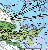
Shipping Routes- Analysis for safer navigation survey
Content Information
- Attribute description
- observation
- Content type
- Physical measurement
Distribution Information
- Distribution format
-
-
PNG
-
PDF
-
ESRI Shapefile
-
- OnLine resource
-
European Atlas of the Seas - Ferry Routes
))
- Begin date
- 2015
Vertical element
- Minimum value
- 0
- Maximum value
- 0
Resource lineage
- Statement
-
ec.europa.eu/maritimeaffairs/atlas/maritime_atlas/#lang=EN;p=w;pos=11.754:54.605:4;bkgd=5:0.75;gra=0;mode=1;theme=2:0.75:1:1,7:1:1:0,13:1:1:0,85:1:1:0;
- Hierarchy level
- Dataset
Spatial representation info
- Axis dimension properties
-
Dimension name Dimension size Resolution Time 1
- Cell geometry
- Transformation parameter availability
- true
- Check point availability
- true
Metadata
- Metadata identifier
- urn:uuid/b7a6bab0-a99b-41e7-97c3-3d355252a364
- Language
- English
- Character encoding
- UTF8
- Contact
-
Organisation Individual Electronic mail address ORCID Role Seazone Solutions
Type of resource
- Resource type
- Dataset
- Name
-
Atlantic - CH10 - Bathymetry
- Metadata linkage
-
https://sextant.ifremer.fr/geonetwork/srv/eng//metadata/72fea185-7548-40a6-9d4f-b26772b84a0d
- Metadata linkage
-
https://sextant.ifremer.fr/geonetwork/srv/eng//metadata/7bd9f88e-a49e-4573-8273-76709e358252
- Metadata linkage
-
https://sextant.ifremer.fr/geonetwork/srv/eng//metadata/a685c66b-081a-40bc-a478-6c389dd04718
- Metadata linkage
-
https://sextant.ifremer.fr/geonetwork/srv/eng//metadata/ed600eef-3758-4af7-b8eb-4c5f7936deae
- Metadata linkage
-
https://sextant.ifremer.fr/geonetwork/srv/eng//metadata/b7a6bab0-a99b-41e7-97c3-3d355252a364
- Metadata linkage
-
https://sextant.ifremer.fr/geonetwork/srv/fre//metadata/b7a6bab0-a99b-41e7-97c3-3d355252a364
- Date info (Revision)
- 2018-04-12T09:49:43Z
- Date info (Publication)
- 2016-07-06T16:21:55
- Date info (Creation)
- 2014-10-08T14:35:32
Metadata standard
- Title
-
ISO 19115-3 - Emodnet Checkpoint - Upstream Data
- Edition
-
1.0
European Atlas of the Seas - Ferry Routes
accessData
Overviews
Spatial extent
)))