Bilans des échouages de mammifères marins sur le littoral de France métropolitaine en 2016-2020
Occurrence data of strandings of marine mammals collected by the correspondents of the National Stranding Network (date, position, species) in metropolitan France in 2016-2020.
Simple
- Title
-
Bilans des échouages de mammifères marins sur le littoral de France métropolitaine en 2016-2020
- Alternate title
-
Convention AAMP/15/054 RNE_échouages_AAMP_pt_wgs84
- Date (Publication)
- 2016-01-19
- Citation identifier
- Convention AAMP/15/054 RNE_échouages_AAMP_pt_wgs84
- Cited responsible party
-
Organisation name Individual name Electronic mail address Role UMS 3462 - Observatoire Pelagis
Vincent, RIDOUX
Local service desk
- Presentation form
- Digital map
- Abstract
-
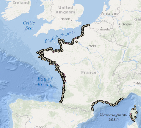
Occurrence data of strandings of marine mammals collected by the correspondents of the National Stranding Network (date, position, species) in metropolitan France in 2016-2020.
- Purpose
-
To produce an inventory of the spatial distribution and abundance of these species and to evaluate their spatial and temporal variability in order to provide the information required to designate and manage marine protected areas.
- Credit
-
PELAGIS observatory- UMS 3462 ULR/CNRS, marine protection agency
- Status
- Under development
- Point of contact
-
Organisation name Individual name Electronic mail address Role UMS 3462 - Observatoire PELAGIS
Author UMS 3462 - Observatoire PELAGIS
Publisher UMS 3462 Pelagis
Olivier Van Canneyt
Local service desk
- Maintenance and update frequency
- As needed
- Resource format
-
Name Version ESRI Shapefile
0.1
-
GEMET - INSPIRE themes, version 1.0
-
-
Species distribution
-
-
Thèmes Sextant
-
-
/Biological Environment/Species/Fauna
-
-
Sous-regions marines
-
-
/Metropolitan France/Channel-North Sea
-
/Metropolitan France/Western Mediterranean
-
/Metropolitan France/Bay of Biscay
-
/Metropolitan France
-
/Metropolitan France/Celtic Seas
-
-
DCSMM : Descripteurs
-
-
D1: Biodiversité - Mammifères
-
-
Cadre Réglementaire - SIMM
-
-
Marine Strategy Framework Directive (MSFD)
-
Maritime Spatial Planning Directive (MSP)
-
-
Thématiques - SIMM
-
-
/Environmental Status/Species
-
- Theme
-
-
MSFD
-
INSPIRE priority data set
-
- Place
-
-
France
-
- Specific usage
-
Presence at sea Distribution at sea
Combining Observation and observation effort :
To define the abundance and distribution of Marine Mammals
Geostatistical modelling
Modelling of preferred habitats
Natura 2000 en mer
Marine Strategy Framework Directive
- User determined limitations
-
Les échouages sont le résultat de variations dans l'abondance et la mortalité des mammifères marins en mer, mais aussi des conditions météorologiques et courantologiques qui peuvent mener à l'échouage et sa découverte. Ils doivent donc être interprétés à la lumière de ces fluctuations.
- User contact info
-
Organisation name Individual name Electronic mail address Role UMS 3462 - Observatoire PELAGIS
Willy DABIN
Principal investigator UMS 3462 - Observatoire PELAGIS
Olivier VAN-CANNEYT
Local service desk
- Use limitation
-
Non commercial use only on the condition that the source is cited in all publications (citing at least the name of the producer) along with the date of the latest update. Occurrence data attests to the presence of species (not their true distribution), rather than their absence as they are not corrected for observation effort. All interpretation without prior analysis and beyond the limitations mentioned should be treated with caution. Use of the dataset as a whole (observation parameters and associated efforts) will be the subject of a request made to the PELAGIS observatory and must respect the Observatory’s data usage charter. Attention! The observations only have quantitative value when they are associated with an observation effort exerted on a specific transect (number of observations/observation time). There is no "raw" data insomuch as the present data has been validated and corrected from a technical and scientific perspective.
- Access constraints
- Intellectual property rights
- Use constraints
- Other restrictions
- Other legal constraints
-
Mandatory citation "Observatoire PELAGIS, UMS 3462 ULR/
CNRS, AAMP, CEBC, 'database name'"
Users must make contact with the data providers prior to all use, scientific publication and/or "coauthorship" if considered necessary by the owners of the data.
- Spatial representation type
- Vector
- Denominator
- 1000000
- Distance
- 100 mètre
- Language
- Français
- Character set
- UTF8
- Topic category
-
- Biota
- Environment description
-
FME 2013+, Arcgis 10+, Access 2003, VOR, Windows 7
))
- Begin date
- 2016-01-01T00:00:00
- End date
- 2020-12-31T00:00:00
- Supplemental Information
-
Metadata being drafted
- Reference system identifier
- EPSG / RGF93 (EPSG:4171) / 8.6
- Topology level
- Geometry only
- Distribution format
-
Name Version Shapefile
- OnLine resource
-
Protocol Linkage Name DOI
10.12770/ba86be2b-a294-43a3-b8e2-78be07ea4d3a DOI
- OnLine resource
-
Protocol Linkage Name OGC:WMS
https://sextant.ifremer.fr/services/wms/observatoire_pelagis PELAGIS_ECHOUAGE_MAMMIFERES_MARINS_METRO_2016
FILE
PELAGIS_ECHOUAGE_MAMMIFERES_MARINS_METRO_2016
- OnLine resource
-
Protocol Linkage Name OGC:WMS
https://sextant.ifremer.fr/services/wms/observatoire_pelagis PELAGIS_ECHOUAGE_MAMMIFERES_MARINS_METRO_2017
FILE
PELAGIS_ECHOUAGE_MAMMIFERES_MARINS_METRO_2017
- OnLine resource
-
Protocol Linkage Name OGC:WMS
https://sextant.ifremer.fr/services/wms/observatoire_pelagis PELAGIS_ECHOUAGE_MAMMIFERES_MARINS_METRO_2018
FILE
PELAGIS_ECHOUAGE_MAMMIFERES_MARINS_METRO_2018
- OnLine resource
-
Protocol Linkage Name OGC:WMS
https://sextant.ifremer.fr/services/wms/observatoire_pelagis PELAGIS_ECHOUAGE_MAMMIFERES_MARINS_METRO_2019
FILE
PELAGIS_ECHOUAGE_MAMMIFERES_MARINS_METRO_2019
- OnLine resource
-
Protocol Linkage Name OGC:WMS
https://sextant.ifremer.fr/services/wms/observatoire_pelagis PELAGIS_ECHOUAGE_MAMMIFERES_MARINS_METRO_2020
FILE
PELAGIS_ECHOUAGE_MAMMIFERES_MARINS_METRO_2020
- Hierarchy level
- Dataset
- Statement
-
- Data taken from the following collection and validation protocol : Methodological guide to observing marine mammals and birds in the France’s mainland coastal waters and adjacent areas – PACOMM – SAMM Programme . G.Dorémus et al. 2011.
- The acquisition protocol for this data on these campaigns was implemented thanks to the experience of the team from the PELAGIS observatory gathered over more than 10 years in the field, and notable through the aerial observation campaigns ROMER( 2000-2002), ATLANCET (2003) and SCANS (2005)
Observations are made from an aeroplane flying over predefined transects at a constant altitude of 600 feet and a speed of 90 knots. Two observers record the environmental conditions and the following observations (at the surface or below the surface):
- Using the strip transect method (200m strips): bird observations
- Using the line transect methods (up to 500m): observations of marine mammals, sharks, rays, bony fish (large fish or shoals of fish) and sea turtles.
- Using the strip transect method: macro waste (200 m strips) and boats (500m strips)
Data is collected and coordinated by the PELAGIS observatory by scientific teams and observers, all of whom are specifically trained in aerial observation protocol (identical protocols for REMMOA and SAMM).
Result: SAMM campaigns have made it possible to collect over 20,000 pieces of data of the same type in France’s mainland waters along over 100,000 km of transects.
REMMOA campaigns have made it possible to collect over 55,000 observations of marine megafauna and human activity (waste, vessels and fishing gear) over nearly 205,000 km of transects covered by plane over the sea.
- flyovers in mainland France – SAMM campaign (Aerial Marine Megafauna Monitoring) – are conducted in the context of the PACOMM programme in order to meet community objectives for conservation and the promotion of maritime areas (Natura 2000, MSFD, regional maritime conventions, etc.).
The dataset is made up of two datasets: samm1 for winter 2011 and samm2 for summer 2012.
- Description
-
At least one campaign is attributed to each region of study.
Observers are attributed a campaign and a geographical area. For each sector there are bathymetric strata and transects which are linked to each of these strata (with a few exceptions for the Indian Ocean).
- Definition of sectors: zones corresponding to distinct maritime areas (seaboard, coast, archipelago, etc.)
- Definition of bathymetric strata : areas at the heart of each sector, determined according to bathymetric characteristics such as depth, relief and slope gradient.
- Definition of transects : breakdown of the observation effort between the bathymetric strata was defined according to expected observation rate (available in the literature or from previous unpublished campaigns) in order to obtain a significant number of observations for cetaceans and to make it possible to modify the effort during the campaign according to the real observation rate (increase or decrease of effort. The transects are distributed systematically within the strata.
- Rationale
-
SAMPLING PROGRAMME
- Description
-
Data was acquired during the flights and is also recorded digitally.
Back on land, the data is checked and errors removed. Corresponding codes for species, name, family and genus were verified using the TAXREFv5.0 reference. If need be, species identification is refined using photos taken during the flyovers. Data remains in the initial system of coordinates. Data is acquired within the context of a protocol defined as of acquisition (observers trained) for technical and scientific validation overseen by the PELAGIS observatory.
- Rationale
-
VALIDATION / SAISIE
- Included with dataset
- Feature catalogue citation
Metadata
- File identifier
- ba86be2b-a294-43a3-b8e2-78be07ea4d3a
- Metadata language
- Français
- Other language
-
Language Character encoding English
- Character set
- UTF8
- Parent identifier
- 9efd49a8-e85c-4393-988d-035a86b58977
9efd49a8-e85c-4393-988d-035a86b58977
- Hierarchy level
- Dataset
- Date stamp
- 2023-12-11T13:18:07.865Z
- Metadata standard name
-
ISO 19115:2003/19139 - SEXTANT
- Metadata standard version
-
1.0
- Metadata author
-
Organisation name Individual name Electronic mail address Role UMS 3462 - Observatoire PELAGIS
Willy DABIN
Local service desk
accessData
Overviews
)))