Spatio-temporal Structure of Macrobenthic Populations in the Seine Bay on Various Observation Scales
The spatio-temporal structures of macrobenthos in the Seine Bay was mapped and then linked to other environmental parameters. Finally it was analysed on various spatial observation scales. This study will be used to better understand the effect of including the spatial dimension in macrobenthos analysis. PNEC Programme (Seine Bay site)
Simple
- Title
-
Spatio-temporal Structure of Macrobenthic Populations in the Seine Bay on Various Observation Scales
- Date (Creation)
- 1998-01-01T00:00:00
- Citation identifier
- FR-DCSMM-PDS-BENTHOSEINE
- Presentation form
- Digital profile
- Abstract
-
The spatio-temporal structures of macrobenthos in the Seine Bay was mapped and then linked to other environmental parameters. Finally it was analysed on various spatial observation scales. This study will be used to better understand the effect of including the spatial dimension in macrobenthos analysis. PNEC Programme (Seine Bay site)
- Credit
-
Data producers : Station biologique de Wimereux
- Status
- Completed
- Point of contact
-
Organisation name Individual name Electronic mail address Role UMR6143
Dauvin Jean-Claude
Local service desk
- Maintenance and update frequency
- Not planned
- Maintenance note
-
Network Duration: temporary device
- Theme
-
-
Cartography
-
Benthic populations
-
Observation scale
-
Biodiversity
-
ROFI
-
Seine estuary
-
Eastern Channel
-
-
GEMET - INSPIRE themes, version 1.0
-
-
Environmental monitoring facilities
-
-
Sous-regions marines
-
-
Channel-North Sea
-
-
DCSMM : Type d'espace concerné
-
-
Pas d'espace particulier concerné
-
-
DCSMM : Descripteurs
-
-
D1: Biodiversity
-
D2: Non-indigenous species
-
D4: Marine Food Webs
-
D6: Sea-floor Integrity
-
-
DCSMM : Méthodes de recueil des données
-
-
Observation par point
-
Observation directe
-
-
Thèmes Sextant
-
-
/Biological Environment/Habitats
-
- Access constraints
- Other restrictions
- Other legal constraints
-
Free access
- Use limitation
-
Charter use of data resomar :
http://resomar-benthos.epoc.u-bordeaux1.fr/docs/Charte_RESOMAR.pdf
- Spatial representation type
- Vector
- Denominator
- 50000
- Language
- Français
- Character set
- UTF8
- Topic category
-
- Oceans
))
- Supplemental Information
-
Project leader :
CNRS-INSU
Prime contractor :
Station biologique de Wimereux
Backer :
PNEC
- Reference system identifier
- EPSG / WGS 84 (EPSG:4326) / 7.9
- Topology level
- Geometry only
- Geometric object type
- Complex
- Geometric object count
- 0
- Hierarchy level
- Dataset
Conformance result
- Title
-
Inspire specifications
- Date (Creation)
- 2012-01-16
- Explanation
-
Non assessed
- Pass
- Statement
-
September 1998 : First sampling campaign
May 1999 : Second campaign
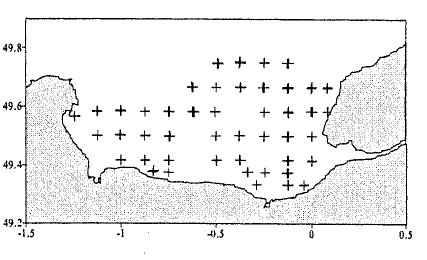
Number of observation or measurement points : 90
System validation: technical and scientific validation, taxonomic quality control, data validation and analysis (see benthos database and Benthos Resomar database)
- Description
-
Data type : Fauna, Geology
Precision on the data type :
Fauna : benthic invertebrate macrofauna
Geology : sedimentology
Measured or observed parameters :
Scientific composition, abundance, biomass, granulometry, organic matter
Parameters resolution :
< 1 m²
Update frequency : twice
Observation frequency : once a year
- Description
-
Taxonomic repository: WoRMS
- Description
-
device associated: SOMLIT
Metadata
- File identifier
- be9da9ba-5326-435e-8b5b-0a9e6c71af86
- Metadata language
- Français
- Other language
-
Language Character encoding English
- Character set
- UTF8
- Parent identifier
-
RESeau des Stations et Observatoires Marins : suivis et base de données benthiques des côtes françaises métropolitaines depuis 1960
d2a8fe27-16b2-4e87-9668-f48c96766bf6
- Hierarchy level
- Series
- Date stamp
- 2020-06-04T00:22:31
- Metadata standard name
-
ISO 19115:2003/19139 - SEXTANT
- Metadata standard version
-
1.0
- Metadata author
-
Organisation name Individual name Electronic mail address Role Sextant
Local service desk
accessData
Overviews
)))