Dune evolution
Study of dune dynamics on the French continental plate
Period : First stage : 2005 to 2009 ; Second Stage : 2013-2017
Simple
- Title
-
Dune evolution
- Date (Creation)
- 2005-01-01T00:00:00
- Citation identifier
- FR-DCSMM-PDS-BD_ATLAS_EVOLUTION_DUNES
- Presentation form
- Digital profile
- Abstract
-
Study of dune dynamics on the French continental plate
Period : First stage : 2005 to 2009 ; Second Stage : 2013-2017
- Purpose
-
The aim of the project is to determine and to map the sectors affected by shifting dunes and sandbanks on the French continental plate. It also aims to improve and ensure navigation safety, to improve hydrographic readings, to improve methods for researching buried objects, to record sand stocks and their dynamics, and to study the impact of the phenomenon on the propagation of acoustic waves.
An inventory of bathymetric reading and the bibliography were conducted in order to determine areas with sandbanks or dunes in order to map them in a GIS.
The different morphological dune parameters are defined using semi-automatic software developed by the SHOM and the RMS.
This software is based on the use of high-resolution bathymetric data from multi-beam echosounders in the following order:
- bathymetry is analysed in order to establish a digital terrain model(DTM)
- the software draws the contour of the structures it meets and demarcates the different dunes which may be refined by the operator.
The projects include the following tasks:
- to establish the state of knowledge regarding dune dynamics, and organise Marid conferences;
- to list the available data and improve knowledge of the French metropolitan plate;
- to characterise the impact of dune dynamics for all applications;
- to improve hydrographic recording methods in dune areas;
- to identify and monitor dunes which could be dangerous to navigation;
- to develop a “Dunes” database;
- Credit
-
Data producer : SHOM
- Status
- On going
- Point of contact
-
Organisation name Individual name Electronic mail address Role SHOM
GARLAN Thierry
Local service desk
- Maintenance and update frequency
- Unknown
- Maintenance note
-
Network Duration: perennial Network
- Theme
-
-
Dunes
-
Evolution of funds
-
Sedimentology
-
Cartography
-
Database
-
Modeling
-
GIS
-
sediment morphology
-
-
GEMET - INSPIRE themes, version 1.0
-
-
Environmental monitoring facilities
-
-
Sous-regions marines
-
-
Bay of Biscay
-
Channel-North Sea
-
Celtic Seas
-
-
DCSMM : Type d'espace concerné
-
-
Pas d'espace particulier concerné
-
-
DCSMM : Descripteurs
-
-
D7: Hydrographical Conditions
-
-
DCSMM : Méthodes de recueil des données
-
-
Observation directe
-
Observation par transect
-
Télédétection
-
Télémétrie
-
Observation par point
-
-
Thèmes Sextant
-
-
/Physical Environment/Sedimentology Geology/Geomorphology
-
- Access constraints
- Other restrictions
- Other legal constraints
-
Restricted access
- Use limitation
-
Pricing methods: At the data
- Spatial representation type
- Vector
- Denominator
- 50000
- Language
- Français
- Character set
- UTF8
- Topic category
-
- Oceans
))
- Supplemental Information
-
Prime Contractor :
SHOM
Contracting Authorities :
SHOM
Backer(s) :
SHOM
- Reference system identifier
- EPSG / WGS 84 (EPSG:4326) / 7.9
- Topology level
- Geometry only
- Geometric object type
- Complex
- Geometric object count
- 0
- OnLine resource
-
Protocol Linkage Name WWW:LINK
http://www.shom.fr/les-activites/activites-scientifiques/sedimentologie/dunes-sous-marines/ Les dunes sous-marines
- Hierarchy level
- Dataset
Conformance result
- Title
-
Inspire specifications
- Date (Creation)
- 2012-01-16
- Explanation
-
Non assessed
- Pass
- Statement
-
October 2005 : First project launched
April 2006 : List of dangerous dunes in the North Sea updated
December 2007 : Request made for implementation of a management tool for the dune database.
October 2008 : summary of the impact of sea floor changes drawn up for the Department of Defence .
December 2008 : Summary report of sediment dynamics studies
March 2009 : Dunes database prototype
January 2013 : Launch of the Dunes II project
Méthode de collecte : SMF imagery, side-scan sonar imagery, surface samples, sediment sounder
- Description
-
Data type :
Hydrography
Geology
Precision on the data type : Bathymetry
Sedimentology
Measured or observed parameters : :
- Water depth
- Height of sediment morphology
- Nature of the sea floor
- Granulometry
- Sediment and orientation Figures
- Résolution du (ou des) paramètre(s) : Variable
- Description
-
Sampling method : Spatial
- Description
-
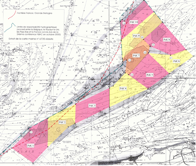
Device associated : scalable areas of Pas de Calais, PROTEVS
Metadata
- File identifier
- bf8a9e15-50a9-4540-8fdd-8bbb313039b7
- Metadata language
- Français
- Other language
-
Language Character encoding English
- Character set
- UTF8
- Hierarchy level
- Series
- Date stamp
- 2024-04-05T07:44:37.272Z
- Metadata standard name
-
ISO 19115:2003/19139 - SEXTANT
- Metadata standard version
-
1.0
- Metadata author
-
Organisation name Individual name Electronic mail address Role Sextant
Local service desk
accessData
Overviews
)))