National Hydrographic Programme - PNH -
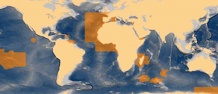
In its 2013-2016 version, the National Hydrographic Programme (PNH) details hydrographic surveys in the maritime areas under French responsibility which are conducted in order to meet France’s international obligations relating to navigational safety (International SOLAS convention). The PNH will be updated yearly in order to account for the new requirements put forward by the maritime community, and the hydrographic capability of the SHOM which can be put into practice in areas under French responsibility.
Simple
- Title
-
National Hydrographic Programme - PNH -
- Date (Creation)
- 2012-01-01T00:00:00
- Citation identifier
- FR-DCSMM-PDS-BD_PNH
- Presentation form
- Digital profile
- Abstract
-
In its 2013-2016 version, the National Hydrographic Programme (PNH) details hydrographic surveys in the maritime areas under French responsibility which are conducted in order to meet France’s international obligations relating to navigational safety (International SOLAS convention). The PNH will be updated yearly in order to account for the new requirements put forward by the maritime community, and the hydrographic capability of the SHOM which can be put into practice in areas under French responsibility.
- Purpose
-
The PNH primarily involves
- either data-gathering campaigns, including surveys at sea using the means available to the SHOM
- or collecting data gathered by others (private ports, local authorities, etc.) within the regulatory frameworks specified in the mining code (article L413-1), the instruction of the Prime Minister relating to the collection and distribution of nautical data (n°228/SGMER) and the defence code (article R3416-6).
These surveys are conducted in order to provide the data required for updating marine maps and nautical documents. The surveys generally relate to bathymetry, but other measurements are also taken. A hydrographic survey collects other data relating to navigation or processes other data that features on nautical maps: current or tide measurements, sea-bed state and marine sedimentology, turbidity and hydrology, temperature, salinity, characteristics of daymarks and beacons, nautical information of interest of maritime navigational safety (use, creation of layers of information such as offshore construction or regulated areas, underwater cabling, shipwrecks or obstructions), measurements of geophysical fields (magnetic anomalies, gravimetry, etc.) remote satellite sensing and aerial photography/photogrammetry, etc.
The information collected I used to meet other needs relating to the PPML: risk prevention, coastal and environmental protection, spatial planning, scientific studies and research (see details)
- Credit
-
Data producer : SHOM
- Status
- On going
- Point of contact
-
Organisation name Individual name Electronic mail address Role SHOM
LANNUZEL Serge
Local service desk
- Maintenance and update frequency
- Annually
- Maintenance note
-
Network duration : perennial network
Continuous acquisition programme, which continues the hydrographic programmes conducted since the creation of the Naval maps and plans depot (1720)
- Theme
-
-
Hydrographiy
-
Bathymetry
-
Sedimentology
-
Tide
-
Currents
-
Topography
-
Marine Mapping
-
Nautical Information
-
Nautical Documentation
-
Photogrammetry
-
Image processing
-
Survey
-
Improved knowledge
-
Sounder
-
Multibeam Sounder
-
LiDar
-
Side-Scan sonar
-
Tide guage
-
Current metre
-
Hydrographic Vessel
-
SHOM
-
-
GEMET - INSPIRE themes, version 1.0
-
-
Environmental monitoring facilities
-
-
Sous-regions marines
-
-
/Métropole
-
Bay of Biscay
-
Channel-North Sea
-
Western Mediterranean
-
Celtic Seas
-
-
DCSMM : Type d'espace concerné
-
-
Pas d'espace particulier concerné
-
-
DCSMM : Descripteurs
-
-
D7: Hydrographical Conditions
-
-
DCSMM : Méthodes de recueil des données
-
-
Observation directe
-
Observation par point
-
Observation par transect
-
Télédétection
-
Observation en plein
-
-
Thèmes Sextant
-
-
/Scanned Maps/SHOM/Marine Maps
-
- Access constraints
- Other restrictions
- Other legal constraints
-
Accès restreint
- Use limitation
-
Tariff: Cost of making the data available
Maritime maps, books and SHOM minutes are in paper format and prices vary according to the work in question. ENC maps or GeoTiff can also be made available in digital format, but are also subject to a fee. Data can be accessed for free without download on the website data.shom.fr.
- Spatial representation type
- Vector
- Denominator
- 50000
- Language
- Français
- Character set
- UTF8
- Topic category
-
- Oceans
))
- Supplemental Information
-
Project leader :
SHOM 1720
Prime contractor :
SHOM 1720
Backer :
SHOM
- Reference system identifier
- EPSG / WGS 84 (EPSG:4326) / 7.9
- Topology level
- Geometry only
- Geometric object type
- Complex
- Geometric object count
- 0
- OnLine resource
-
Protocol Linkage Name WWW:LINK
http://www.shom.fr/fileadmin/data-www/MIP/DTI/HYDRO/S-44_Ed.5.0.1_FR.pdf Normes OHI pour les levés hydrographiques
WWW:LINK
http://www.shom.fr/fileadmin/data-www/MIP/DTI/HYDRO/Leves_bathymetriques.pdf Levés bathymétriques
WWW:LINK
http://www.shom.fr/les-activites/activites-scientifiques/qualification-des-leves/ Qualification des levés bathymétriques
- Hierarchy level
- Dataset
Conformance result
- Title
-
Inspire specifications
- Date (Creation)
- 2012-01-16
- Explanation
-
Non assessed
- Pass
- Statement
-
2012 : Update made to the SHOM survey programme over the period 2013-2016
Collection methods : multibeam sounders, side-scan sonar, tide guages, current metres, surface sediment sampling, GPS
The bathymetric surveys conducted by and for the SHOM respect IHO standard S-44. Tide and hydrology data respect UNESCO/IOC standards
- Description
-
Precision on the data type :
Article L413-1 of the (new) mining code specifies that "information of interest to surface navigation safety, and that relating to the physio-chemical properties and movements of related waters, collected at sea, are immediately in the public domain. As soon as it is obtained, this information must be communicated to the heads of the national meteorology service, and the naval hydrographic and oceanographic service for their respective missions, who can immediately demand all information and documentation of interest to underwater navigational security as well as that relating to the morphology and nature of underwater terrain”.
Consequently, those who conduct or are responsible for work at sea must transmit all data and documents to the SHOM within a month of the work being carried out, along with all of the elements needed to process and access the data, so that the SHOM might use the information for its public service missions (by post to SHOM – 13 rue du Chatellier – CS 92803 – 29228 Brest cedex 2, FRANCE, or by email to eez-france@shom.fr ou zee- france@shom.fr ).
These obligations are associated with the Prime Minister’s decree n°228 SG Mer, as of 3 May 2002, relating to the collection and distribution of nautical data, which makes transmission of nautical information to the SHOM compulsory.
- Description
-
Data type :
Physical Oceanography Hydrography
Geology
Coastal Hydrodynamics
General Maritime data
Precision on the data type :
Bathymetry
Sedimentology
Tides
Measured or observed parameters :
Depth of the sea floor
Nature of the sea floor, granulometry
Currents
Water level
Regulated areas, daymarks, cables, topography, coast line
Parameters resolution :
Variable depending on the period and the collection system used
Update frequency : Annual
Observation frequency : Variable according to the characteristics of geographical areas
- Description
-
Data type :
Physical oceanography
Hydrography
Photogrammetry,
remote sensing
Precision on the data type :
Hydrological profiles
Aerial photos
Satellit imagery (for areas of interest to the MSFD, the PNH is essentially based on “ortho-littorale”)
Measured or observed parameters :
Temperature
Salinity
(parameters required for processing bathymetric data)
Turbidity
Update frequency : Annual
Observation frequency : Variable according to the characteristics of geographical areas
- Description
-
Sampling method : Spatial, Geometric
- Description
-
Associated information : BDBS, BD currents, TDB, HistoLitt, Litto3D, BDSS, Coriolis, Evolutionary areas of Pas de Calais
Metadata
- File identifier
- c18a9eda-a765-4926-bd8a-c146826ac46c
- Metadata language
- Français
- Other language
-
Language Character encoding English
- Character set
- UTF8
- Hierarchy level
- Series
- Date stamp
- 2020-06-04T00:28:56
- Metadata standard name
-
ISO 19115:2003/19139 - SEXTANT
- Metadata standard version
-
1.0
- Metadata author
-
Organisation name Individual name Electronic mail address Role Sextant
Local service desk
accessData
Overviews
)))