Bathymetry and Elevation | Bathymetry | European Marine Observation and Data Network - Bathymetry | Bathymetry
Simple
Identification info
- Alternate title
-
Bathymetry
- Date
- Citation identifier
- Bathymetry and Elevation | Bathymetry | European Marine Observation and Data Network - Bathymetry | Bathymetry
- Convention
-
Bathymetry Viewing and Download service
- Status
- On going
- Point of contact
-
Organisation Individual Electronic mail address ORCID Role European Marine Observation and Data Network - Bathymetry
EMODNet Bathymetry
edmerp European Marine Observation and Data Network - Bathymetry
edmo EMODNet Bathymetry
Originator
- Spatial representation type
- Vector
Spatial resolution
- Spatial resolution
- 235 meter
- Topic category
-
- Oceans
Extent
))
Extent
- Time period
- 2014-01-01T00:00:00 2016-09-01T00:00:00
Vertical element
- Minimum value
- 0
- Maximum value
- -6000
- Maintenance and update frequency
- Unknown
- Used by challenges
-
-
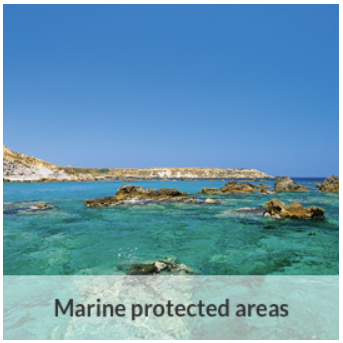
MedSea - CH02 - Marine Protected Areas
-
- Environmental matrix
-
-
Seabed - Riverbed
-
- Production mode
-
-
Delayed
-
- Parameter Discovery Vocabulary (P02)
-
-
Bathymetry and Elevation
-
- GEMET - INSPIRE themes, version 1.0
-
-
Elevation
-
- Processing level of characteristics
-
-
Other
-
- Data delivery mechanisms
-
-
Online discovery + downloading + viewing services (Advanced services)
-
- Parameter Usage Vocabulary (other)
-
-
Bathymetry
-
- Agreed Parameter Groups (P03)
-
-
Gravity, magnetics and bathymetry
-
- Service extent
-
-
The datasets are provided through an EU Inspire catalogue service (OGC)
-
- Visibility
-
-
Search via reference catalogue (e.g. MyOcean, GEOSS Geoportal…)
-
- Policy visibility
-
-
There is detailed information provided to understand data policy
-
- Readyness
-
-
Format not proprietary and content clearly specified (e.g. autodescriptive like ODV, NetCDF CF) or at least with appropriate document describing the content
-
Resource constraints
- Access constraints
- Other restrictions
- Other constraints
-
Unrestricted
Resource constraints
- Use limitation
-
Open and Free. No charge
- Language
- Français
- Character encoding
- UTF8
Content Information
- Attribute description
- observation
- Content type
- Physical measurement
- Description
-
0
Distribution Information
- Distribution format
-
-
NetCDF
-
Ascii
-
GeoTIFF
-
CSV
-
Fledermaus SD files
-
ESRI ASCII
-
- OnLine resource
-
Data products
- OnLine resource
-
Identifier of the dataset in the catalogue
MEDSEA_CH2_Product_5 / Representativity of habitats/species/other features
))
- Begin date
- 2013-01-01T00:00:00
Vertical element
- Minimum value
- 0
- Maximum value
- 5200
Resource lineage
- Hierarchy level
- Dataset
Spatial representation info
- Axis dimension properties
-
Dimension name Dimension size Resolution Time
- Cell geometry
- Transformation parameter availability
- true
- Check point availability
- true
Metadata
- Metadata identifier
- urn:uuid/d255deba-9d62-4612-99af-7b14868c2880
- Language
- English
- Character encoding
- UTF8
- Contact
-
Organisation Individual Electronic mail address ORCID Role Hellenic Centre for Marine Research
Point of contact
Type of resource
- Resource type
- Dataset
- Name
-
MedSea - CH02 - Marine Protected Areas
- Metadata linkage
-
https://sextant.ifremer.fr/geonetwork/srv/eng//metadata/d255deba-9d62-4612-99af-7b14868c2880
- Metadata linkage
-
https://sextant.ifremer.fr/geonetwork/srv/fre//metadata/d255deba-9d62-4612-99af-7b14868c2880
- Date info (Revision)
- 2017-08-24T12:28:59Z
- Date info (Creation)
- 2015-02-24T16:18:08
Metadata standard
- Title
-
ISO 19115-3 - Emodnet Checkpoint - Upstream Data
- Edition
-
1.0
Bathymetry Viewing and Download service
accessData
Overviews

Spatial extent
)))