Industrial activity | Submarine telecommunication cables | SIGCables | Information about 15 submarine telecommunication cables in the Atlantic.
Simple
Identification info
- Alternate title
-
Information about 15 submarine telecommunication cables in the Atlantic.
- Date
- Citation identifier
- Industrial activity | Submarine telecommunication cables | SIGCables | Information about 15 submarine telecommunication cables in the Atlantic.
- Convention
-
Information about 15 submarine telecommunication cables in the Atlantic.
- Purpose
-
Information supplied by Orange Marine about submarine telecommunication cables, aims to inform sailors, and especially skippers of fishing vessels and their crews about submarine active or non-active cable routes
- Status
- On going
- Point of contact
-
Organisation Individual Electronic mail address ORCID Role SIGCables
SIGCables
edmerp SIGCables
edmo Orange Marine
Originator
- Spatial representation type
- Vector
- Topic category
-
- Oceans
Extent
))
Extent
- Time period
- 1976-01-01T00:00:00 2012-12-31T00:00:00
Vertical element
- Minimum value
- NA
- Maximum value
- NA
- Maintenance and update frequency
- Unknown
- Used by challenges
-
-
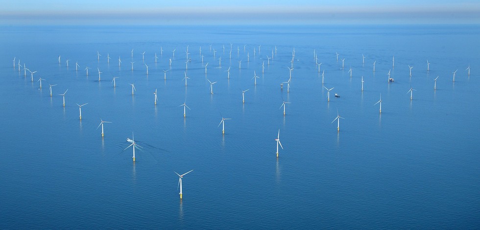
Atlantic - CH01 - Windfarm Siting
-
- Environmental matrix
-
-
Human activities
-
- Production mode
-
-
Delayed
-
- Visibility
-
-
Search via reference catalogue (e.g. MyOcean, GEOSS Geoportal…)
-
- Policy visibility
-
-
There is no information at all on data policy adopted by data providers
-
- Readyness
-
-
Format not proprietary and content clearly specified (e.g. autodescriptive like ODV, NetCDF CF) or at least with appropriate document describing the content
-
- Parameter Discovery Vocabulary (P02)
-
-
Industrial activity
-
- GEMET - INSPIRE themes, version 1.0
-
-
Production and industrial facilities
-
- Processing level of characteristics
-
-
High level analyzed
-
- Data delivery mechanisms
-
-
Online discovery and downloading services
-
- Parameter Usage Vocabulary (other)
-
-
Submarine telecommunication cables
-
- Agreed Parameter Groups (P03)
-
-
Human activity
-
- Service extent
-
-
The datasets are referenced in a public national catalogue, in an international catalogue service
-
- Validation
-
-
Submitted
-
Resource constraints
- Access constraints
- Other restrictions
- Other constraints
-
Unrestricted
Resource constraints
- Use limitation
-
Open and Free. No charge
- Language
- Français
- Character encoding
- UTF8
- Environment description
-
Submarine cable routes data intends to evaluate the areal conflict of OWF siting with other industries.
Content Information
- Attribute description
- observation
- Content type
- Physical measurement
- Description
-
NA
Distribution Information
))
- Begin date
- 2006-01-01
- End date
- 2015-12-31
Vertical element
- Minimum value
- 0
- Maximum value
- 0
))
- Begin date
- 2006-01-01
- End date
- 2015-12-31
Vertical element
- Minimum value
- 0
- Maximum value
- 0
))
- Begin date
- 2006-01-01
- End date
- 2015-12-31
Vertical element
- Minimum value
- 0
- Maximum value
- 0
))
- Begin date
- 2006-01-01
- End date
- 2015-12-31
Vertical element
- Minimum value
- 0
- Maximum value
- 0
Resource lineage
- Lineage
-
NA
- Hierarchy level
- Dataset
Spatial representation info
- Dimension name
- Time
- Resolution
- 1 year
- Cell geometry
- Transformation parameter availability
- true
- Check point availability
- true
Metadata
- Metadata identifier
- urn:uuid/d4ba73f7-770e-4b48-ad3d-92b4c9ffc29e
- Language
- English
- Character encoding
- UTF8
- Contact
-
Organisation Individual Electronic mail address ORCID Role Instituto Português do Mar e da Atmosfera (IPMA)
Type of resource
- Resource type
- Dataset
- Name
-
Atlantic - CH01 - Windfarm Siting
- Metadata linkage
-
https://sextant.ifremer.fr/geonetwork/srv/eng//metadata/d4ba73f7-770e-4b48-ad3d-92b4c9ffc29e
- Metadata linkage
-
https://sextant.ifremer.fr/geonetwork/srv/fre//metadata/d4ba73f7-770e-4b48-ad3d-92b4c9ffc29e
- Date info (Revision)
- 2018-03-15T16:48:09Z
- Date info (Creation)
- 2014-10-08T14:35:32
Metadata standard
- Title
-
ISO 19115-3 - Emodnet Checkpoint - Upstream Data
- Edition
-
1.0
Information about 15 submarine telecommunication cables in the Atlantic.
accessData
Overviews
Spatial extent
)))