Bathymetry and Elevation | Sea-floor depth (below mean sea level) {bathymetric depth} | EMODNet Bathymetry | EMODnet bathymetry
Simple
Identification info
- Alternate title
-
EMODnet bathymetry
- Date
- Citation identifier
- Bathymetry and Elevation | Sea-floor depth (below mean sea level) {bathymetric depth} | EMODNet Bathymetry | EMODnet bathymetry
- Purpose
-
Bathymetric Chart
- Status
- On going
- Point of contact
-
Organisation Individual Electronic mail address ORCID Role EMODNet Bathymetry
edmo European Marine Observation and Data Network - Bathymetry
EMODNet Bathymetry
edmerp EMODNet Bathymetry
edmo
- Spatial representation type
- Vector
Spatial resolution
- Spatial resolution
- 230 meters
- Topic category
-
- Oceans
Extent
))
- Maintenance and update frequency
- Unknown
- Used by challenges
-
-
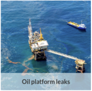
MedSea - CH03 - Oil Platform Leaks
-
- Environmental matrix
-
-
Seabed - Riverbed
-
- Production mode
-
-
Delayed
-
- Parameter Discovery Vocabulary (P02)
-
-
Bathymetry and Elevation
-
- GEMET - INSPIRE themes, version 1.0
-
-
Elevation
-
- Processing level of characteristics
-
-
High level analyzed
-
- Data delivery mechanisms
-
-
Online downloading services
-
- Parameter Usage Vocabulary (P01)
-
-
Sea-floor depth (below mean sea level) {bathymetric depth}
-
- Agreed Parameter Groups (P03)
-
-
Gravity, magnetics and bathymetry
-
- Service extent
-
-
The datasets are provided through an EU Inspire catalogue service (OGC)
-
- Visibility
-
-
Use of open search engines, searching by name either the data provider or the characteristics
-
- Policy visibility
-
-
There is detailed information provided to understand data policy
-
- Readyness
-
-
Format not proprietary and content clearly specified (e.g. autodescriptive like ODV, NetCDF CF) or at least with appropriate document describing the content
-
Resource constraints
- Access constraints
- Other restrictions
- Other constraints
-
Accessible under moratorium
Resource constraints
- Use limitation
-
Open and Free. No charge
- Language
- Français
- Character encoding
- UTF8
- Environment description
-
Oil spill predictions
forecast of the oil spill transport and transformation using the oil spill model (MEDSLIK-II, MEDSLIK); output oil concentration evolution in space and time
Content Information
- Attribute description
- observation
- Content type
- Physical measurement
Distribution Information
- Distribution format
-
-
NetCDF
-
Ascii
-
Geo-coded vector data
-
OnLine resource
- Protocol
-
WWW:LINK
MEDSEA_CH3_Product_2 / Oil Platform Leak Bulletin released after the DG MARE alert received by email on the 10th of May 2016
))
- Begin date
- 2013-08-13T08:15:00
- End date
- 2013-08-16T08:15:00
Vertical element
- Minimum value
- 0
- Maximum value
- 5
Resource lineage
- Hierarchy level
- Dataset
Spatial representation info
- Axis dimension properties
-
Dimension name Dimension size Resolution Time second
- Cell geometry
- Transformation parameter availability
- true
- Check point availability
- true
Metadata
- Metadata identifier
- urn:uuid/d949211b-cd58-41dc-8764-c2708b5ad687
- Language
- English
- Character encoding
- UTF8
- Contact
-
Organisation Individual Electronic mail address ORCID Role Istituto Nazionale di Geofisica e Vulcanologia – INGV, Sede di Bologna
Point of contact
Type of resource
- Resource type
- Dataset
- Name
-
MedSea - CH03 - Oil Platform Leaks
- Metadata linkage
-
https://sextant.ifremer.fr/geonetwork/srv/eng//metadata/d949211b-cd58-41dc-8764-c2708b5ad687
- Metadata linkage
-
https://sextant.ifremer.fr/geonetwork/srv/fre//metadata/d949211b-cd58-41dc-8764-c2708b5ad687
- Date info (Revision)
- 2017-08-24T12:29:05Z
- Date info (Creation)
- 2015-03-24T17:04:48
Metadata standard
- Title
-
ISO 19115-3 - Emodnet Checkpoint - Upstream Data
- Edition
-
1.0
accessData
Overviews

Spatial extent
)))