PACOMM – Remote Monitoring of Shearwaters – Mainland France – 2011/2014
Understanding the spatio-temporal dynamics of shearwaters’ marine habitats by equipping birds with trackers in order to monitor their movements to feeding grounds at sea during mating season (GPS, linked with dive recorders and Argos tracking beacons transmit data by satellite), or during winter migration (thanks to GLS geolocators).
Simple
- Title
-
PACOMM – Remote Monitoring of Shearwaters – Mainland France – 2011/2014
- Date (Creation)
- 2011-01-01T00:00:00
- Citation identifier
- FR-DCSMM-PDS-PUFFINS
- Presentation form
- Digital profile
- Abstract
-
Understanding the spatio-temporal dynamics of shearwaters’ marine habitats by equipping birds with trackers in order to monitor their movements to feeding grounds at sea during mating season (GPS, linked with dive recorders and Argos tracking beacons transmit data by satellite), or during winter migration (thanks to GLS geolocators).
- Credit
-
Data producers : AAMP, CEFE-CNRS
- Status
- On going
- Point of contact
-
Organisation name Individual name Electronic mail address Role AAMP
STERCKEMAN Aurore
Local service desk CEFE-CNRS
PERON Clara
Local service desk
- Maintenance and update frequency
- Annually
- Maintenance note
-
Network duration : temporary network
- Theme
-
-
Marine birds
-
Remote sensing
-
Beacons
-
GPS
-
Argos
-
GLS
-
Feeding grounds
-
-
GEMET - INSPIRE themes, version 1.0
-
-
Species distribution
-
-
Sous-regions marines
-
-
Western Mediterranean
-
-
DCSMM : Type d'espace concerné
-
-
Sites gérés par les Conservatoires d'espaces naturels (CEN)
-
Zone de Protection Spéciale (ZPS)
-
Parc national
-
Réserve Naturelle de Corse (RNC)
-
Réserve Naturelle Nationale (RNN)
-
Site Natura 2000
-
-
DCSMM : Descripteurs
-
-
D1: Biodiversity
-
-
DCSMM : Méthodes de recueil des données
-
-
Télémétrie
-
-
Thèmes Sextant
-
-
/Biological Environment/Species/Avifauna
-
- Access constraints
- Other restrictions
- Other legal constraints
-
Restricted access
Elementary exchange data (information relating to the presence of species : geographical position, date, species, number) are open access as soon as the campaign is completed.
The full dataset (elementary exchange data + observation parameters and environmental parameters) remains confidential for three years as of the end of the campaign.
- Use limitation
-
Use of raw data (observation parameters and associated effort) is restricted. It is available upon request from CEFE/CNRS and is subject to the implementation of a partnership / collaborative agreement with CEFE/ CNRS
- Spatial representation type
- Vector
- Denominator
- 50000
- Language
- Français
- Character set
- UTF8
- Topic category
-
- Oceans
))
- Supplemental Information
-
Project leader : :
AAMP Novembre 2010 - Septembre 2014
Prime contractor :
CEFE-CNRS Novembre 2010 - Septembre 2014
AAMP Novembre 2010 - Septembre 2014
Backer :
AAMP Novembre 2010 - Septembre 2014
- Reference system identifier
- EPSG / WGS 84 (EPSG:4326) / 7.9
- Topology level
- Geometry only
- Geometric object type
- Complex
- Geometric object count
- 0
- Hierarchy level
- Dataset
Conformance result
- Title
-
Inspire specifications
- Date (Creation)
- 2012-01-16
- Explanation
-
Non assessed
- Pass
- Statement
-
May – October 2011 : Bird equipment season 11
Mai – Août 2012 : Bird equipment season 12
Number of observation or measurement points : tens of thousands of points for each individual (all equipment combined) for around 200 individuals.
The sampling protocol and techniques used for installing and fitting electronic devices are described in a field protocol.
Metadata files are provided with all the location files in order to obtain information relating to equipping birds. These files can be extremely large. Files are in .txt and .xls format.
No ACCESS database.
- Description
-
A document explaining the 2012 protocol, applied for FAME marine bird monitoring, was drawn up by the LPO and sent to partners and contributors. In 2013 it will serve as a basis for reflection on extending and prolonging the network.
- Description
-
Data type :
Yelkouan shearwater
Cory's shearwater
Precision on the data type :
Remote sensing data : individual monitoring of movements at sea by GPS
Measured or observed parameters :
Individual location data
Date-time-Longitude-Latitude
Parameters resolution :
Location acquisition frequency: 3 minutes
Accuracy <50m
Update frequency :
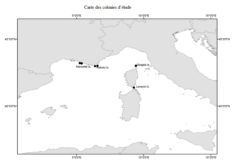
Devices fitted on around 10 birds over 3-4 days at a site at Port Cros
Devices fitted on around 100 birds over 3-4 days at 5 different sites
Observation frequency :
2 years. Reproduction period : 15 may-15 june (chick rearing) 2011 & 2012
- Description
-
Data type :
Yelkouan shearwater
Cory's shearwater
Precision on the data type :
Pressure data: individual monitoring of diving behaviour using a TDR (Temperature Depth Recorder)
Measured or observed parameters :
Date-Time-Pressure-Temperature Date-Time-Longitude-Latitude
Parameters resolution : One reading every 2 seconds
Update frequency :
Devices fitted on around 10 birds over 3-4 days at a site at Port Cros
Devices fitted on around 100 birds over 3-4 days at 5 different sites
Observation frequency :
2 years. Reproduction period : 15 may-15 june (chick rearing) 2011 & 2012
- Description
-
Data type :
Yelkouan shearwater
Cory's shearwater
Precision on the data type :
Remote sensing data: individual monitoring of movements at sea via Argos tracker
Measured or observed parameters :
Individual location data (time-latitude-longitude)
Date-time-Longitude-Latitude
Parameters resolution :
Location acquisition frequency: 1h
Daily acquisition cycle : 8H ON/48H OFF (energy: solar panels)
Accuracy <1km
Update frequency :
June-July 2011 : 1 individual failed to breed
June-July 2012 : 4 individuals in final breeding stages
August - September 2011 : 8 immature individuals
October 2011 : 3 adults and 12 chicks in flight
Observation frequency :
Transmission duration varies from a few days to 1 month
Transmission duration varies from a few days to 3 months
- Description
-
Data type :
Yelkouan shearwater
Cory's shearwater
Precision on the data type :
Remote sensing data: individual monitoring of movements at sea via geolocators
Measured or observed parameters :
Individual location data : (time-latitude-longitude) and activity data (immersion sensor)
Individual location data (time-latitude-longitude) and activity data (immersion, temperature and pressure sensors)
Parameters resolution :
aquisition frequency : 2 locations/day
Accuracy: ~180km
aquisition frequency : 1 location/day
Accuracy: ~180km
Update frequency :
Devices fitted over a year on around 20 birds at one site : Port Cros
Observation frequency :
May 2011 : 25 birds equipped/ 15 devices retrieved in 2012
May 2012 : 20 birds equipped
July/august 2011 : 120 GLS deployed at 5 sites/~90 retrieved in May/April or August 2012
- Description
-
Data type :
Yelkouan shearwater
Cory's shearwater
Precision on the data type :
Isotopic data on bird feathers (primary 1 and coverts)
Isotopic data on bird feathers (primaries 1 & 10)
Measured or observed parameters :
Isotopic ratios : #13C & #15N
Parameters resolution :
Records the feeding habits and feeding grounds over a period of weeks during the mating period and the winter period
Observation frequency :
Collection of feathers in Spring 2011 & 2012 Collection of feathers in Summer 2011 & 2012
- Description
-
Sampling method : Random
Metadata
- File identifier
- e4fe0e51-7b3e-4e31-a0dc-eaad0f74cbbf
- Metadata language
- Français
- Other language
-
Language Character encoding English
- Character set
- UTF8
- Hierarchy level
- Series
- Date stamp
- 2020-06-04T01:01:30
- Metadata standard name
-
ISO 19115:2003/19139 - SEXTANT
- Metadata standard version
-
1.0
- Metadata author
-
Organisation name Individual name Electronic mail address Role Sextant
Local service desk
accessData
Overviews
)))