GLOBAL OCEAN GRIDDED L4 SEA SURFACE HEIGHTS AND DERIVED VARIABLES REPROCESSED (1993-ONGOING) & NRT
For the Global Ocean - Multimission altimeter satellite gridded sea surface heights and derived variables computed with respect to a twenty-year mean. Previously distributed by Aviso+, no change in the scientific content. All the missions are homogenized with respect to a reference mission which is currently Jason-3. The acquisition of various altimeter data is a few days at most. The sla is computed with a non-centered computation time window (6 weeks before the date).
Simple
- Title
-
GLOBAL OCEAN GRIDDED L4 SEA SURFACE HEIGHTS AND DERIVED VARIABLES REPROCESSED (1993-ONGOING) & NRT
- Date (Creation)
- 2013-01-01
- Abstract
-
For the Global Ocean - Multimission altimeter satellite gridded sea surface heights and derived variables computed with respect to a twenty-year mean. Previously distributed by Aviso+, no change in the scientific content. All the missions are homogenized with respect to a reference mission which is currently Jason-3. The acquisition of various altimeter data is a few days at most. The sla is computed with a non-centered computation time window (6 weeks before the date).
- Credit
-
E.U. Copernicus Marine Service
- Point of contact
-
Organisation name Individual name Electronic mail address Role Copernicus
Marine Core Service - SLTAC
Publisher AVISO+
SSALTO/DUACS
Principal investigator
-
Centre de données ODATIS
-
-
CDS-AVISO
-
- Keywords
-
-
Type de jeux de donnée ODATIS
-
-
/Observational data/satellite
-
-
Processing level
-
-
Level 4
-
-
ODATIS aggregation parameters and Essential Variable names
-
-
Sea surface height
-
Currents
-
- Use limitation
- Licence
- Access constraints
- License
- Use constraints
- License
- Other legal constraints
-
Les conditions spécifiques de la licence sont détaillées dans http://marine.copernicus.eu/services-portfolio/service-commitments-and-licence/
- Language
- Français
- Character set
- UTF8
- Topic category
-
- Oceans
))
- Begin date
- 2013-01-01
- Geometric object type
- Complex
- Distribution format
-
Name Version
- OnLine resource
-
Protocol Linkage Name WWW:LINK
https://resources.marine.copernicus.eu/product-detail/SEALEVEL_GLO_PHY_L4_NRT_OBSERVATIONS_008_046/INFORMATION Plus d'information sur CMEMS (NRT)
WWW:LINK
https://resources.marine.copernicus.eu/product-detail/SEALEVEL_GLO_PHY_CLIMATE_L4_MY_008_057/INFORMATION Plus d'information sur CMEMS (DT)
WWW:LINK
ftp://my.cmems-du.eu/Core/SEALEVEL_GLO_PHY_CLIMATE_L4_MY_008_057 Accès authentifié aux données DT via FTP
WWW:LINK
ftp://nrt.cmems-du.eu/Core/SEALEVEL_GLO_PHY_L4_NRT_OBSERVATIONS_008_046/dataset-duacs-nrt-global-merged-allsat-phy-l4 Accès authentifié aux données NRT via FTP
OGC:WMS
http://my.cmems-du.eu/thredds/wms/dataset-duacs-rep-global-merged-allsat-phy-l4 sla
OGC:WMS
http://nrt.cmems-du.eu/thredds/wms/dataset-duacs-nrt-global-merged-allsat-phy-l4?service=WMS&request=GetCapabilities sla
- Hierarchy level
- Dataset
- Statement
-
Detailed description:
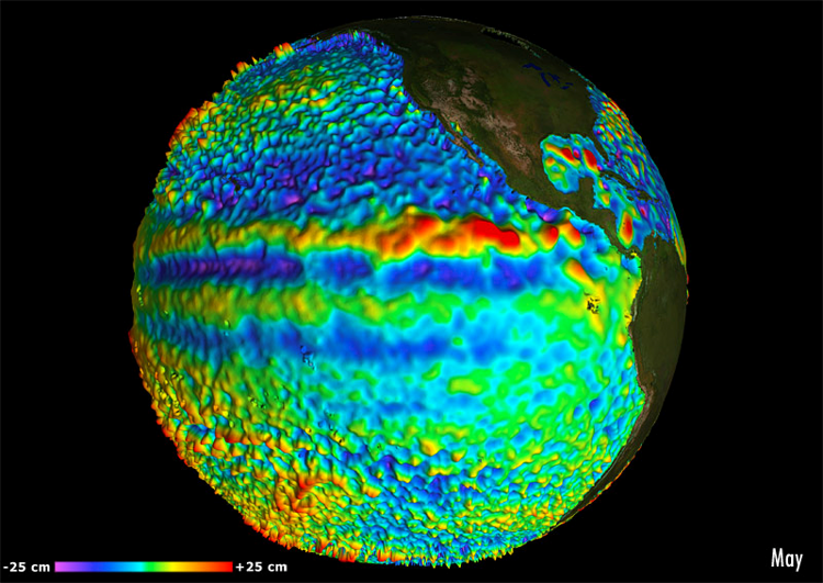
This product is processed by the SL-TAC multimission altimeter data processing system. It serves in near-real time the main operational oceanography and climate forecasting centers in Europe and worldwide. It processes data from all altimeter missions: Jason-3, Sentinel-3A, HY-2A, Saral/AltiKa, Cryosat-2, Jason-2, Jason-1, T/P, ENVISAT, GFO, ERS1/2. It provides a consistent and homogeneous catalogue of products for varied applications, both for near real time applications and offline studies.
Horizontal sampling:
1/4 degree
Metadata
- File identifier
- ef8ae468-1efd-4410-a98a-36635202ea53
- Metadata language
- Français
- Other language
-
Language Character encoding English UTF8
- Character set
- UTF8
- Hierarchy level
- Dataset
- Date stamp
- 2024-10-15T14:44:34.796069Z
- Metadata standard name
-
ISO 19115:2003/19139 - SEXTANT
- Metadata standard version
-
1.0
accessData
Overviews
)))