Bathymetry from Les Saintes area (Lesser Antilles volcanic arc): 10m grid from the Bathysaintes cruise
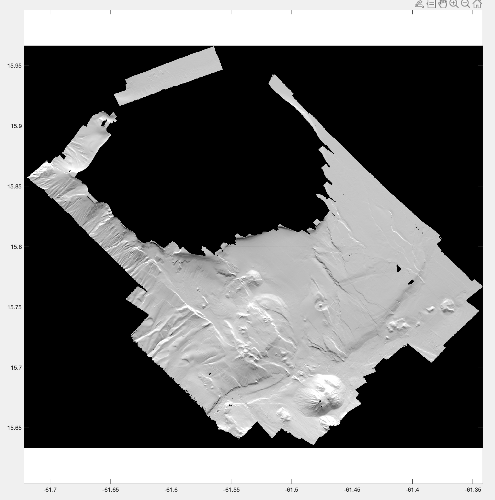
Bathymetry grid, with a pixel resolution of 10 m, from bathymetry data acquired during the 2010 Bathysaintes cruise (https://doi.org/10.17600/10030020).
Data were controlled and processed with the Ifremer Caraibes software.
Simple
- Title
-
Bathymetry from Les Saintes area (Lesser Antilles volcanic arc): 10m grid from the Bathysaintes cruise
- Date (Publication)
- 2023
- Date (Revision)
- 2024-02-06
- Other citation details
-
Deplus Christine, Feuillet Nathalie (2023). Bathymetry from Les Saintes area (Lesser Antilles volcanic arc): 10m grid from the Bathysaintes cruise. SEANOE. https://doi.org/10.17882/96053
- Abstract
-
Bathymetry grid, with a pixel resolution of 10 m, from bathymetry data acquired during the 2010 Bathysaintes cruise (https://doi.org/10.17600/10030020).
Data were controlled and processed with the Ifremer Caraibes software.
- Point of contact
-
Organisation name Individual name Electronic mail address Role Institut de Physique du Globe de Paris, CNRS UMR 7154, Paris, France
DEPLUS Christine
Author Institut de Physique du Globe de Paris, CNRS UMR 7154, Paris, France
FEUILLET Nathalie
Author SEANOE
Publisher
- Theme
-
-
Bathymetry
-
Caribbean
-
Volcanic arc
-
Marine geology
-
- Use constraints
- Other restrictions
- Other legal constraints
-
Not to be used for navigation
- Title
-
Bathymetry from Les Saintes area (Lesser Antilles volcanic arc): 25m grid from the Bathysaintes cruise
- Date (Publication)
- 2021
- Cited responsible party
-
Organisation name Individual name Electronic mail address Role SEANOE
Publisher Deplus
Author Christine
Author Feuillet
Author Nathalie
Author
- Code
- 10.17882/81174
- Association Type
- Cross reference
- Initiative Type
- dataset
- Code
- 10.17600/10030020
- Association Type
- Cross reference
- Initiative Type
- Platform
- Language
- English
- Topic category
-
- Oceans
))
- Distribution format
-
Name Version TIF
- OnLine resource
-
Protocol Linkage Name WWW:DOWNLOAD-1.0-link--download
https://www.seanoe.org/data/00849/96053/data/104104.tif Processed data
- OnLine resource
-
Protocol Linkage Name WWW:LINK-1.0-http--metadata-URL
https://doi.org/10.17882/96053 DOI of the product
rel-canonical
https://www.seanoe.org/data/00849/96053/ Seanoe
- Hierarchy level
- Dataset
- Statement
-
Shipboard multibeam system from the N/O Pourquoi pas ? - Seabat 7150
Metadata
- File identifier
- seanoe:96053
- Metadata language
- English
- Character set
- UTF8
- Hierarchy level
- Dataset
- Date stamp
- 2024-02-06
- Metadata standard name
-
ISO 19115:2003/19139
- Metadata standard version
-
1.0
- Metadata author
-
Organisation name Individual name Electronic mail address Role Institut de Physique du Globe de Paris, CNRS UMR 7154, Paris, France
DEPLUS Christine
Local service desk

)))