CATDS-PDC L3OS 3P mixed - Average 10 days & monthly salinity field product from SMOS satellite (mixed orbits)
This product contains average 10 days & monthly salinity field based on L2P products, mixing ascending and descending orbits.
** This product is no longer available, see below **
| Date(s) Date(s) |
|
| Author(s) Auteur(s) |
CATDS
|
| Contact(s) Contact(s) |
Jacqueline Boutin
(
LOCEAN
)
CATDS (CNES, IFREMER, LOCEAN) |
| Source Source |
CATDS (CNES, IFREMER, LOCEAN) |
| Lineage Généalogie |
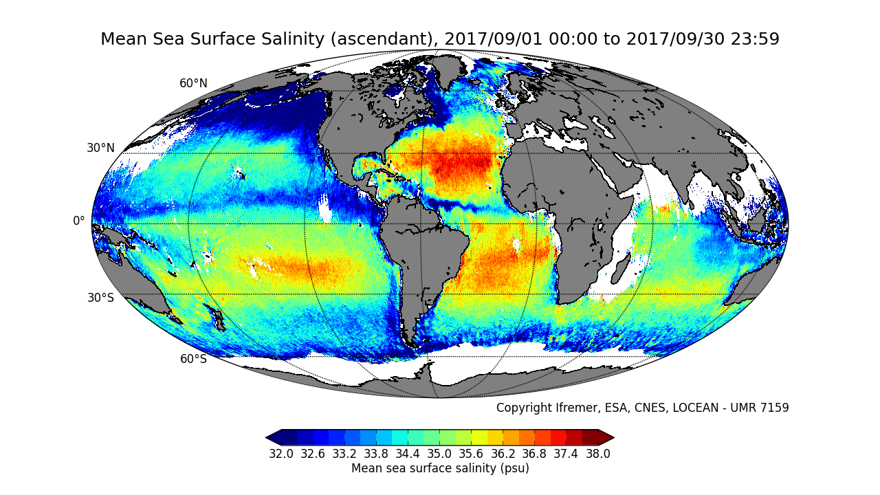
This product is no longer available. Instead, we recommend to use the product CATDS-PDC L3OS 3Q mixed - Debiased average 10 days & monthly salinity field product from SMOS satellite, mixed orbits ( https://doi.org/10.12770/0f02fc28-cb86-4c44-89f3-ee7df6177e7b). However, if the L3OS 3Q mixed product doesn't fit your need, and you really need access to the L3OS 3P mixed product, please send us a message with the appropriate justification at support@catds.fr . The base products, for all the CATDS-PDC (Centre Aval de Traitement des Données SMOS - Production & Dissemination Center) processing chains, are the SMOS L1B products from ESA (European Space Agency). From these, brightness temperatures at various incidence angles are reconstructed. The Sea Surface Salinity (SSS) are retrieved from multi-angular brightness temperatures through a maximum likehood Bayesian approach in which measured Tb and Tb simulated using a forward direct model are compared (see Zine et al. 2008 for a general description of the retrieval method, and pro_con table for a summary of the similarities/differences with respect to ESA level 2 ocean salinity processing). The L3OS 3P mixed product contains average 10 days & monthly salinity field based on L2P products, at 4 spatial resolutions (25km, 50km, 100km, 200km), mixing ascending and descending orbits. Products from reprocessing RE05 are available for the period 01/2010 - 03/2017. Products from operational (OPER) processing are available since 04/2017. Reprocessed products and operational products are derived using the same algorithm and configuration, hence ensuring the temporal continuity. Note that Dual Polarisation (DP) configuration was used only during the commissionning phase (CP ; 01/2010 - 05/2010), alternately to Full Polarisation (FP) configuration.In order to ensure similar number of retrievals and errors on SSS maps during CP and after CP, DP and FP maps need to be averaged. Note that links are only provided for the 25km spatial resolutions products. Other resolutions can be accessed by changing the product name (see below) File naming : SM_clas_MIR_CSp3r__startdate_enddate_vvv_ccc_7 - clas : File class (OPER : operational mode, REXX : reprocessing xx) - p : F for full polarization, D for dual polarization - r : A for 25km, B for 50km, C for 100km, D for 200km - startdate : sensing start date/time of the data (format yyyymmddThhmiss) - enddate : sensing end date/time of the data (format yyyymmddThhmiss) - vvv : version number of the processor generating the product - ccc : file counter File format : In each archive file (.tgz extension), there are two files - A Header file (.HDR), which is a text file, in XML Earth Explorer Header format - A Data file (.DBL.nc), which is a netcdf file, format variant 2 (netcdf 3 with 64 bits offset option) Reference : Zine, S., J. Boutin, J. Font, N. Reul, P. Waldteufel, C. Gabarró, J. Tenerelli, F. Petitcolin, J. L. Vergely, M. Talone, and S. Delwart (2008), Overview of the SMOS sea surface salinity prototype processor, IEEE T. Geosci. Remote Sensing, 46, 621-645. |
| Constraints Contraintes |
|
| Spatial informations Informations géographiques |
|
Citation proposal Proposition de citation
CATDS (2017).CATDS-PDC L3OS 3P mixed - Average 10 days & monthly salinity field product from SMOS satellite (mixed orbits).CATDS (CNES, IFREMER, LOCEAN)
http://dx.doi.org/10.12770/75ccd428-74b5-45db-879e-37ab98fa28a1
)))