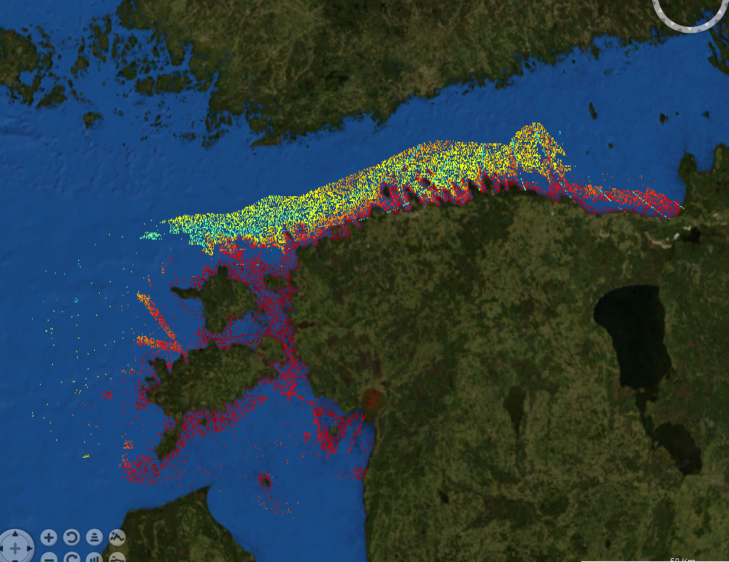
Estonian waters 50m resolution
Data extracted from the Estonian Maritime Administrations database. Extraction has been made using a grid for data reduction and only populated cells has been exported.
What
Metadata details
- File identifier
- SDN_CPRD_3085_E50M
- Catalogue type
-
Product record
-
Project name
-
-
EMODnet HRSM
-
- Dissemination level
-
public
- Metadata language
- English
- Date stamp
- 2022-06-22T19:24:38.311Z
Identification
- Dataset name
-
Estonian waters 50m resolution
- Short name of dataset (SDN Local Product-ID)
-
E50M
-
Parameter Discovery Vocabulary (P02)
-
-
Bathymetry and Elevation
-
-
SeaDataNet device categories
-
-
single-beam echosounders
-
plummets
-
multi-beam echosounders
-
Geometry
- Spatial representation type
- Vector
- Pixel size
- 50 Metres (m)
- Maximum scale of use
- 5000
Abstract
- Dataset description abstract
-
Data extracted from the Estonian Maritime Administrations database. Extraction has been made using a grid for data reduction and only populated cells has been exported.
- Description of processed data sources
-
As this is an extract of the entire database it consist of various sources and ages. It is still the best available dataset for the region.
- Description of data processing
-
Point resolution reduction during export.
Quality
Accuracy / Calibration
Hor. accuracy
- Measure description
-
Varying positioning methods has been used and hence it is impossible to set one value of the accuracy. It can vary from <50cm to 50m.
- Value
- 50m
- Evaluation method description
-
No validation done.
Vert. accuracy
- Measure description
-
Varying survey methods has been used and hence it is impossible to set one value of the accuracy. All modern surveys fulfills the demands in IHO-S44.
- Evaluation method description
-
No validation done
Suitability
- Suitability, Expected type of users / uses and limitations
-
Data originates from the Estonian Hydrographic Office.
Quality Indicators
- Horizontal Quality Indicator
- 1 - Between 500m and 50m
- Vertical Quality Indicator
- 2 - MBES low frequency (lower than 100kHz) (similar than 1+2%d)
- Purpose Quality Indicator
- 3 - Hydrographic survey or compatible with hydrographic standards
Where
))
- Min. depth in meters (>0 below Sea Level)
- -0.35
- Max. depth in meters (>0 below Sea Level)
- 223.7
Projection
- code
-
WGS 84 (EPSG:4326)
- Version or custom projection details
-
7.4
When
Creation date
- date
- 2018-03-28
Revision date
- date
- 2018-03-28
Temporal extent*
- Begin
- 1900-01-01
- End
- 2018-12-31 Before
Who
Originator
Data Holding Center
- Organisation name
-
Estonian Maritime Administration
Collating Centre = Metadata author
- Organisation name
-
Swedish Maritime Administration
Access
Distributor
- Organisation name
-
Estonian Maritime Administration
Data formats*
- Format
-
XYZ Ascii
- Transfer size (in MB)
- 115
Intellectual property
- Use limitation
-
Data are not to be:
*used for safety of navigation purposes
*used in Electronic Chart Display Systems
*used as an aid to navigaton
- Access constraints
- License
- Use constraints
- Copyright
- Other constraints
-
Data are not to be:
*used for safety of navigation purposes
*used in Electronic Chart Display Systems
*used as an aid to navigaton
)))