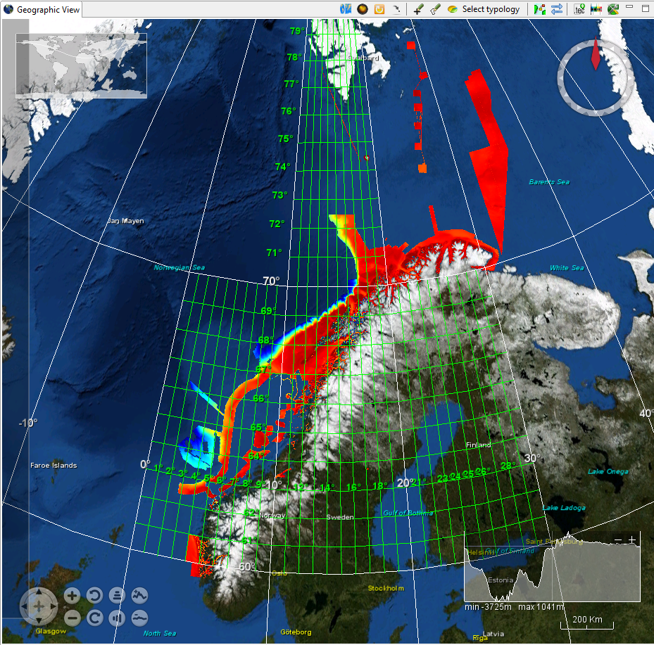
Norwegian Hydrographic Service, 50m grid in UTM33 converted to geographical coordinates
Multibeam surveys by Norwegian Hydrographic Service until February 2016 gridded to 50*50m in UTM33 (north Norway) or UTM32 (South Norway) with Euref 89 as datum. Data established whithin 30*30 minutes cells but tiled into 2*2 degrees tiles. Data extends up to 78,5 degrees N.
What
Metadata details
- File identifier
- SDN_CPRD_543_NHS-50m_grid_UTM33
- Catalogue type
-
Composite Product Record
-
Project name
-
-
EMODNet Hydrography
-
- Dissemination level
-
public
- Metadata language
- English
- Date stamp
- 2018-03-15T10:43:12
Identification
- Dataset name
-
Norwegian Hydrographic Service, 50m grid in UTM33 converted to geographical coordinates
- Short name of dataset (SDN Local Product-ID)
-
NHS-50m_grid_UTM33
-
Parameter Discovery Vocabulary (P02)
-
-
Bathymetry and Elevation
-
-
Measuring devices
-
-
multi-beam echosounders
-
-
Measuring devices
-
-
NAVSTAR Global Positioning System receivers
-
Geometry
- Spatial representation type
- Grid
- Number of columns
- 650
- Number of lines
- 11112
- Pixel size
- 50 Metres (m)
- Maximum scale of use
- 25000
Abstract
- Dataset description abstract
-
Multibeam surveys by Norwegian Hydrographic Service until February 2016 gridded to 50*50m in UTM33 (north Norway) or UTM32 (South Norway) with Euref 89 as datum. Data established whithin 30*30 minutes cells but tiled into 2*2 degrees tiles. Data extends up to 78,5 degrees N.
- Description of processed data sources
-
Description of processed data sources : Exist in norwegian, will be translated into English
- Description of data processing
-
Description of data processing :
Quality
Accuracy / Calibration
Hor. accuracy
- Measure description
-
Estimated at 60 degrees nadir angle, 100m depth, 5 different echosounders
- Value
- 3m
Vert. accuracy
- Measure description
-
Estimated at 60 degrees nadir angle, 100m depth, 5 different echosounders:
average depth accuracy: 0,5m, One instance at 1600m: 5m
Suitability
- Suitability, Expected type of users / uses and limitations
-
not to be used for navigation
Where
))
- Min. depth in meters (>0 below Sea Level)
- 0.5
- Max. depth in meters (>0 below Sea Level)
- 3200
Projection
- code
-
WGS 84 (EPSG:4326)
- Version or custom projection details
-
7.4
When
Creation date
Revision date
Temporal extent*
- Begin
- 2005-01-01T12:00:00
- End
- 2016-02-25T12:00:00
Who
Originator
- Organisation name
-
Norwegian Hydrographic Service
Data Holding Center
- Organisation name
-
Norwegian Hydrographic Service
Collating Centre = Metadata author
- Organisation name
-
Norwegian Hydrographic Service
Access
Distributor
- Organisation name
-
Norwegian Hydrographic Service
Data formats*
- Format
-
Text
- Version
-
ascii
- Transfer size (in MB)
- 5.5
Intellectual property
- Access constraints
- License
- Use constraints
- Copyright
)))