Les principaux objectifs sont :
- constitution de séries temporelles d'indices d'abondances pour les principales espèces commerciales de la mer du Nord (évaluation des principaux stocks de poissons commerciaux de Mer du Nord : merlan, morue, églefin, tacaud norvégien, hareng, sprat, maquereau, plie).
- calcul de l'indice larvaire pour le hareng et le sprat.
Les objectifs complémentaires sont :
- échantillonnage des œufs au CUFES (Continuous Underwater Fish Eggs Sampling) en Mer du Nord.
- étude de la distribution et de l'abondance relative hivernale des mammifères et oiseaux marins en Mer du Nord.
-enregistrement des données acoustiques (pour analyse ultérieure).
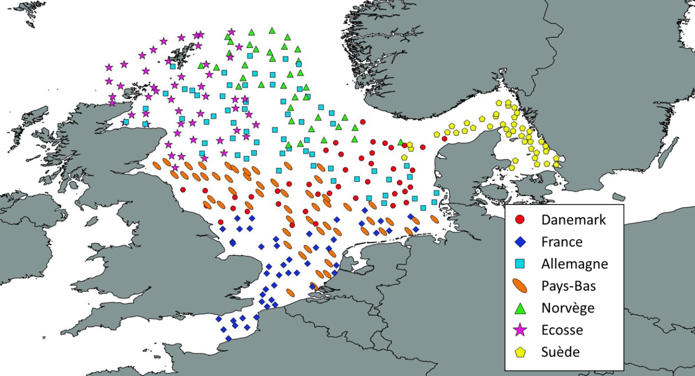
Le projet de rattachement est "International Bottom Trawl Survey - Evaluations des pêcheries sous gestion communautaires, et sous gestion non communautaires. Système d'Informations Halieutiques".
01-01-1960 : Les premières campagnes pour le suivi des juvéniles de hareng sont mises en place sont mises en place par les Pays-Bas et l'Allemagne. Ces campagnes IYHS (International Young Herring Survey) sont coordonnées par l'ICES (International Council for the Exploitation of the Sea).
01-01-1962 : Progressivement, les autres pays riverains s'associent à ce programme et la zone d'étude est étendue à l'ensemble de la mer du Nord. D'autres espèces sont intégrées au suivi et les campagnes sont renommées IYFS (International Bottom Trawl Survey).
01-01-1976 : La France s'associe à ce programme et couvre au premier trimestre de chaque année deux zones importantes pour la pêcherie Française, l'une au sud de la mer du Nord et l'autre en Ouest Ecosse.
01-01-1980 : Un groupe de travail chargé de coordonner les campagnes en mer du Nord et d'analyser les données et créé. C'est le début officiel de cette série de campagne de suivi.
01-01-1992 : Pour assurer une meilleure coordination de l'ensemble des campagnes mises en place par les pays à différentes périodes de l'année, aussi bien en mer du Nord que dans l' Atlantique nord-ouest, il a été décidé de créer un groupe de travail commun chargé d'analyser les données.
01-01-1996 : Les résultats de cet échantillonnage bi-annuel en mer du Nord sont analysé et l'ICES conclue de continuer les deux campagnes annuelles en redistribuant l'effort des pays participants qui conserve une campagne soit au premier trimestre comme la France, soit au second trimestre comme la France.
01-01-1997 : A partir de cette année, la campagne française a lieu une fois par an au cours de la période hivernale. Elle est chargée d'échantillonner le sud de la mer du Nord.
01-01-2007 : La zone d'échantillonnage allouée à la France et aux Pays-Bas est étendue à la manche Orientale.
01-01-2015 : Remplacement du Navire ‘Gwen Drez’ par le navire ‘Thalassa II’.
01-01-2017 : Réduction du nombre de jours en mer (23 jours contre 30 auparavant)
Pour la Collecte de données sur les déchets : analyse des données par catégories , cartographie et tendance selon un protocole harmonisé au niveau européen.
- Protocole validé depuis 1994 (MEDITS) et 1995 (IBTS/EVHOE)
- Protocole harmonisé au niveau européen (maille, protocole, chaluts)
- Protocole retenu pour la mise ne place de la DCSMM au niveau européen
Limites : dispositif devant être complété localement pour les petits fonds ( 0-20 mètres).
• Plan(s) d’échantillonnage :
Aléatoire, stratifié
• Précision sur le type de donnée :
- Pour la faune :
Melanogrammus aeglefinus ; Merlangius merlangus ; Gadus morhua ; Trisopterus esmarki ; Clupea harengus ; sprattus sprattus ; scomber scombrus ; Pleuronectes platessa
Oiseaux marins
Zooplancton ; invertébrés benthique ; poissons
Mammifères marins
- Pour les déchets :
Inventaire des différents types de déchets (plastiques, verre, métal, bouteilles plastiques, cuir et tissus, engins de pêche, divers)
• Paramètre(s) observé(s) ou mesuré(s) :
- Pour la faune :
Dénombrement des juvéniles. Prélèvement d'otolithe
Observation à bord du navire
Présence dans l'échantillon de zooplancton depuis 2008 ; présence et détermination des poissons invertébrés benthiques
- Pour les déchets :
Densité
• Résolution du (ou des) paramètre(s) :
- Pour la faune :
Par opération de pêche, analyse systématique des captures de pêche scientifiques
- Pour les déchets :
Densité par hectare
• Format(s) :
Les données disponibles existent sous le format : csv
The main objectives are :
- to build up time series of abundance indices for the main commercial species in the North Sea (assessment of the main commercial fish stocks in the North Sea: whiting, cod, haddock, Norway pout, herring, sprat, mackerel, plaice).
- calculation of the larval index for herring and sprat.
The complementary objectives are :
- egg sampling with CUFES (Continuous Underwater Fish Eggs Sampling) in the North Sea.
- study of the distribution and relative winter abundance of marine mammals and birds in the North Sea.
-Recording of acoustic data (for later analysis).
The associated project is "International Bottom Trawl Survey - Assessments of EU and non-EU managed fisheries. Fisheries Information System".
01-01-1960 : The first cruises to monitor juvenile herring are set up by the Netherlands and Germany. These IYHS (International Young Herring Survey) cruises are coordinated by the ICES (International Council for the Exploitation of the Sea).
01-01-1962 : Gradually, the other riparian countries join this programme and the study area is extended to the entire North Sea. Other species are included in the monitoring and the surveys are renamed IYFS (International Bottom Trawl Survey).
01-01-1976 : France joins this programme and covers two important areas for the French fishery in the first quarter of each year, one in the southern North Sea and the other in Western Scotland.
01-01-1980 : A working group in charge of coordinating the North Sea surveys and analysing the data is created. This is the official start of this series of monitoring campaigns.
01-01-1992 : In order to ensure a better coordination of all the campaigns set up by the countries at different periods of the year, both in the North Sea and in the North-West Atlantic, it was decided to create a common working group in charge of analysing the data.
01-01-1996 : The results of this bi-annual sampling in the North Sea are analysed and ICES concludes to continue the two annual campaigns by redistributing the effort of the participating countries which keep a campaign either in the first quarter like France, or in the second quarter like France.
01-01-1997 : From this year onwards, the French cruise takes place once a year during the winter period. It is responsible for sampling the southern North Sea.
01-01-2007 : The sampling area allocated to France and the Netherlands is extended to the Eastern Channel.
01-01-2015 : Replacement of the vessel 'Gwen Drez' by the vessel 'Thalassa II'.
01-01-2017: Reduction in the number of days at sea (23 days compared to 30 previously)
For the collection of data on waste: analysis of data by category, mapping and trends according to a protocol harmonised at European level :
- Protocol validated since 1994 (MEDITS) and 1995 (IBTS/EVHOE)
- Protocol harmonised at European level (mesh size, protocol, trawls)
- Protocol adopted for the implementation of the DCSMM at European level
Limitations : system to be completed locally for shallow waters (0-20 metres)
• Sampling plan(s) :
Random, stratified
• Specification of data type :
- For fauna:
Melanogrammus aeglefinus; Merlangius merlangus; Gadus morhua; Trisopterus esmarki; Clupea harengus; sprattus sprattus; scomber scombrus; Pleuronectes platessa
Seabirds
Zooplankton; benthic invertebrates; fish
Marine mammals
- For litter :
Inventory of different types of waste (plastics, glass, metal, plastic bottles, leather and fabrics, fishing gear, miscellaneous)
• Parameter(s) observed or measured:
- For fauna :
Counting of juveniles. Otolith sampling
Observation on board the vessel
Presence in the zooplankton sample since 2008; presence and determination of benthic invertebrate fish
- For litter :
Density
• Resolution of parameter(s) :
- For fauna :
Per fishing operation, systematic analysis of scientific fishing catches
- For litter :
Density per hectare
• Format(s):
The available data exist in the format: csv
)))