Seismic dataset for de-risking study in the Gulf of Roussillon
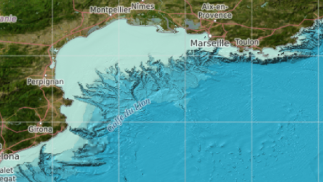
This seismic data package is being made available as part of the de-risking study to be carried out in the Gulf of Roussillon for the award of a "commercial floating wind turbine" call for tenders by 2022.
It includes seismic data acquired only in French territorial waters on board 4 oceanographic campaigns: CALMAR97, RHOSOS, CASCADE, AM-MED-1.
Simple
Identification info
- Date (Publication)
- Citation identifier
- SISMER_SIS-MED_AO_EOLIEN_FLOTTANT_COMMERCIAL
- Point of contact
-
Organisation Individual Electronic mail address ORCID Role IFREMER / IDM / SISMER - Scientific Information Systems for the SEA
Point of contact IFREMER / IDM / SISMER - Scientific Information Systems for the SEA
Author IFREMER / GM-MARINE GEOSCIENCES
Author
- Spatial representation type
- Vector
- Topic category
-
- Oceans
Extent
))
Extent
- Time period
- 1997-11-13 2013-09-25
- GEMET - INSPIRE themes, version 1.0
-
-
Geology
-
- Thèmes Sextant
-
-
/Physical Environment/Geology
-
Resource constraints
- Use limitation
- Open Licence
- Access constraints
- Copyright
- Use constraints
- License
- Other constraints
-
The user undertakes to comply with the terms of the Etalab license
- Language
- Français
- Character encoding
- UTF8
Distribution Information
- Distribution format
-
- OnLine resource
-
DOI campagne CALMAR97
- OnLine resource
-
DOI campagne RHOSOS
- OnLine resource
-
DOI campagne CASCADE
- OnLine resource
-
DOI campagne AM-MED 1
- OnLine resource
-
MNT à 100 mètres de EMODnet Bathymetrie
- OnLine resource
-
Produits de EMODnet geologie
- OnLine resource
-
Lien de téléchargement FTP
FTP download link
Data quality info
- Hierarchy level
- Dataset
Report
Result
- Title
-
RÈGLEMENT (UE) N o 1089/2010 DE LA COMMISSION du 23 novembre 2010 portant modalités d'application de la directive 2007/2/CE du Parlement européen et du Conseil en ce qui concerne l'interopérabilité des séries et des services de données géographiques
- Date (Publication)
- 2010-12-08
- Explanation
-
See the referenced specification
Resource lineage
- Lineage
-
The data provided are of different kinds:
- CALMAR97: acquisition of 6-channels rapid seismic and chirp (sparker) data;
- RHOSOS: acquisition of 2-track HR seismic (sparker) and chirp data;
- CASCADE: acquisition of chirp data;
- AM-MED-1: acquisition of 72-track HR seismic and chirp data.
The data are seismic reflection profiles provided in "SEG-Y" revision 1 or "SEG-D" format.
Depending on the campaigns, the data are:
- raw seismic reflection data files (ship output);
- processed seismic reflection data files (migrated stacked);
- validated seismic reflection data files (stacked, migrated and corrected for positioning offset).
- Hierarchy level
- Dataset
Spatial representation info
- Geometric object type
- Curve
Reference System Information
- Reference system identifier
- EPSG/WGS 84 (EPSG:4326)
Metadata
- Metadata identifier
- 1ff7094d-b607-424c-8cc4-2cb52cc1f221
- Language
- Français
- Character encoding
- UTF8
- Language
- English
- Character encoding
- UTF8
Type of resource
- Resource type
- Dataset
- Metadata linkage
-
https://sextant.ifremer.fr/geonetwork/srv/api/records/1ff7094d-b607-424c-8cc4-2cb52cc1f221
- Date info (Creation)
- 2019-10-08T12:03:23Z
- Date info (Revision)
- 2025-05-15T21:36:59.543209Z
Metadata standard
- Title
-
ISO 19115-3 - SEXTANT
- Edition
-
1.0
accessData
Overviews

Spatial extent
)))