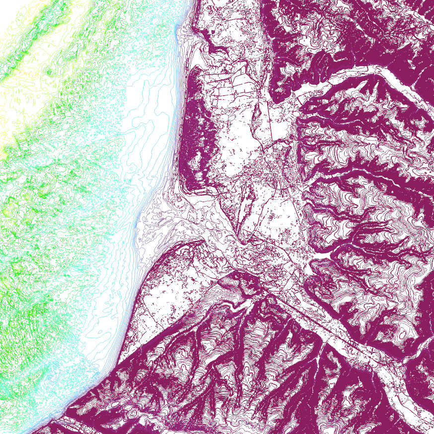
Altitude : Courbes de niveaux (tous les mètres mNGF) territoire BSA
Altimétrie du territoire PAPI BSA : courbes de niveaux (tous les mètres NGF)
Simple
Identification info
- Date (Creation)
- 2015-12-18
- Date (Publication)
- 2015-10-30
- Date (Revision)
- 2015-10-30
- Citation identifier
- fr-258001924-papibsa-2015-MNTU-Courbe-niveau-1-m-MNT10m
- Credit
-
SMBSGLP
- Point of contact
-
Organisation Individual Electronic mail address ORCID Role Syndicat Mixte Baie de Somme Grand Littoral Picard / CC Opale Sud
Owner ARTELIA Eau et Environnement
0
Author ROLNHDF
Publisher
- Spatial representation type
- Vector
- Topic category
-
- Elevation
Extent
))
Extent
- Theme
-
-
risque naturel
-
inondation
-
modélisation
-
changement climatique
-
tempête
-
crue
-
PAPI
-
Hauts-de-France
-
littoral
-
altimétrie
-
altitude
-
- GEMET inspire themes - version 1.0
-
-
Altitude
-
Resource constraints
- Use limitation
-
Aucune condition ne s'applique
Resource constraints
- Classification
- Unclassified
- Language
- Français
- Character encoding
- UTF8
Distribution Information
- Distribution format
-
-
ESRI Shapefile
-
- OnLine resource
-
185
T00_DIAG_GEN_Courbe_de_niveau_1_m_MNT10m
Data quality info
- Hierarchy level
- Dataset
Report
Result
- Title
-
COMMISSION REGULATION (EU) No 1089/2010 of 23 November 2010 implementing Directive 2007/2/EC of the European Parliament and of the Council as regards interoperability of spatial data sets and services
- Date (Publication)
- 2010-10-23
- Explanation
-
Information sur la conformité de la ressource à une spécification (INSPIRE)
- Pass
- 1
Resource lineage
- Lineage
-
Création PAPI BSA sur la base du Modèle Numérique de Terrain Unifié PAPI BSA grille 10 mètres.
- Hierarchy level
- Dataset
Reference System Information
- Reference system identifier
- EPSG/Lambert 93
Reference System Information
- Reference system identifier
- INSPIRE RS registry/grégorien
Metadata constraints
- Classification
- Unclassified
Metadata
- Metadata identifier
- PAPIBSA_2015_MNTU_Courbe_de_niveau_1_m_MNT10m
- Language
- Français
- Character encoding
- UTF8
- Contact
-
Organisation Individual Electronic mail address ORCID Role Syndicat Mixte Baie de Somme Grand Littoral Picard / CC Opale Sud
Point of contact ROLNHDF
Point of contact
Type of resource
- Resource type
- Dataset
- Name
-
Série de données
- Metadata linkage
-
https://sextant.ifremer.fr/geonetwork/srv/api/records/PAPIBSA_2015_MNTU_Courbe_de_niveau_1_m_MNT10m
- Date info (Creation)
- 2024-07-04T15:58:24.949Z
- Date info (Revision)
- 2025-05-15T23:32:25.884328Z
Metadata standard
- Title
-
ISO 19115-3 - SEXTANT
- Edition
-
1.0
accessData
Overviews
Spatial extent
)))