Modélisations hydrodynamiques (MARS3D) pour la façade Méditerranée Nord-Ouest (F2 1200, 1200sn, 1200 v10)
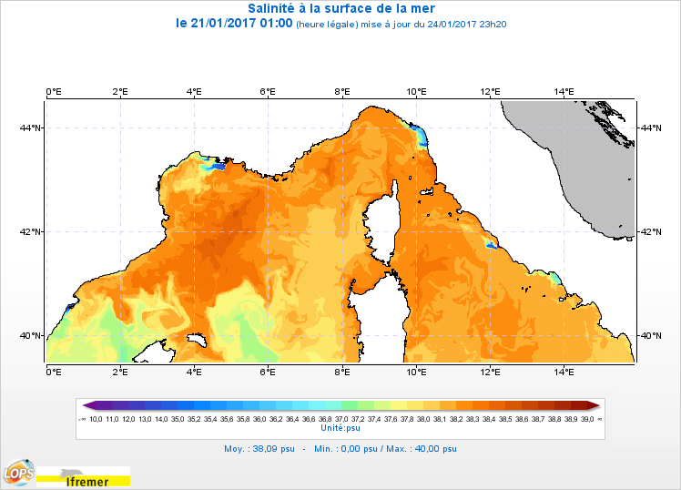
Le modèle hydrodynamique MARS3D sur la façade Méditerranée Nord-Ouest (MARC_F2-MARS3D-MENOR1200) est un modèle 3D de résolution spatiale 1,2 km sur 60 niveaux qui fournit les courants, niveaux de la mer, température et salinité toutes les heures.
Simple
Identification info
- Date (Creation)
- 2010-01-01
- Citation identifier
- https://sextant.ifremer.fr/record/aca0fac4-5104-43f3-9d0d-dbb892098e9b
- Citation identifier
- FR-330-715-368-00032-IFR-F2-1200-ECOMARS3D-MANGA4000
- Credit
-
MARC
- Point of contact
-
Organisation Individual Electronic mail address ORCID Role CNRS
Ardhuin Fabrice
Author IFREMER
Le Roux Jean-Francois
Custodian
- Spatial representation type
- Grid
- Topic category
-
- Oceans
Extent
))
Extent
- Time period
- 2010-01-01
- Maintenance and update frequency
- Weekly
- GEMET - INSPIRE themes, version 1.0
-
-
Caractéristiques géographiques océanographiques
-
- Thèmes Sextant
-
-
/Milieu physique/Hydrodynamique/Colonne d'eau
-
- Sous-regions marines
-
-
/Métropole/Méditerranée occidentale
-
- Thématiques - SIMM
-
-
/Etat du Milieu/Hydrodynamique
-
Recherche
-
- ODATIS aggregation parameters and Essential Variable names
-
-
Température de la mer
-
Salinité
-
Courants
-
Hauteur de la surface de la mer
-
- Type de jeux de donnée ODATIS
-
-
Données de simulation
-
Resource constraints
- Use limitation
-
Données sous Licence ouverte / Open licence : http://www.etalab.gouv.fr/pages/licence-ouverte-open-licence-5899923.html
- Access constraints
- Other restrictions
- Use constraints
- Copyright
- Language
- Français
- Character encoding
- UTF8
Distribution Information
- Distribution format
-
- OnLine resource
-
SAL
MARC F2 1200sn - Sea water salinity
- OnLine resource
-
/home/ref-marc/f2_1200_sn
- OnLine resource
-
/home/ref-marc/f2_1200
- OnLine resource
-
/home/ref-marc/f2_1200_v10
- OnLine resource
-
TEMP
MARC F2 1200sn - Sea water temperature
- OnLine resource
-
XE
MARC F2 1200sn - Sea surface height
- OnLine resource
-
UZ
MARC F2 1200sn - Sea water velocity (x)
- OnLine resource
-
VZ
MARC F2 1200sn - Sea water velocity (y)
- OnLine resource
-
Opendap
MARC F2 1200sn
- OnLine resource
-
SAL
MARC F2 1200 - Sea water salinity
- OnLine resource
-
TEMP
MARC F2 1200 - Sea water temperature
- OnLine resource
-
XE
MARC F2 1200 - Sea surface height
- OnLine resource
-
UZ
MARC F2 1200 - Sea water velocity (x)
- OnLine resource
-
VZ
MARC F2 1200 - Sea water velocity (y)
- OnLine resource
-
Opendap
MARC F2 1200
Resource lineage
- Lineage
-
Paramètres calculés :
Les paramètres calculés sont les suivants :
* XE : sea_surface_height_above_geoid (m)
* UZ : sea_water_x_velocity_at_u_location (m.s-1)
* VZ : sea_water_y_velocity_at_v_location (m.s-1)
* SAL : sea_water_salinity (PSU)
* TEMP : sea_water_potential_temperature (degree_celsius)
* TAUX : surface_downward_x_stress_at_u_location (N.m-2)
* TAUY : surface_downward_y_stress_at_v_location (N.m-2)
- Hierarchy level
- Dataset
Spatial representation info
- Number of dimensions
- 2
- Dimension name
- Column
- Resolution
- 1.2
- Dimension name
- Row
- Resolution
- 1.2 km
- Cell geometry
Reference System Information
- Reference system identifier
- EPSG/WGS 84 (EPSG:4326)
Metadata
- Metadata identifier
- aca0fac4-5104-43f3-9d0d-dbb892098e9b
- Language
- Français
- Character encoding
- UTF8
- Contact
-
Organisation Individual Electronic mail address ORCID Role IFREMER
Matthieu Caillaud
Point of contact IFREMER
Bonnat Armel
Point of contact IFREMER
Le Roux Jean-Francois
Point of contact CDOCO APR Océanographie côtière : Façade Métropolitaine
Publisher
Type of resource
- Resource type
- Dataset
- Metadata linkage
-
https://sextant.ifremer.fr/geonetwork/srv/api/records/aca0fac4-5104-43f3-9d0d-dbb892098e9b
- Date info (Creation)
- 2018-03-05T08:36:44Z
- Date info (Revision)
- 2025-05-15T23:42:55.451943Z
Metadata standard
- Title
-
ISO 19115-3 - SEXTANT
- Edition
-
1.0
accessData
Overviews
Spatial extent
)))