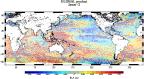
Sea along-track L3 Sea Surface Heights reprocessed (1993-ongoing) - Regional (Europe)
Monomission altimeter satellite along-track sea surface heights computed with respect to a twenty-year mean. Previously distributed by Aviso+, no change in the scientific content. All the missions are homogenized with respect to a reference mission which is currently OSTM/Jason-2. The sla is computed with an optimal and centered computation time window (6 weeks before and after the date). Two kinds of datasets are proposed: filtered (nominal dataset) and unfiltered.
Simple
- Title
-
Sea along-track L3 Sea Surface Heights reprocessed (1993-ongoing) - Regional (Europe)
- Date (Creation)
- 1993-01-01
- Abstract
-
Monomission altimeter satellite along-track sea surface heights computed with respect to a twenty-year mean. Previously distributed by Aviso+, no change in the scientific content. All the missions are homogenized with respect to a reference mission which is currently OSTM/Jason-2. The sla is computed with an optimal and centered computation time window (6 weeks before and after the date). Two kinds of datasets are proposed: filtered (nominal dataset) and unfiltered.
- Credit
-
Marine Core Service
- Point of contact
-
Organisation name Individual name Electronic mail address Role Copernicus
Marine Core Service
Local service desk
-
Centre de données ODATIS
-
-
CDS-SAT-AVISO
-
- Keywords
-
-
Type de jeux de donnée ODATIS
-
-
/Remote sensing
-
-
Thèmatiques ODATIS
-
-
Operational oceanography
-
-
ODATIS aggregation parameters and Essential Variable names
-
-
Sea surface height
-
- Use limitation
- Aucune condition ne s’applique
- Access constraints
- License
- Use constraints
- License
- Other legal constraints
-
Les conditions spécifiques de la licence sont détaillées dans http://marine.copernicus.eu/services-portfolio/service-commitments-and-licence/
- Spatial representation type
- Grid
- Language
- Français
- Character set
- UTF8
- Topic category
-
- Oceans
))
- Begin date
- 1993-01-01
- Geometric object type
- Complex
- Distribution format
-
Name Version
- OnLine resource
-
Protocol Linkage Name WWW:LINK
ftp://nrt.cmems-du.eu/Core/SEALEVEL_EUR_PHY_L3_NRT_OBSERVATIONS_008_059 Accès authentifié aux données Europe NRT via FTP
WWW:LINK
http://marine.copernicus.eu/services-portfolio/access-to-products/?option=com_csw&view=details&product_id=SEALEVEL_EUR_PHY_L3_NRT_OBSERVATIONS_008_059 Plus d'information sur CMEMS (Europe, NRT)
WWW:LINK
http://marine.copernicus.eu/services-portfolio/access-to-products/?option=com_csw&view=details&product_id=SEALEVEL_EUR_PHY_L3_REP_OBSERVATIONS_008_061 Plus d'information sur CMEMS (Europe, DT)
WWW:LINK
ftp://my.cmems-du.eu/Core/SEALEVEL_EUR_PHY_L3_REP_OBSERVATIONS_008_061 Accès authentifié aux données Europe DT via FTP
WWW:LINK-1.0-http--metadata-URL
https://doi.org/10.48670/moi-00140 DOI dataset
- Hierarchy level
- Dataset
- Statement
-
Detailed description:
This product is processed by the SL-TAC multimission altimeter data processing system. It processes data from all altimeter missions: Sentinel-6 Michael Freilich, Jason-3, Sentinel-3A, HY-2A, Saral/AltiKa, Cryosat-2, Jason-2, Jason-1, T/P, ENVISAT, GFO, ERS1/2. It provides a consistent and homogeneous catalogue of products for varied applications, both for near real time applications and offline studies. Two resolutions are proposed (appears in the file name): *vfec* : for validated, filtered, sub-sampled and LWE-corrected data *vxxc* (named unfiltered) : for validated, NON-filtered, NON-sub-sampled and LWE-corrected data
Horizontal sampling:
14km for filtered, 7km for unfiltered
Metadata
- File identifier
- b8215445-3610-4aab-82ac-d62a0a31c2bc
- Metadata language
- Français
- Other language
-
Language Character encoding English UTF8
- Character set
- UTF8
- Parent identifier
-
Produits altimétriques global SLA et ADT - Hauteurs - (monomission, L3, le long de la trace)
66babe59-04d8-41d0-b1b8-5f94fe857611
- Hierarchy level
- Dataset
- Date stamp
- 2023-05-22T07:25:03.64Z
- Metadata standard name
-
ISO 19115:2003/19139 - SEXTANT
- Metadata standard version
-
1.0
accessData
Overviews
)))