ERA5 monthly averaged data on single levels from 1979 to present
ERA5 is the fifth generation ECMWF reanalysis for the global climate and weather for the past 4 to 7 decades. Currently data is available from 1950, split into Climate Data Store entries for 1950-1978 (preliminary back extension) and from 1979 onwards (final release plus timely updates, this page). ERA5 replaces the ERA-Interim reanalysis.
Reanalysis combines model data with observations from across the world into a globally complete and consistent dataset using the laws of physics. This principle, called data assimilation, is based on the method used by numerical weather prediction centres, where every so many hours (12 hours at ECMWF) a previous forecast is combined with newly available observations in an optimal way to produce a new best estimate of the state of the atmosphere, called analysis, from which an updated, improved forecast is issued. Reanalysis works in the same way, but at reduced resolution to allow for the provision of a dataset spanning back several decades. Reanalysis does not have the constraint of issuing timely forecasts, so there is more time to collect observations, and when going further back in time, to allow for the ingestion of improved versions of the original observations, which all benefit the quality of the reanalysis product.
ERA5 provides hourly estimates for a large number of atmospheric, ocean-wave and land-surface quantities. An uncertainty estimate is sampled by an underlying 10-member ensemble at three-hourly intervals. Ensemble mean and spread have been pre-computed for convenience. Such uncertainty estimates are closely related to the information content of the available observing system which has evolved considerably over time. They also indicate flow-dependent sensitive areas. To facilitate many climate applications, monthly-mean averages have been pre-calculated too, though monthly means are not available for the ensemble mean and spread.
ERA5 is updated daily with a latency of about 5 days (monthly means are available around the 6th of each month). In case that serious flaws are detected in this early release (called ERA5T), this data could be different from the final release 2 to 3 months later. So far this has not been the case and when this does occur users will be notified.
The data set presented here is a regridded subset of the full ERA5 data set on native resolution. It is online on spinning disk, which should ensure fast and easy access. It should satisfy the requirements for most common applications.
An overview of all ERA5 datasets can be found in this article. Information on access to ERA5 data on native resolution is provided in these guidelines.
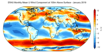
Data has been regridded to a regular lat-lon grid of 0.25 degrees for the reanalysis and 0.5 degrees for the uncertainty estimate (0.5 and 1 degree respectively for ocean waves). There are four main sub sets: hourly and monthly products, both on pressure levels (upper air fields) and single levels (atmospheric, ocean-wave and land surface quantities).
The present entry is "ERA5 monthly mean data on single levels from 1979 to present".
Simple
Identification info
- Date (Publication)
- 2019-04-18
- Date (Revision)
- 2021-09-06
- Citation identifier
- ff2cd349-ecab-48e1-817a-1ed87dc0c4be
- Credit
-
European Centre for Medium-Range Weather Forecasts
- Point of contact
-
Organisation Individual Electronic mail address ORCID Role ECMWF
Hans Hersbach
Author ECMWF
Dick Dee
Author Copernicus
Publisher
- Spatial representation type
- Grid
Spatial resolution
- Spatial resolution
- 0.5 degree
- Topic category
-
- Oceans
Extent
))
Extent
- Time period
- 1979-01-01
- Thèmes Sextant
-
-
/Physical Environment
-
- GEMET - INSPIRE themes, version 1.0
-
-
Meteorological geographical features
-
- Mission Atlantic - Resources
-
-
Data
-
- Mission Atlantic - Case Studies
-
-
Canary Current system
-
Atlantic Ocean
-
- Mission Atlantic - BODC Parameters
-
-
/Atmosphere/Meteorology
-
- Mission Atlantic - Data type (DMP)
-
-
Environmental data
-
- Mission Atlantic - Work Package
-
-
WP5 Assessing state, drivers and tipping points
-
- Ocean Hackathon - Ville
-
-
International and global data portals
-
Resource constraints
- Use limitation
- Licence to use Copernicus Products
- Language
- English
- Character encoding
- UTF8
Distribution Information
- Distribution format
-
-
GeoTIFF
-
- OnLine resource
-
Copernicus access data
- OnLine resource
-
ERA5 reanalysis is in production
Resource lineage
- Lineage
-
The CDS datasets are assessed by the Evaluation and Quality Control (EQC) function of C3S independently of the data supplier. EQC encompasses a framework of processes aimed to assure technical and scientific quality harmonized across all dataset types available through the CDS. During the EQC process, the documentation provided with the dataset is scrutinized and data are checked for usability and reliability.
- Hierarchy level
- Dataset
Reference System Information
Identifier
- Code
- EPSG:4326
Metadata
- Metadata identifier
- ff2cd349-ecab-48e1-817a-1ed87dc0c4be
- Language
- English
- Character encoding
- UTF8
- Contact
-
Organisation Individual Electronic mail address ORCID Role Ifremer
Sextant
Point of contact
Type of resource
- Resource type
- Dataset
- Metadata linkage
-
https://sextant.ifremer.fr/geonetwork/srv/api/records/ff2cd349-ecab-48e1-817a-1ed87dc0c4be
- Date info (Creation)
- 2021-10-03T16:20:02Z
- Date info (Revision)
- 2025-05-16T09:44:34.046018Z
Metadata standard
- Title
-
ISO 19115-3 - SEXTANT
- Edition
-
1.0
accessData
Overviews
Spatial extent
)))